200 km hab ich noch nicht hinbekommen, konnte heute erstmalig für ca. 50 km auf dem Motorrad testen, wurde auch echt Zeit. Etwas einfacher und in der Anwendung schöner gelöst ist das Umschalten der “Kurvigkeit”; hatte mal schnell ein Ziel eingegeben, und weil der aktuelle Standort implizit gesetzt wurde, konnte es auch sofort losgehen. Dann nochmal zurück und von “wenig kurvig” auf “mehr kurvig” umgestellt und wieder in die Navigation. In K1 muss man dafür durchs Menü.
Diesen Fall der Navigation nutze ich sicher zu 80%, am Motorrad als auch im Auto.
Vermutlich wiederhole ich hier auch wieder Punkte dann einfach skippen.
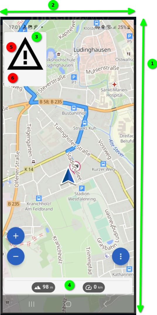
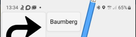
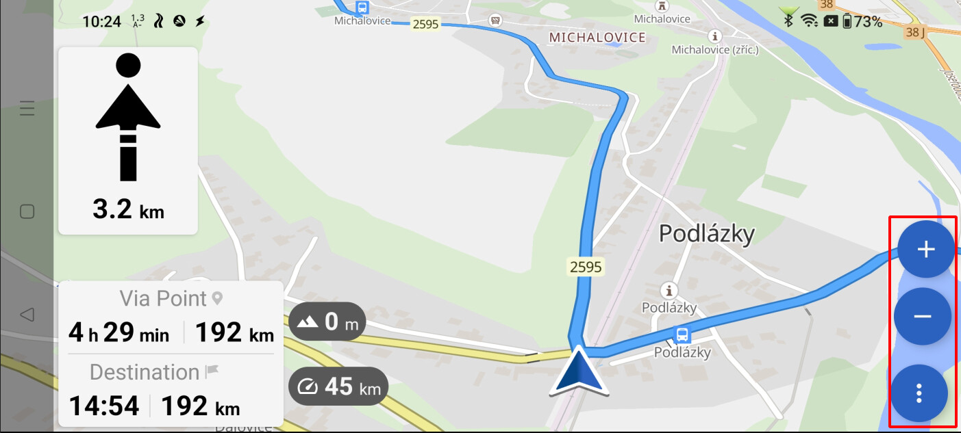
Was mir so richtig gut gefällt ist die maximale Ausnutzung der Bildschirm für die Karte (1)(2), mehr geht nicht  . Kann sein dass das geräteabhängig ist ( hier Galaxy S20FE ), auf dem Motorrad ist nicht viel Platz im Bereich des Cockpit, daher top. Sahne + Kirsche oben drauf wäre’s wenn die Bereiche (3) & (4) noch transparent wären. Ich fahre häufig bei hellem Umbebungslicht und dann auch mit Sonnenbrille. Daher steht mein Display wenn’s eingeschaltet ist auf 100%. Die sich bewegende Karte verhindert dann übermäßiges Einbrennen.
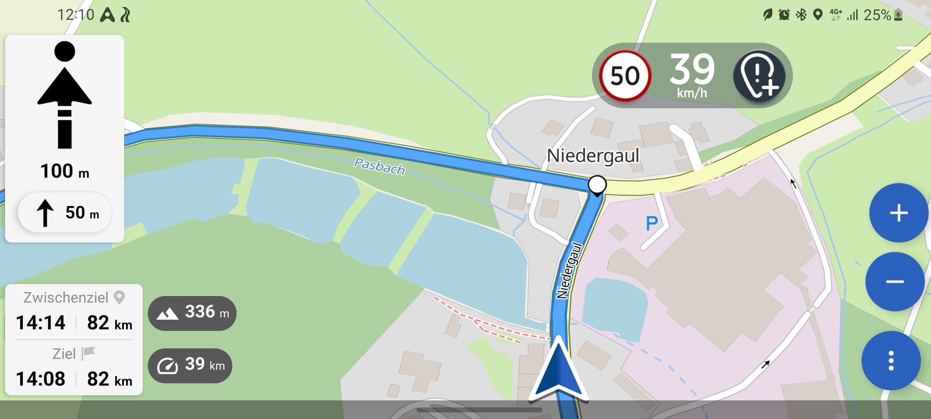
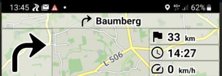
Das Verhaltnis der Symbole und Schrift (5)(6) ist noch nicht stimmig. Abbiegepfeile, Kreisverkehre etc. dürften gerne bei gleicher Größe weniger prägnant sein, die Zeichengröße für Entfernungen wesentlich größer ( min. Faktor 2 ). In der Breite wurde nur 25% des Platzes ausgenutzt.
Der Übergang in der Verwendung von Vorsätzen dürfte gerne früher passieren.
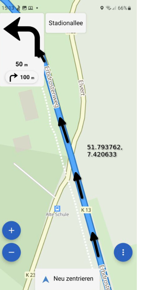
Wenn ich’s richtig gesehen habe wird dir Entfernung bis runter zum 400 m als 0,4 km angezeigt,
darunter dann 350 m etc. Gerne schon Umschalten wenn das Digit vor dem Komma auf 0 geht.
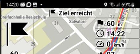
Was noch ein Fehler sein könnte: Navigationsmodus bleibt eingeschaltet, auch wenn man das Ziel erreicht hat. Habe das erst nicht bemerkt und noch 15 Minuten weiter navigiert.
200 km I have not yet managed, could test today for the first time for about 50 km on the motorcycle, was also really time. Somewhat easier and more beautifully solved in the application is the switching of the “curviness”; had once quickly entered a destination, and because the current location was implicitly set, it could also start immediately. Then back again and changed from “less curvy” to “more curvy” and back into the navigation. In K1 you have to go through the menu for that.
I use this case of the navigation surely to 80%, at the motorcycle as well as in the car.
Probably I repeat here also again points then simply skipping.
What I really like is the maximum use of the screen for the map (1)(2), more is not possible . Can be that this is device-dependent ( here Galaxy S20FE ), on the bike is not much space in the cockpit area, therefore top. Cream + cherry on top would be it if the areas (3) & (4) would still be transparent. I often drive in bright ambient light and then also with sunglasses. Therefore, my display when it is switched on at 100%. The moving map then prevents excessive burn-in.
The ratio of symbols and font (5)(6) is not yet coherent. Turning arrows, traffic circles etc. should be less concise at the same size, the character size for distances much larger ( min. factor 2 ). In width, only 25% of the space was used.
The transition in the use of attachments might like to happen earlier.
If I saw it correctly, the distance down to 400 m is displayed as 0.4 km,
below that then 350 m etc. Gladly already switch when the digit before the comma goes to 0.
What else could be a bug: Navigation mode remains on, even if you have reached the destination. Have not noticed that first and still navigated 15 minutes further.
Translated with DeepL Translate: The world's most accurate translator (free version)