There is no offroad issue, it is just the old national road. Take a look at Google Street view
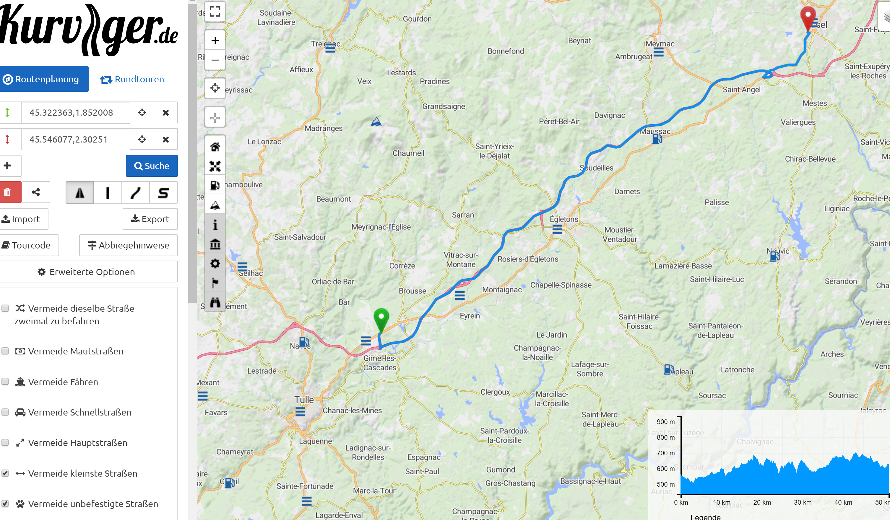
Hi some screen shots
Just try to select a starting point near west of Gijon on N632 and a target close to Lluarca and try getting it to route via N632.
My quick’n dirty idea is, if you deselect highways, then the routing option “fastest direct” (Highway Symbol) becomes unrecognized by the routing algo, at least for the 1st leg.
It seems the router completely ignores that part of the road (in both directions) because of this. Notice how the blue line never appears on that part.
Yes, that is most probably the issue, thanks for finding this!
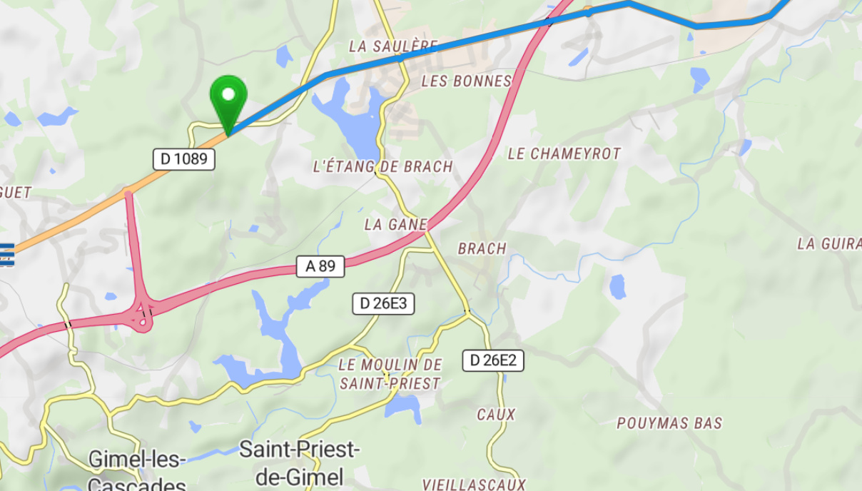
If you look at the surrounding ways, there is maxspeed:backward=80. Maybe it would make sense to “hot fix” this like that and keep the note open? 80 is probably more correct than 1.
Hi,
leaves me w/ a few questions:
Max speed in France is 80Km/h ? Wasn’t there an issue w/ setting Maxspeed for all roads (Non Highway) to 80Km/h as a general override?
What means back or forward? everything is relative? We talk about roads, not lanes??
I added the route in France to excluide that there was a particular issue w/ the route in Spain. Your contribution suggests, that there is a peculiarity on the road in France. Hence I choose another road where the national road goes in parallel to a highway, and I end up with a similar problem.
Take a look at this route. https://kurv.gr/icNCq
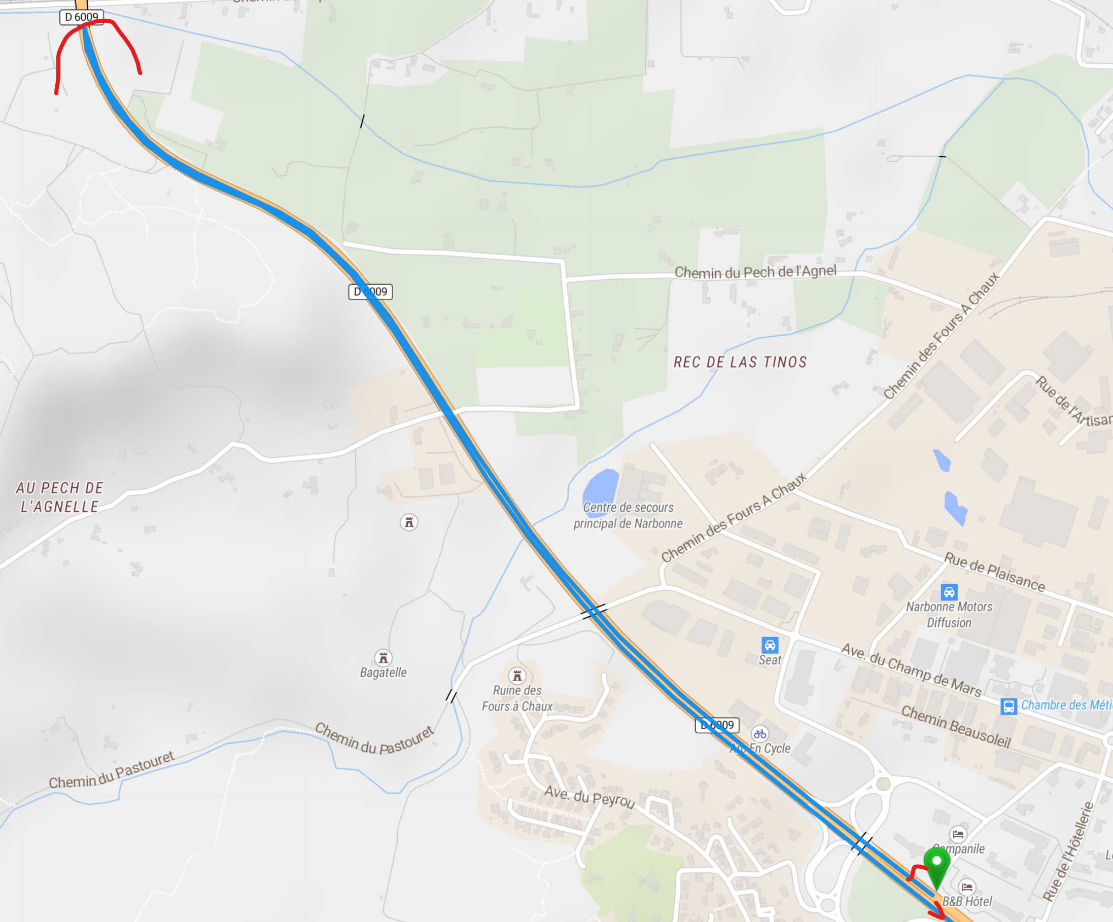
Over Highway is OK, when Highway is switched off, the routing takes you back! a few hundred meters and then asks for a U-turn.
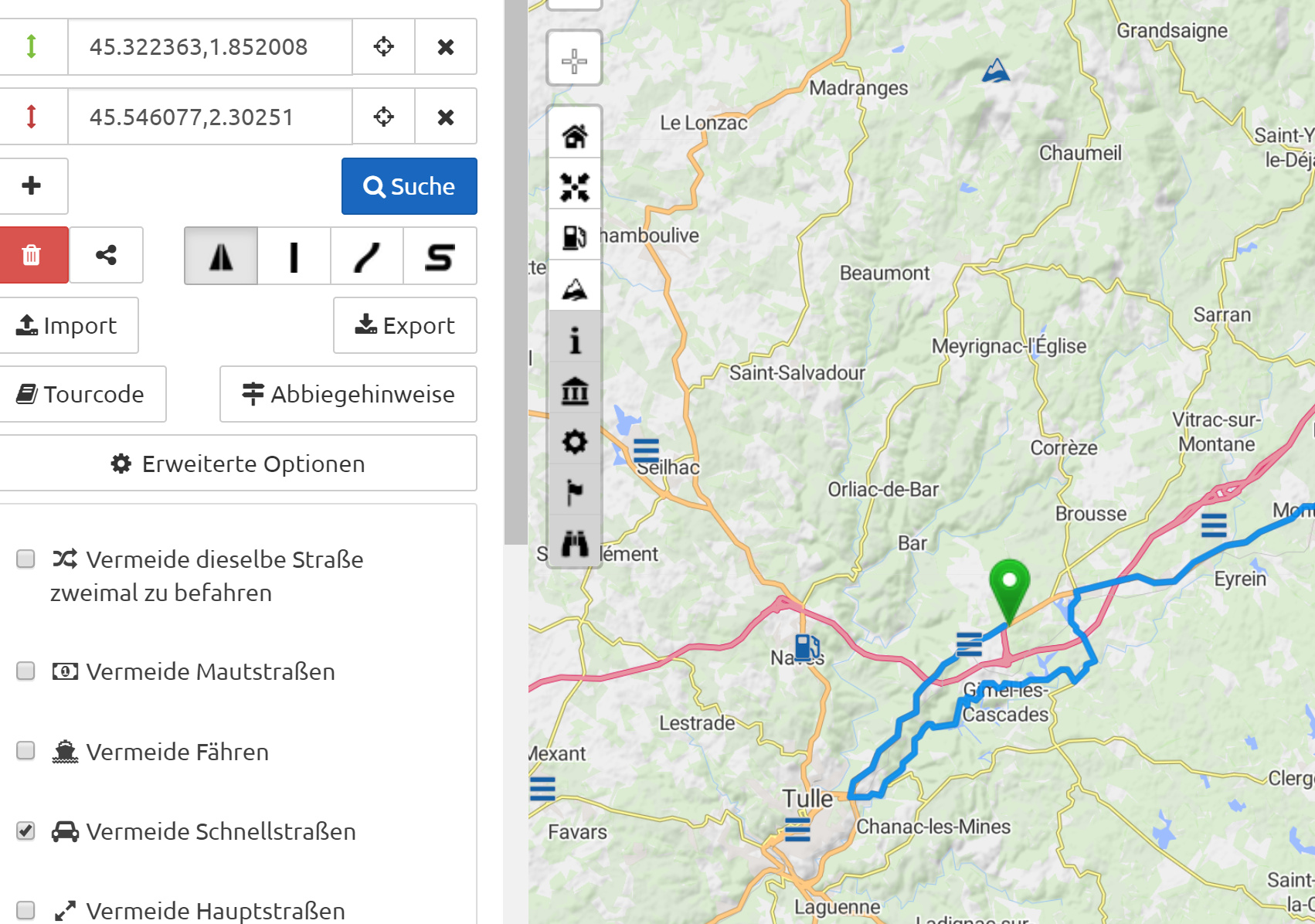
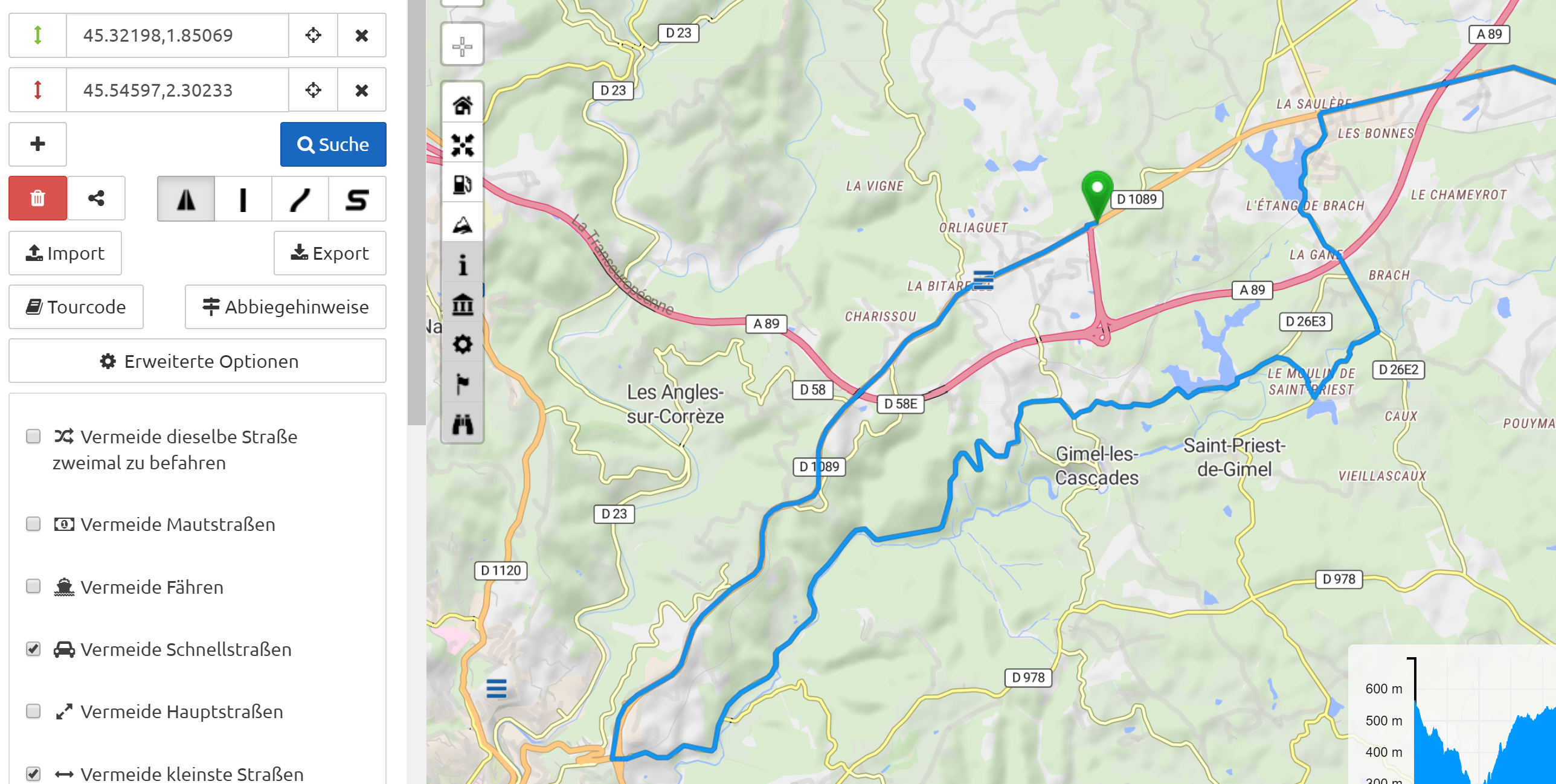
It appears to me that the positioning of the starting point is not independent from directions. Apparently it is set onto a lane, not a road. I checked this section on Google Maps and found out that this road has a separator in the middle, hence you cannot just turn around. Apparently the starting point is now on the wrong side of the road and therefor routes the initial leg into the wrong direction. However this should not happen and the starting mark should be “direction less” , enabling routing into the direction of the target point right away.
Edited: I just zoomed to max and moved the starting point on the “right” lane, and routing is OK, which confirms my reasoning above.
Same applies for the other French road, it is a multi lane road with a contiguous white line in the middle, - no turns allowed.
RGDS
hk
Hi,
sorry I didn’t know this. I thought screen shots would be required. Screen shots show, what is on my screen, while I cannot control what shared links produce on other PCs.
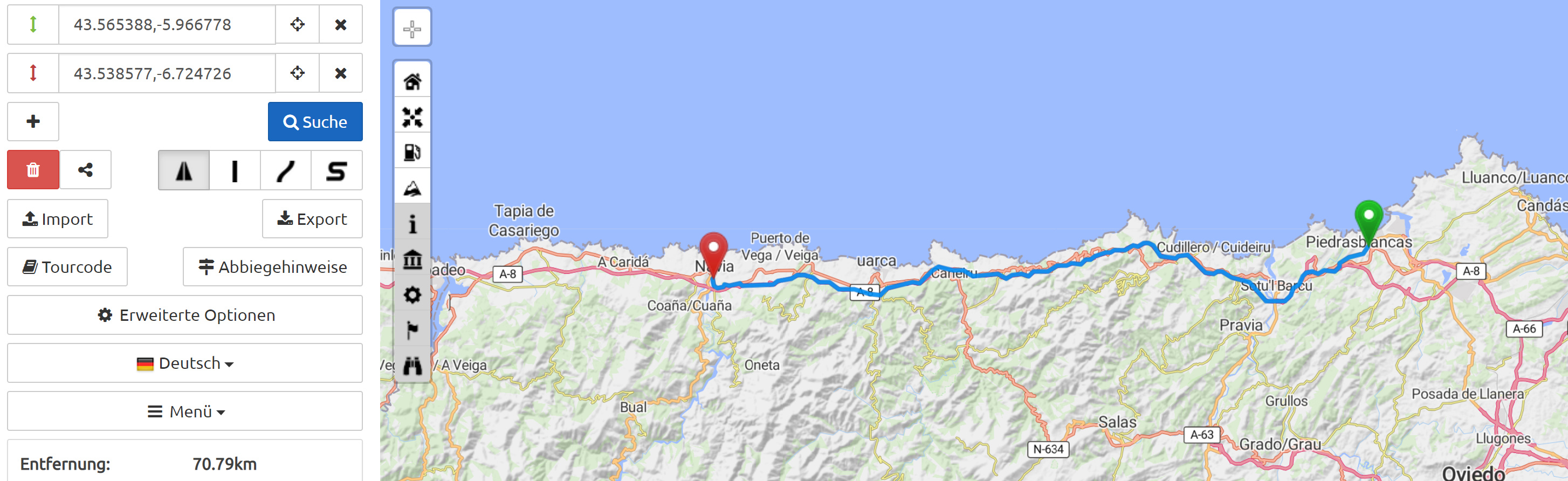
Here is now the link for the problem in Spain.
https://kurv.gr/Aq0G2
The problem is to use whatever configuration parameter, to convince Kurviger to route via the national road N632 and not over the Highway.
Rgds
hk
That’s the beauty of Kurviger links, they contain all the information needed to make a route with exactly the same parameters that you set. So we get by definition the same output as you from the algorithm. Links are really the easiest way for debugging. Screenshots on top are of course super nice and very helpful as well
Hi Ive, that’s not really correct. This entirely depends on the underlying map data, and in our case OSM treats most bigger highways as separate roads per direction. You can see this on the map itself most times as well, the “directional roads” are often separated by a few pixels. Thus we naviation users have to be a bit careful where we place our markers. To alleviate this, I would always recommend starting and ending somewhere else, on a smaller road
Do you have any other questions about this? In your last post it seems you’re good now, right? Don hesitate to ask again if anything’s unclear
Kurviger does not override things like that, it (again) follows the OSM data. If you find an error in the OSM data please don’t hesitate to correct it! (or ask in the forum and maybe somebody else has time to help out with the editing)
Yeah I know, I remembered that discussion, that’s what I meant to say, we can just listen to OSM, not more. If all roads in OSM have been correted -> nice. If not -> bad luck for us
The issue presented here is a data issue. Changing the max speed for France is definitely a challenge for OSM, if maxspeeds have been tagged that are now changed from 90 to 80, but not yet reflected in the data.
Every way in OSM has a direction. You can set many attributes in forward direction and in backward direction. For example with maxspeed it can happen that a road leading into town is already at 50km/h but the same road in other direction, leaving the town has a higher speed limit, like 80km/h. The forward and backward allows to set this. In your example, someone set the maxspeed to 1km/h. Therefore, Kurviger won’t use this road and take a detour.
Hi, All,
OK, I learnt a few things from this discussion:
Starting Points (I guess End Points as well) are put on lanes, not on roads. I can see advantages and disadvantages for this, so I keep my mouth shut and take it as a given. Hence if you place your starting point onto the wrong lane, and if the road does not allow you to make a U-turn, you may be routed initially into the undesired direction. If its not already there, pse put this into the documentation. As a naive user, I did not expect this. I thought, waypoints would by “direction-less”.
The A89/D1089 routing problem comes from an OSM data problem; OK I guess, this is the price to pay, when using FoC chart material. I guess, there are many of these in France.
However, there is still no explanation for my 1st problem in Spain, why the hell it is absolutely impossible to make Kurviger route over N632 rather than A8 and what could solve the problem, rather than having to put 20++ waypoints.
Here once more the share https://kurv.gr/Aq0G2
RGDS
hk
And all others as well All waypoints are trying to put the route where the tip of the marker is. It’s just that only the most major of major roads even have separate lanes. So in absolutely most cases you’ll be fine with putting the marker roughly where you want to go
hm I guess maybe in this case it’s quite tricky to get Kurviger there because it thinks that the N632 is also a “bigger” road and not one to heavily prefer? I think setting the route profile to “curvy” helps already a little bit Kurviger
But yeah, I mean it’s always true that… if you know best where to go, where the road is nicest, you’ll probably have to wrangle the computer a little bit to do what you want. I guess in this case you’ll need a couple waypoints to get this going