I also see approximately 25% overestimation of the time required by Kurviger. Often for routes of 6 to 8 hours. But this was always the case with K2 as well.
On most routes I have a similar observation. But that depends on on the actual route.
For routing questions, please open a separate topic, and always include a link to a routing example.
IMO it is better when the calculated time is greater than the other way round.
This way you have some safety margin to arrive in time.
4 Likes
That’s my thoughts also. It would be worst, if the calculation would lead into a delay.
And I think the calculation is based on the data source of the map. It can be just as good as the source is.
There seems to be a big difference between Google Maps and Kurviger for the same route. I was looking for a shortish ride of 160km, Kurviger shows 2hr 20min and Google maps 1hr 45min.
Does Kurviger differentiate between different roads (motorway, 100km/h, 80km/h, towns (50km/h), mountain roads, etc etc? Is that taken in to account? Can we change the “average speed” as a user applicable for various road types? I think that would be very useful!
thanks
Robert
Yes
Currently not, sorry. Please feel free to share links to routes where the calculation is wrong and what the real time would be in your experience.
Google Maps can use statistics of million of people that travel all over the world (and they do), we don’t so I very much doubt we will be ever as good as GMaps when it comes to travel times. We improve the calculation regularly. You can also support us by improving the data at OpenStreetMap (for example when you enter the legal max speed for roads). When you are a Kurviger Tourer user, you can switch to the max speed details, if you see a road that has no max speed where you know the speed, you could enter the speed, it will appear in Kurviger a few days later and improve the ETA calculation.
2 Likes
I have a Tourer membership but on the web version I have not seen anything where you can enter speeds.
Where would that be visible?
You can view speeds on Kurviger, entering speeds is possible in OpenStreetMaps.
For OSM I would recommend to have a look at a tutorial first to get started.
For example: LearnOSM
Or on youtube: Learn How To Map in OpenStreetMap - YouTube
There are a lot of different tutorials out there, if you have a specific question, don’t hesitate to ask ![]()
1 Like
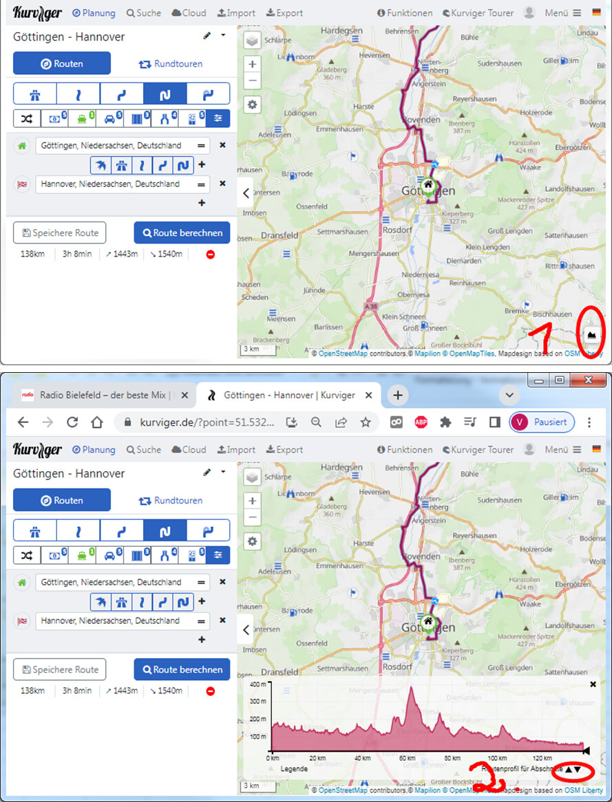
With Tourer membership you can show the speed limits of the route
- using the topographic diagram in the way as viola described
or - via the Route settings
.
.
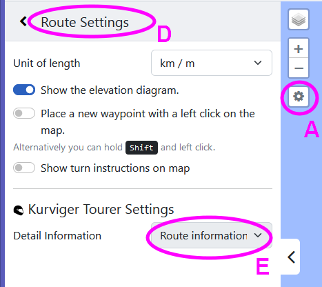
Clicking A opens B, there clicking C opens D, there at E you can select Speed limit.
Thanks, I can see the speed limits now, but still not clear how the ETA is caluclated.
If I use the max speed as per the table I get 1hr42min, but that is significantly dfferent from the 2hr20min Kurviger calculates (google maps gave 1hr46m). This cacluations uses max speed per section which is unlikely, especially when encountering traffic lights, so there must be a “fudge” factor somewhere that changes the calculation to 2hr20.
Where can we see what that fudge factor is (per road type)?
There are a lot of different factors that play into ETA calculation, sorry there is not much I can share here.
Like what? Help me understand, because I am curious why Kurviger is so slow.
I tried another route, from my home to the Eifel tower in Paris. Distance 481km (google maps)/483km Kurviger; Duration 5hr 29min (GM) and 6hr 9min (KR),… a difference of 12%, over the same distance…
Hello Bob,
to compare the system is more or less always difficult, google knows all the traffic jams, Kurviger not.
My calculation is for years about 55Km/h plus 30 minutes.(no highway used).
The result is accurate enough and includes the breaks.
In the Alps, the average speed is lower …about 50Km/h.
Don’t expect a “perfect” calculation like Googlemaps, Kuviger doesn’t collect users private data. Google is also sometimes wrong, last weekend it took me 6 instead of 3.5 hours on the highway for 340 km of traffic jams everywhere.
Cheers
4 Likes
But then you would expect KR to have shorter times than GM, not the otherway around. I recalculated the original route using the max speeds on the roads per section and the answer was closer to GM than KR.
So there must be a fudge factor or alternative speeds in the Kurviger Algorythm/database. What is the point of a planningtool if it is not reasonably accurate, and 12% of is not accurate by a long shot, especially if the distance is within 1% range of either calculation.
As previously mentioned, I can’t go into detail here. If you need exact ETAs I would really recommend using GMaps.
You will find cases where Kurviger is calculating too fas, too slow, or even just right. It always depends on your riding style etc. - we are constantly improving our ETA calculations, but I doubt we will have access to traffic data in the foreseeable future, which is required to calculate exact ETAs.
2 Likes
I don’t want exact ETAs, but want to have an idea what you use to determine ETAs, that way
Is it 10% less than the max speed for instance?
To get the same time as GM I need to adjust the max speed by 0.735…
My God Bob,
just imagine that there is a 10% discount and keep your feet still.
You don’t need any detail information about the algorithm and therefore you won’t get it.
4 Likes
Hello erverybody,
I’ve made same Routings with KR and export this routings as *.gpx File to share with Garmin Navigator.
So I import the files in BaseCamp from Garmin and see very less different between the times of the routings.
So in my point of view the calculation of time between KR and Garmin BaseCamp is very smal an for me more than acceptable.
1 Like
It does not work that way, there are a lot of different factors.
I have always found that the Kurviger website overestimates the time required to ride a route, but it’s usually been on the order of ~25% or so. However, today I created a route that was a portion of a route that I regularly ride. Kurviger estimated the ride time for just this portion of my usual route as 2 hours and 13 minutes. I ride the usual full route in less than one hour. I cross-checked the travel time by putting the exact same route portion in Google Maps. Google Maps estimates the travel time as 49 minutes, about what I expected. For some reason, the Kurviger website is overestimating the time travel of this route by a factor of 133/49 = 2.7 (2h13m vs 49m).
Here’s the link for the Kurviger version of the route: Kurviger
Here’s the link for the Google Maps version of the route: Google Maps
(Debug information, this helps us helping you, you can remove this if you don’t want to share this data, it should not contain any personal or sensitive information)
Device: Google - Pixel 6 Pro - Android: 13 - WebView: 107.0.5304.141
App-Version: 3.0.0 - 249