I think an implemenation of waypoint names / colors / categories is somehow difficult due to the format Kurviger website and app use for exchanging and saving routes.
Every waypoint is only stored with its coordinates. By adding huge additional information (like names, colors or categories) the format wil get quite “bulky” an there are some difficulties and risks (e.g. if using special characters in names etc.).
So maybe a simpler approach could be a good compromise: using only one additional character (A-Z) per waypoint to classify it. Then the format would stay compact as every waypoint would be stored like “point=48.366804%2C10.898697%A” for example.
By using A-Z he amount of possible labels should be enough for a quite flexible usage.
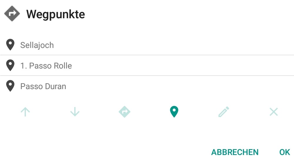
The user should then be able to select the classification label A-Z for a waypoint (A could be default) and to configure his own name/category and color for every label on the website and in the app.
In the app the simple label character (A-Z) could be displayed additionally to the number of a waypoint in the according fields and display elements (better than longer names) and be displayed in the configured color. Therefore displayed information would stay neat and clean although different types of waypoints can easily be distinguished.
If exporting a route as GPX the configured name/category of a waypoint could be used in the <name>-tag, so that this individual information would even be preserved if sharing the route.
Absolutely. But I think the URL format is used (and necessary) for handling routes on the Kurviger website, right? Or would there be also a possibility to use JSON?
In theory we could encode the whole content of the .kurviger json file in the url. There are existing standards to encode information in urls for example here or here.
Unfortunately, browsers do limit us here quite a bit with the url length. Different browsers support different url lengths. Generally it’s recommended to stay below 2.000 characters. Current browsers support over 30.000 characters. Which might sound like a lot, but the .kurviger for a medium sized route would probably not fit. Longer routes will definitely not fit.
Transfering only waypoints and some routing parameters should fit however.
That’s the point which I thought could make trouble.
That’s the point which may be solved by using a pragmatic format with a small footprint like in my suggestion. I think you always have to accept trade offs concerning certain aspects. But it would nevertheless improve flexibility.
Hallo nochmal,
will nochmal nachfragen zu Wegpunktnamen im Kurviger Planer ändern.
Wenn ich eine Route im Kurviger Planer erstelle möchte ich bei einem Stop
bei einem Hotel, Gasthof, …, einen Wegpunkt setzen und dem einen Namen geben.
Thanks for implementing the new features also in website!
If you want to use the given names in a GPX, as an interim solution you can use the konverter Shaping with the combination of exported GPX and exported .kurviger file as described in the last paragraph of Help
Vielen Dank für den Einbau der neuen Funktionen auch in die Website!
Wenn Ihr die vergebenen Namen in einem GPX verwenden wollt, könnt Ihr als Zwischenlösung den Konverter Shaping mit der Kombination aus exportiertem GPX und exportierter .kurviger-Datei verwenden, wie im letzten Absatz von Help beschrieben.
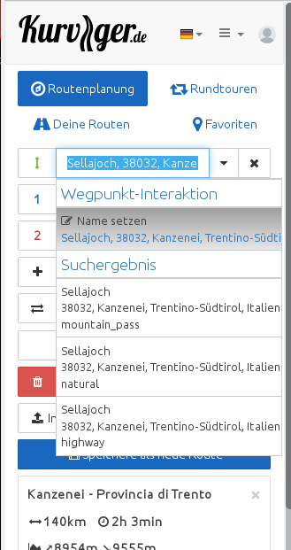
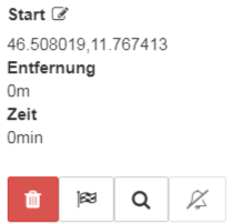
Now clicking on the markers does not show the name:
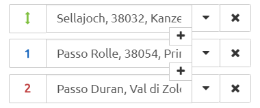
Nevertheless the names are shown in the list on the left:
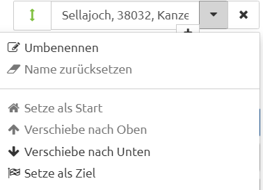
And using the pulldown menu on the left does not offer “set name” - just disabled “reset name”:
If I chose “rename” and click on option “Set name” in “rename”, then the right name is given:
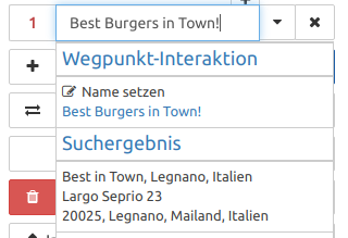
So my proposal is: If a point is added via the search function the name of the added point should be set automatically to the name of the search result.
From my point of view this should be also done when adding a point via context menu of mountain pass icon on the map.
As far as I have seen, in the app this is already done for search results:
But to say it clear: I think, the solution of the app is much better: Entering a point using the search result automatically sets the waypoint name.
I have some doubts if anybody wants to have the coordinates as name - but if you want to have the useful names, you save a lot of clicks.
Regards Markus
 on the map.