There is no time available to work on offline map creation or map style.
As already mentioned, these should be public so that the community can improve them.
Use bayern.map from kurviger download server (all my examples are in Munich, so berlin.map will not help ). Result: Roads still disappear (just a check to ensure that not the map size is the problem)
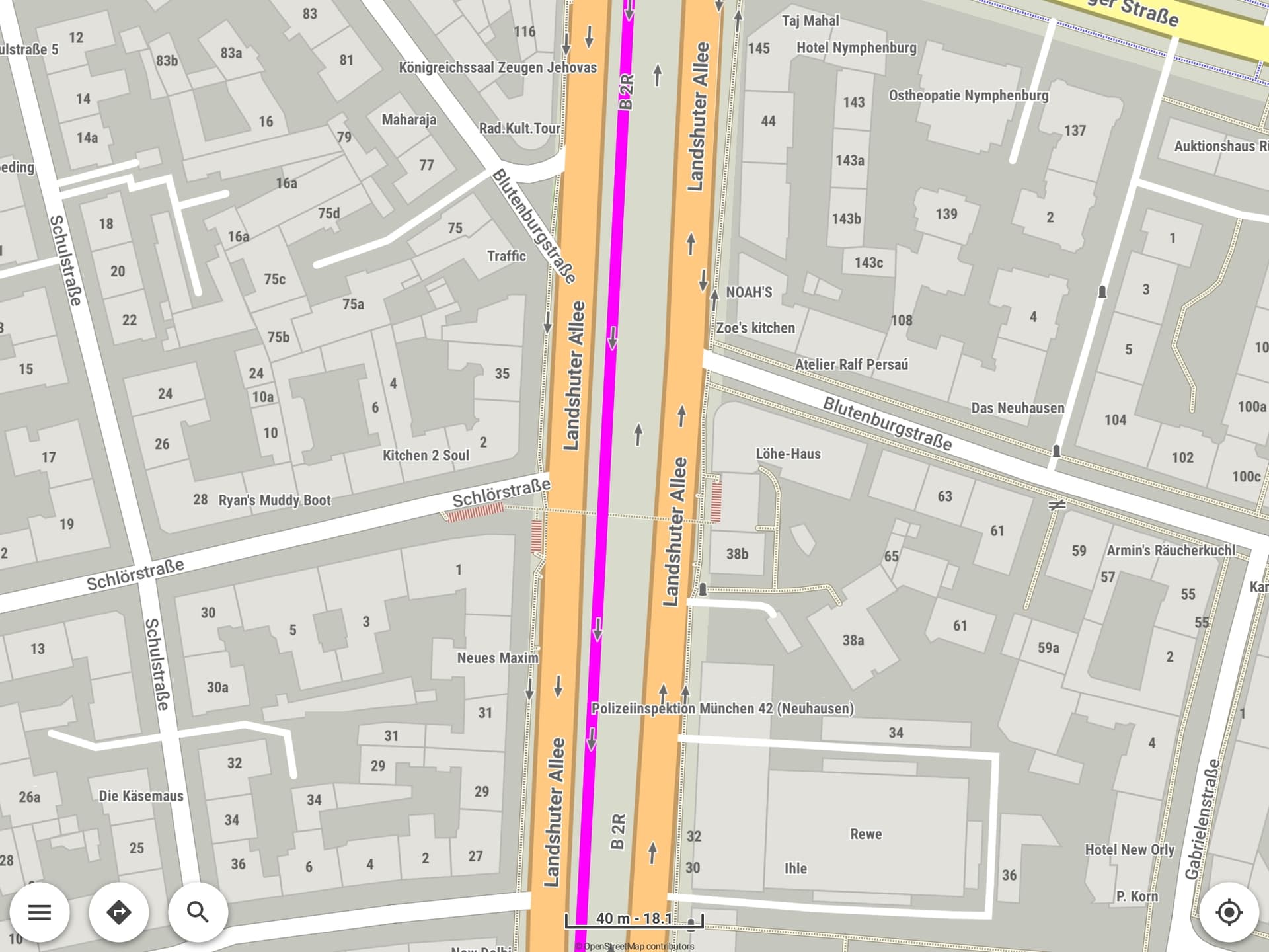
Use bayern.map from OpenAndroMap . Result: Roads visible until max. Zoom (still default style from Kurviger App used)
Use bayern.map from kurviger download server, but open style from OpenAndroMap. Result: Roads still disappear, indenpendent of selected style (Elements.xml or Elevation.xml)
Conclusion: Seems to be a topic of maps on Kurviger download server.
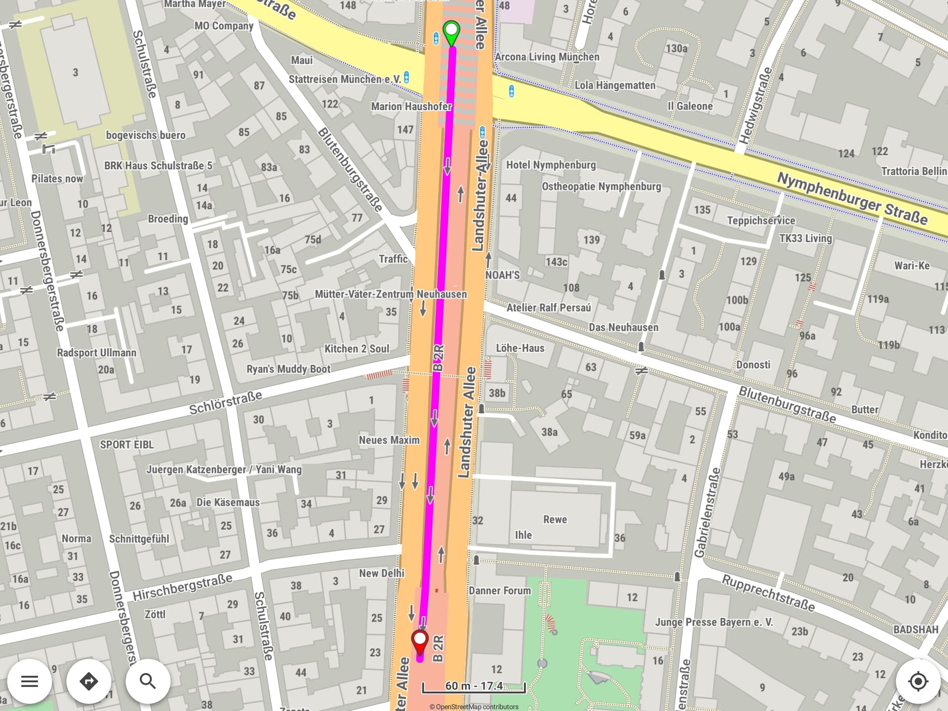
Hmmmmm - you are right twice: The oneway arrow symbols still appear . And as far as I can see, all disappearing roads are tagged with layer=-1.
But - as mentioned before and in the other thread - the disappearing could be fixed by using other maps, but style had no influence. For the Z-Level topic it was vice versa: The used map had no influence, but it could be fixed by using an other style (my first idea was to write both topics in one thread, but now it seems that two threads are better).
But nevertheless I think it is a bug in map generation: Why is the colored line for the street gone only, if I zoom in to zoom level 18 or higher ? And why does it work correctly with map from OpenAndroMaps?
I will try OpenAndroMaps for the next time - but downloading them is not as comfortable as downloading the maps from Kurviger download server. Up to now I thought using the maps from Kurviger server would be the best, because it is the “native” map provider, probably most people use it, so maximum test depth …

 ). Result: Roads still disappear
  (just a check to ensure that not the map size is the problem)
 (still default style from Kurviger App used)