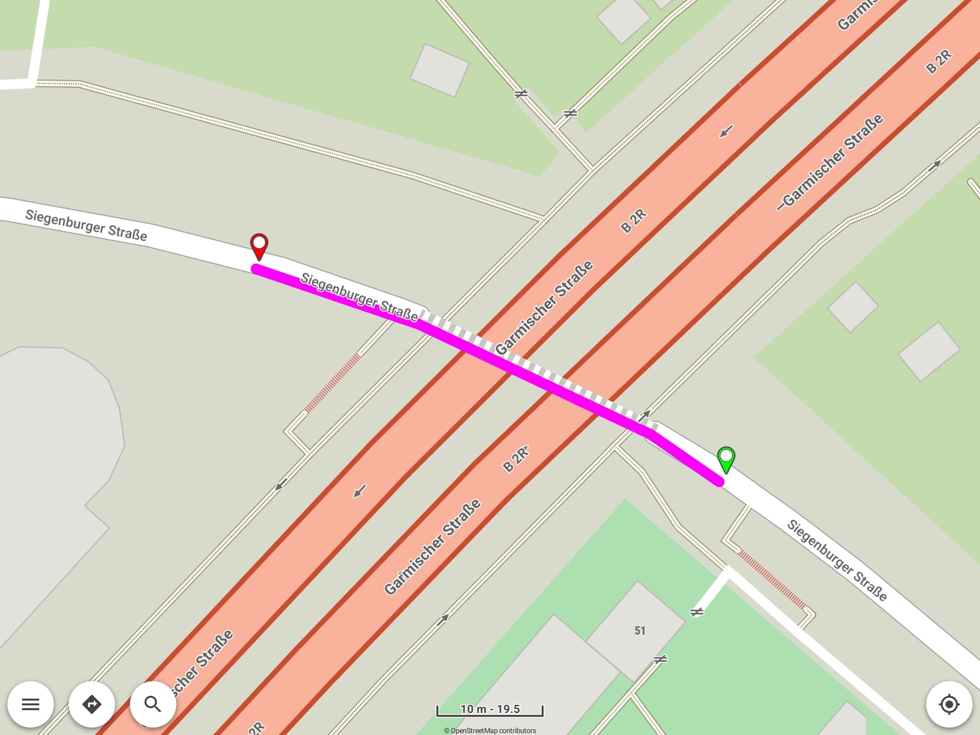
Sometimes crossing roads with tunnels or bridges are shown in wrong order - the wrong road is on top.
As far as I can see, the OSM data is correct.
Example: Kurviger
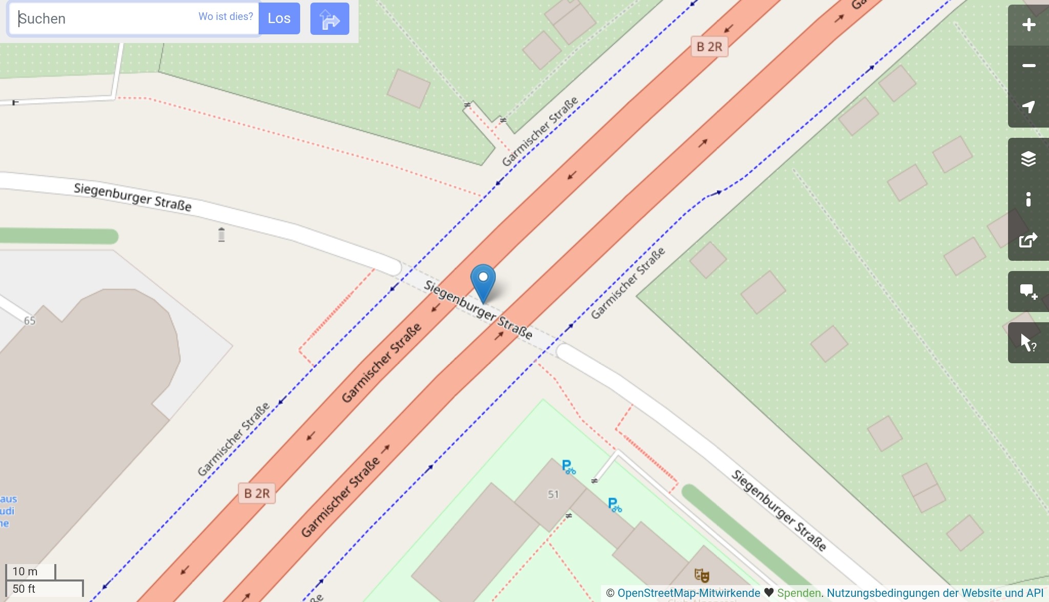
Further examples:
If useful I can provide further screenshots.
I opened only the germany.map (just downloaded → up to date). I use the internal map style.
There is no time available to work on offline map creation or map style.
As already mentioned, these should be public so that the community can improve them.
For me, application development is a priority…
Also check OpenAndroMaps with or without Elevate map style.
Please check map region files, we cannot download 2.5 GB of germany.map for a test. 
e.g. berlin.map is much better for testing
Thanks for the feedback.
I will try other maps/styles (probably tonight).
Changing to an other map did not help (neither bayern.map from Kurviger download server, nor from OpenAndroMaps).
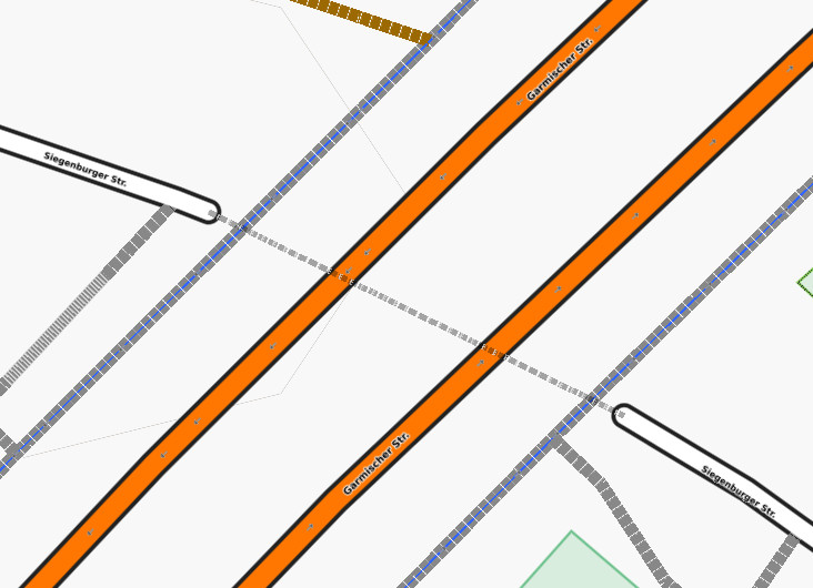
But opening style from from OpenAndroMaps lead to success: The tunnel was always below the road, indenpendent of selected style (Elements.xml or Elevation.xml). 
But I have to admit that I do not really like the view of the OpenAndroMaps styles - so I will switch back to default Kurviger style and try to find out, if I can solve that by modifying it. But not tonight …
Any hints how to proceed are welcome (also of non-Kurviger developers, of course )!
2 Likes
Thanks for the tests.
OpenAndroMaps in addition to its map style also has public
the tag-mapping and tag-transform, both used in map-writer.
The map-writer on Kurviger server probably uses something similar…
About map styles, they have separate rules for bridges and tunnels.
You can also try with Cruiser GL (Android or Desktop).
It contains other map styles (see here).
Quick update: checking OpenAndroMaps and Elevate,
tunnels have dashed line and layer is not below roads.
1 Like