Good morning,
How can I ensure that when exporting to GPX the waypoints do not have the writing waypoint 1…2…3…etc. in the notes all field?
Unfortunately, when I import the file into the GPS device, the names of the WPs appear followed by waypoints 1…2…3…
I just tried and if there is a name for the waypoint with these setiings
it is in the gpx file
before it read like this:
<wpt lat="50.411739" lon="9.70789"><name>Waypoint 14</name><desc>Waypoint 14</desc><sym>Waypoint</sym><type>shaping</type></wpt>
and then I gave it the name “Ausweichpunkt” and now it looks like this
<wpt lat="50.411739" lon="9.70789"><name>Ausweichpunkt</name><desc>Waypoint 14</desc><sym>Waypoint</sym><type>shaping</type></wpt>
Maybe you have to edit manually (or use a little script) to have the same text in <desc><\desc>
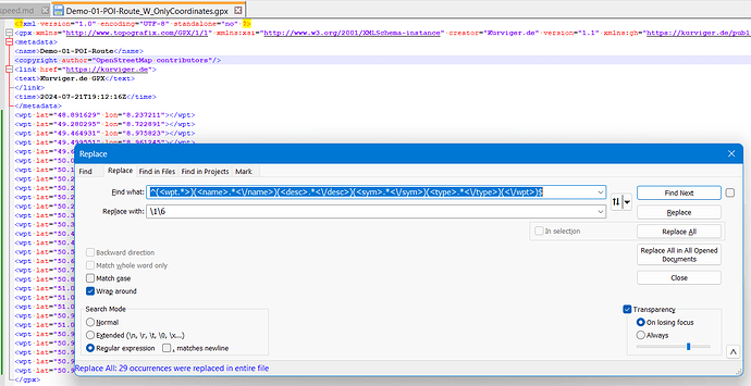
When you use Notepad++ you could use this procedure. Open the gpx-file and do a replace like this.
^(<wpt.*>)(<name>.*<\/name>)(<desc>.*<\/desc>)(<sym>.*<\/sym>)(<type>.*<\/type>)(<\/wpt>)$

\1\6
The “backslash + number” is related to the text in brackets.
Here: Take the part 1 “<wpt …>” and part 6 “</wpt>”
My testfile:
Demo-01-POI-Route_W.gpx (4.7 KB)
thanks for the replies, but it would be nice to have the waypoint or shaping point info field customizable to be able to insert notes as desired as with other applications.
The name of the waypoints are exported as “Waypoint n”, in case you enter no additional information to the waypoint.
When you enter here a useful information, then this information is exported as name in th gpx-file. Useful information could also be just a space or a dot, but I do nor know how your application displays it.

I can assure you that even if you put the name as you like, during the export phase you will find it followed by waypoint (n) because it is automatically inserted in the info field of the waypoint itself, while at the starting point it will say continue and at the final point it will say the name you chose followed by arrived at destination.
This happens both by importing the gpx on MRA and on Basecamp and by importing directly on gps.
It would be enough to make sure that the info field is not filled in and that the user is given the possibility to do so and it would become, in my opinion, the most performing application at the moment.
And the usecase is that it looks cleaner, or to save clicks in MRA and Basecamp?
I am not aware, this has been a requirement before. I not using both software packages, so perhaps these both packages have an option to filter something on import.
Fo the future I could imagine, there could be special export options.
As an an option on th UI, at least for me, I see more issues explaning the usecase, than I can see an advantage. My opinion.
For my opinion it’s quite easy:
There is no “info field” - only NAME, CMT, DESC are relevant for information about the waypoint in a gpx-file. And NAME is enough to work with.
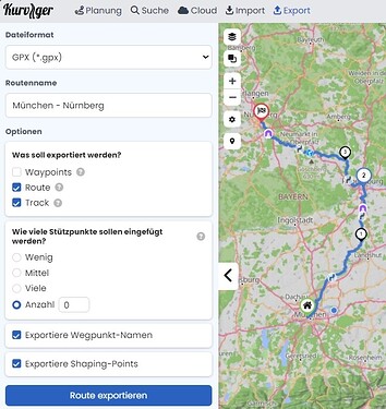
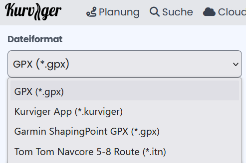
If you name your waypoints (mostly Via-Points I guess) in Kurviger the exported gpx-file will contain this information. Take this example: https://kurv.gr/SsuvH and export it with this specification:
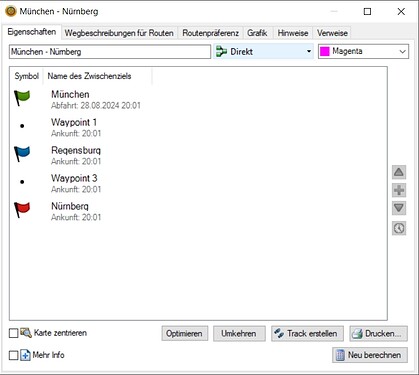
I named Start, WP2 and End by “München”, “Regensburg” and “Nürnberg” and if I import the corresponding gpx-file into BaseCamp these names are there - proven by the export out of BaseCamp: München - Nürnberg bc.gpx (539,3 KB) or by this screenshot:
Don’t know what MRA does and I’m not interested to learn it.
Thanks for your interest, unfortunately even with this solution the “problem” persists, in my opinion if the developers could read this thing I think they can make sure to have the info field visible and fillable by the user and if it is not filled in leave it blank by default. It is a very useful field, keep in mind that it is inserted by the GPS following the WP and helps you during navigation to take notes on the points themselves!!
Still I do not see what your problem is.
Could you please display the entries from a gpx file that is “correct” to your opinion?
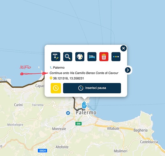
the problem is that when you go to import the gpx into the gps device, in my case a BMW CRN, in the name of the waypoint is added below what you see in red in the photo, these would be the notes that with professional software you can fill in at will that are used to help you on the route, especially if you use the tracks, go offroad etc… unfortunately here it is not clear why this field is automatically generated by Kurviger and cannot be modified, unless you import it into another software and then modify it. Some gps devices do not take this data into account and you do not notice it, others instead take this into account and therefore it is annoying to see your own WP with personalized names the addition of other names not wanted by the user. I know that for many this thing does not matter, but I assure you that it is annoying
Does this “planned feature” (wishlist) fit to the requirement?
The used <desc> field in the gpx file could contain user data instead of the predefined data. A description field on the UI had to be introduced, which exports/imports to/from gpx-files and possibly the other formats.
Is the description field in gpx currently used in any kind in Kurviger-Code? What would happen, if it is not exported at all, any (good) reason to keep it as it currently works?
Another usecase here:
exactly, if the field could be customized it would be perfect, at the moment the gpx generated by kurviger (and it seems to be the only one) inserts data automatically (it seems that they are data related to navigation) and it is not possible to modify them unless with other utilities. At the moment it is one of the few shortcomings that kurviger has in addition to the fact that it would be nice to have enabled the field for planning the day and time of departure of the routes and the breaks to be inserted in the WP, after which I think it could become the best utility for creating gpx!!!

