Sorry if it’s badly translated because I use google translate. And if a similar subject is already treated on the forum because not easy to search in another language.
I have always used Calimoto for my region and am looking for a free application for the whole of France for a road trip this summer. I tried kurviger the other day but there are some issues that bother me for a long ride, maybe it’s a misunderstanding on my part so here’s what I found:
Impossible to pause navigation when stopping for hiking, for example. so it must be consuming battery and looking for a new route all the time in the background I think.
I don’t plan in advance where I stop each day, so I’m going to create a large complete itinerary, but you can’t start in the middle of the circuit without deleting the waypoints one by one… application crashed in the middle of my 500km ride with 55 waypoints, I had to restart and delete everything.
I saw on the subject of the last 3.0.9 update that you could add a starting point, I tried at home, it moves the starting point but not the waypoints before.
I had to refuel, but impossible to add a waypoint during navigation, and impossible to pause the navigation to add a point, as with calimoto. (It will also be practical to see the name of the stations on the map (Total, supermarket…) and not just a logo because on Sundays the small garage stations are closed and are expensive the rest of the time)
I also had other small problem, the navigation often wanted to make me leave the road to make a small “loop” on the small piece of parallel road which deserve the dwellings for example, then to make me return on the road initial 100m further. And the GPS position is behind the map which is annoying for close intersections in town, when you say to yourself “I’m turning to the next street” finally it was the one and you have to turn around.
Restarting the navigation, even with many Via- and/or Shaping-Points is not a problem, as the navigation after new start finds its position “within” the route, so it will not force you to go to previous points.
You do not have to delete previous points, after restart (as mentioned above), as the navigation after new start finds its position “within” the route, so it will not force you to go to previous points.
Yes, adding waypoint directly from the navigation is not possible yet, but you may stop the navigation and add the gas station in the planning mode and then restart the navigation.
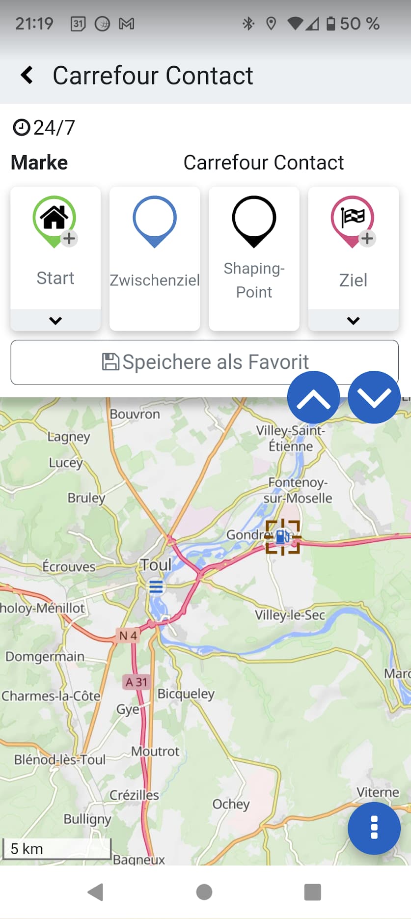
When clicking on the gas station POI symbol in the planning mode, you can see some information about it and if you add it into the route, you will see the coordinates as well, which may be used for further queries e.g. with Google Maps.
Je suppose que tu viens de France, c’est pourquoi j’ai utilisé le traducteur Deepl.
Il est bien sûr possible d’arrêter la navigation, appuie sur le bouton avec les 3 points dans la partie inférieure droite pendant la navigation et sélectionne ‘Quitter’.
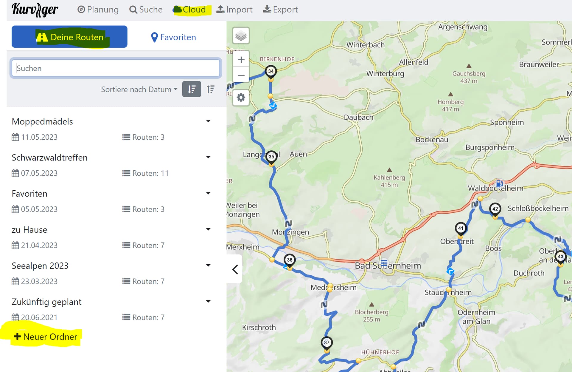
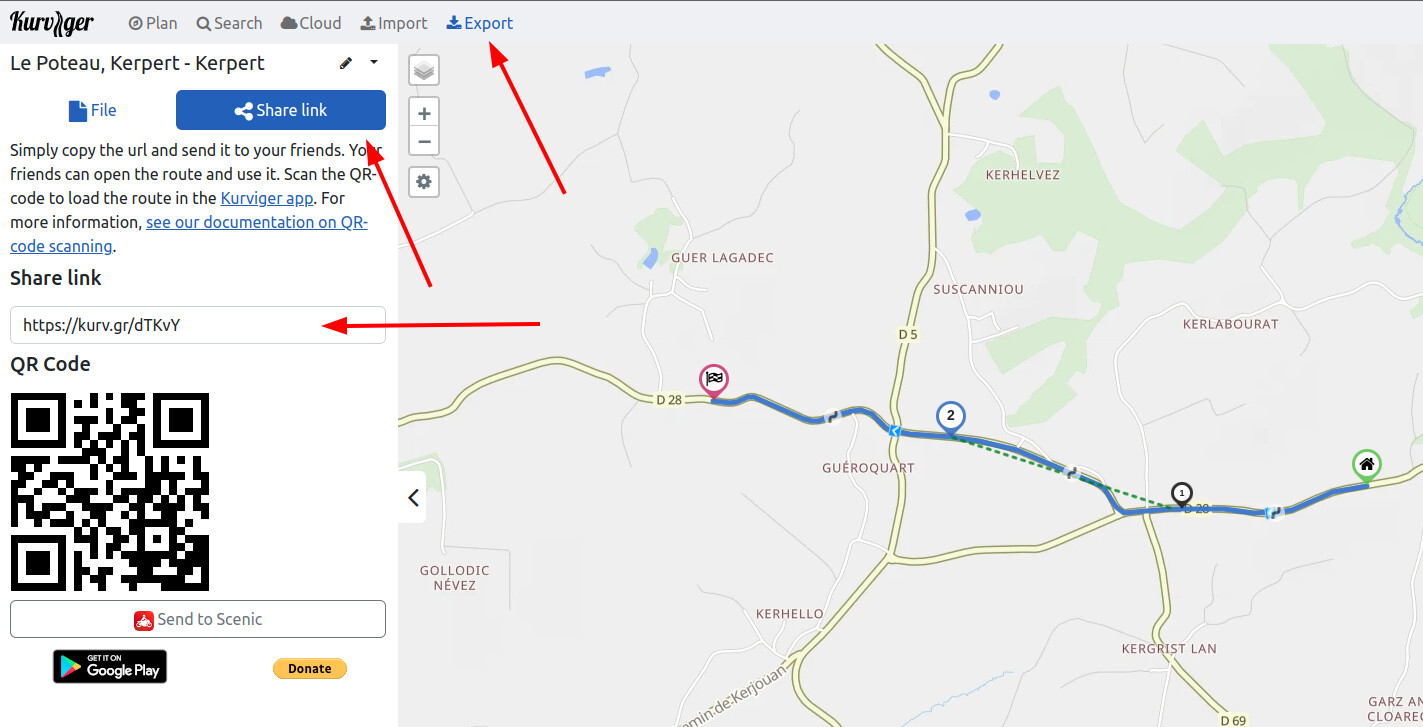
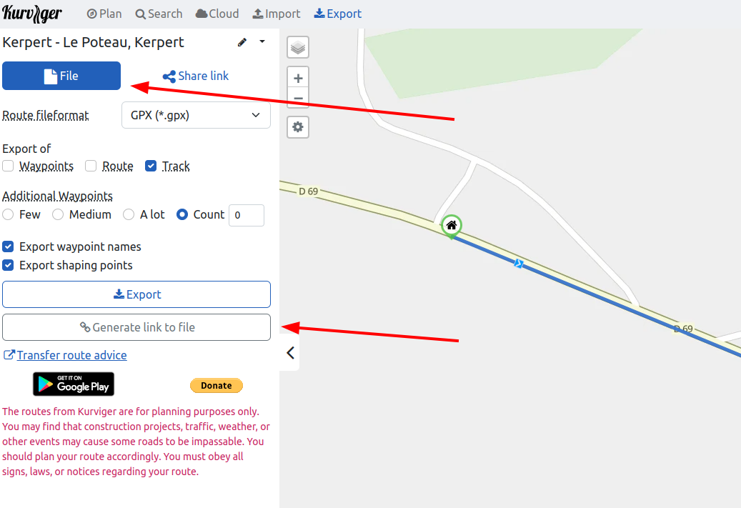
En général, il est préférable d’enregistrer l’itinéraire planifié dans le cloud :
Tu peux soit les placer dans un nouveau dossier, soit les enregistrer dans les favoris. Tu peux ainsi recharger l’itinéraire planifié en cours de route, si tu as accès à Internet. Si ce n’est pas le cas, exporte l’itinéraire planifié en tant que fichier *.kurviger et enregistre-le dans un dossier local sur ton téléphone portable.
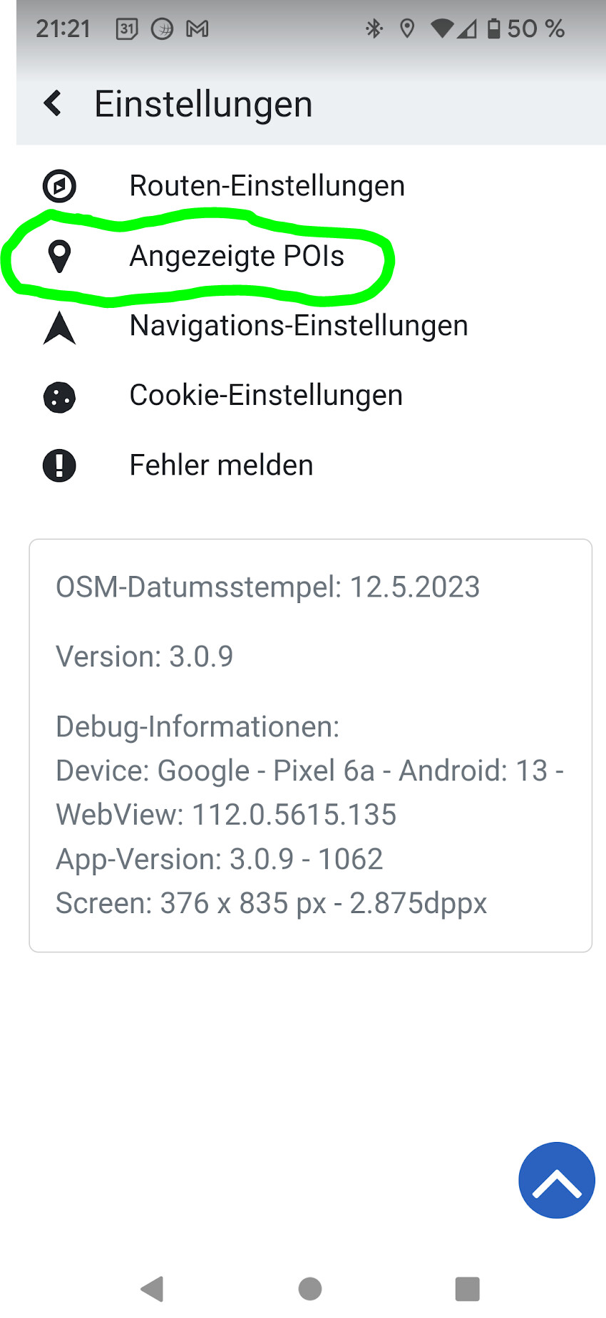
pour trouver des stations-service, il suffit de le sélectionner dans les paramètres :
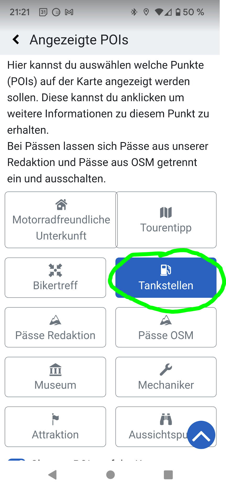
Si tu tapes ensuite sur la station-service dans l’application Kurviger (important : terminer la navigation avant !), tu obtiens une indication sur le type de station-service
Je ne comprends pas bien le problème avec les boucles, tu devrais vérifier avant de partir si les points de repère sont bien placés sur l’itinéraire prévu.
Le problème du retard de la position actuelle est connu et les développeurs y travaillent - il devrait être résolu dans une prochaine version.
I didn’t dare try on a walk, but when I create a route at home by placing the start further away with forward waypoints and I launch it, it wants to take me to the previous points. Maybe it’s only when we start rolling that he cancels the other points? I’ll give it a try then.
If we can stop the ride without having to delete the points then that also solves the problem for the gas pumps
How do I share part of the trip?
Yes I had registered but according to my tests at home we could not start in the middle of the circuit created, so I did not want to stop the navigation. Apparently finally yes, I will have to test in real condition, and that also solves the problem for gas stations.
I found a bit of road where there was this bug. Strangely the bug is not present on PC, and on the application the bug is corrected only by checking the “level of avoidance of narrow roads” at 1 (therefore the lowest which should make you take small roads on the contrary) or by disabling it.
Did you have the “Simulation off”?
With “Simulation on” it starts with the planned Start-Point e.g. continues from the begginning.
With “Simulation off”, when you are on the Route, it continues from where you are…
If you are not close enough to the route, some mismatch may be possible, in such case you have to go closer to the route…
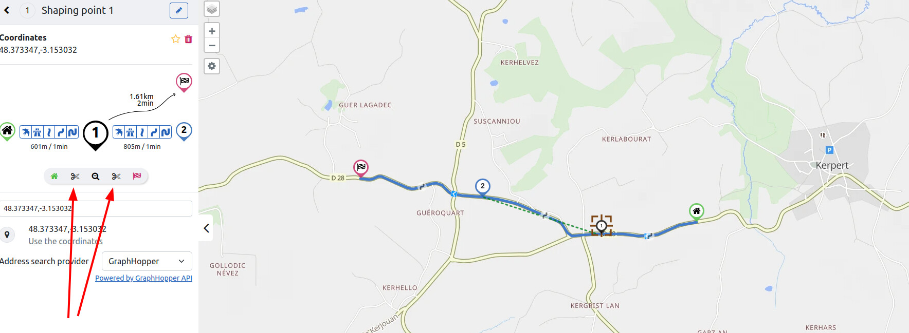
I cannot see much from the .gpx . If you have the (full) original route, you may cut a part from it using the scissors at points, after clicking at point (if you hoover over the scissor with mouse pointer, short explanation occurs)
I have found this to happen many times when I place a shaping point or a way point slightly off the desired route in an area where there are other roads. This is particularly true for urban neighborhoods. The app takes me as close to the shaping point as possible and then turns around if necessary. This is also more likely when asking for curvier routes.
Indeed the problem appears when I set the level of turn to the maximum. It is however a very different road and not of the same color as the other.
There are no misplaced waypoints.
In general, the “golden rule” mentioned here is to “avoid avoidance”. In my understanding, that is because the avoidance needs more additional information from the OSM, which may be prone to be erroneous, resulting in weird routing in some special case.
I was able to try on a short trip to cut the navigation in the middle of the ride and restart it. The application automatically moves the starting point to where I am, but always wants me to go through all the first waypoints again. Maybe because I use “intermediate point” waypoints but I should use “shaping point”? I don’t know the difference.
Yes, that is exactly the one single difference between the bigger intermediate points and the smaller shaping points - intermediate points are given to the navigation engine as “must-drive” So there are some ways to improve this situation for you. You can use shaping points, yes, but even if you want an intermediate point (like a restaurant break at lunchtime) you can work with this. You can either
start the route then click on “skip” in the menu until the intermediate points you have already driven are skipped
or modify your route in the planning screen before restarting the navigation. It’s only two clicks per point, click on the point and then on the trash can at the top right
OK thanks. I’m going to try with the fitness points then because it’s for a big tour of France there will be a lot of points to delete at each break every day otherwise XD
In general we strongly recommend splitting your routes up into smaller links / files. It makes life so much easier in multiple ways. You can store multiple routes in a folder in the cloud so you can still pack them into a trip collection