Hi everyone, There is a mapping app problem and I would like to learn what has caused the problem and if there is a solution.
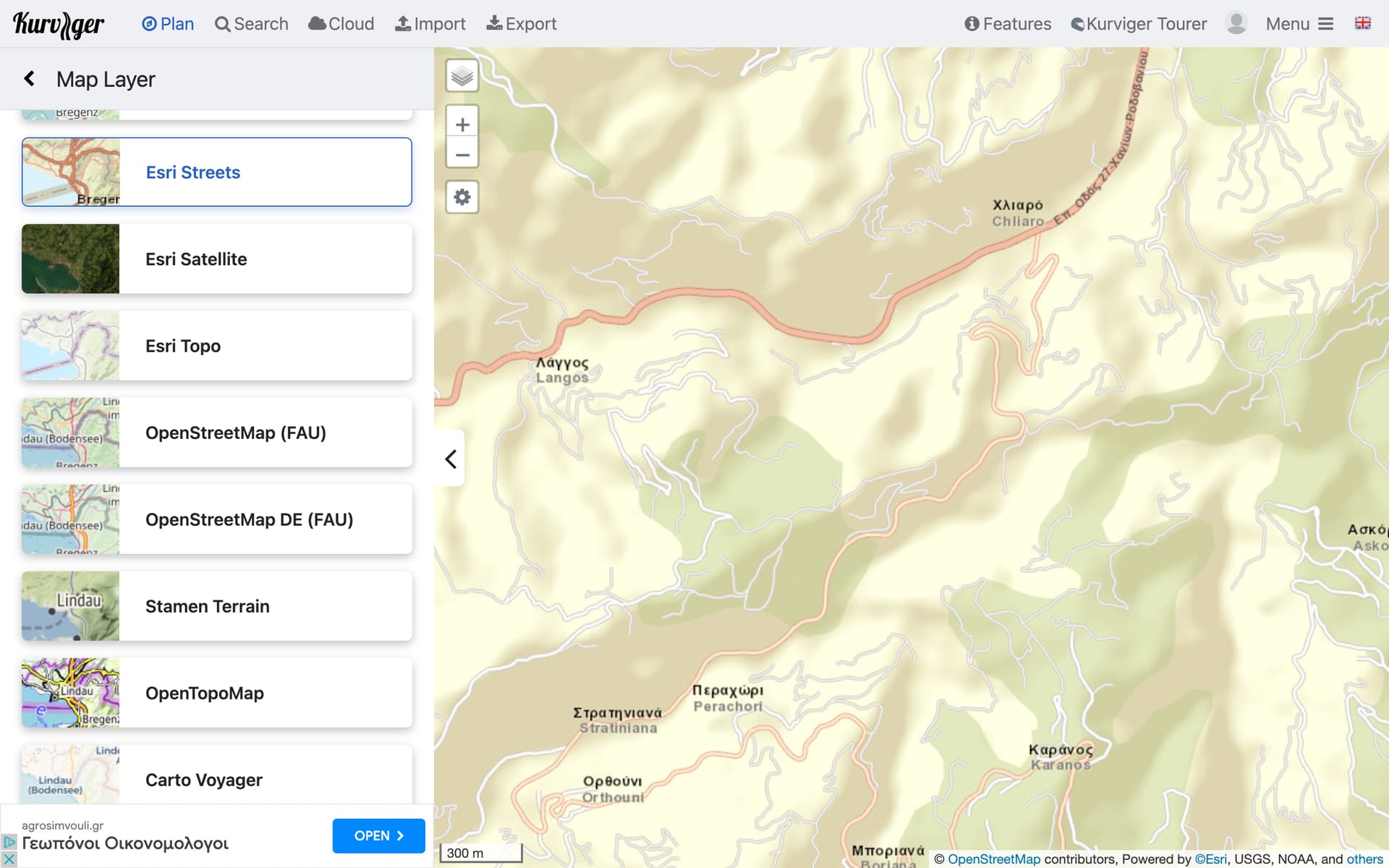
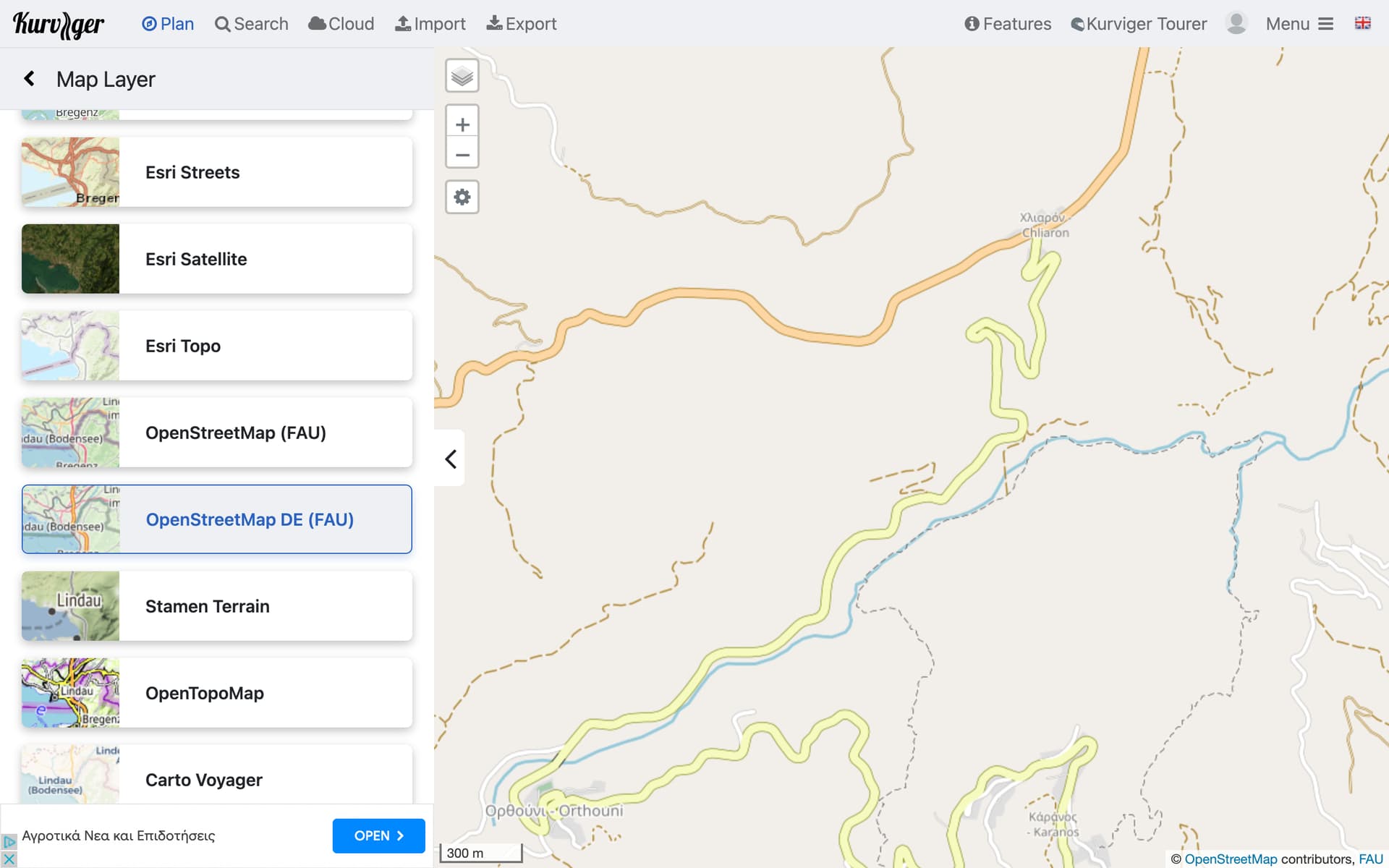
In the desktop version of kurviger, it is possible to select different maps,
“Esri streets” v “open street map DE”, . Esri Streets contains far more information in terms of the number of minor/dirt roads shown than openmaps DE.
Previously I was told "Esri streets " does not work accurately on the kurviger GPS phone app so it’s not included. When I compared routes on the desktop it would seem that this is correct.Why is this so? ?? If you look at the official website of Esri it is a premium mapping application used by NASA!!
Is it the maps themselves that are wrong or the interface between the mapping application and the map or something else? It would be great to learn something of how all this works and how it is produced.
Does anybody know of a mapping app that uses Esri streets with a good level of accuracy. Esri is not perfect and sometimes openmaps DE is better, but it would be nice to have an alternative for the kind of riding i do.
Hoping someone can help.
Just to clarify, you can use ESRI maps on the app to plan a route. You can’t use them for navigation.
For navigation you can use Kurviger Liberty and Kurviger OSM, because these maps work offline and have several other features included that the other maps don’t have.