Hallo,
ich habe mit Basecamp eine Tour geplant und die ganze Liste mit Wegepunkten, Route und Track gespeichert/exportiert und sie anschließend in kurviger importiert. Dazu ein paar Fragen:
Zunächst mal der Link: Kurviger
Der Import auf der Web-Seite sieht anders aus als in der Android-app, bei gleicher Einstellung (Automatisch, Automatisch, 25).
-
In der Webseite sind 14 Punkte angelegt, bei Android 23 + Start und Ziel.
-
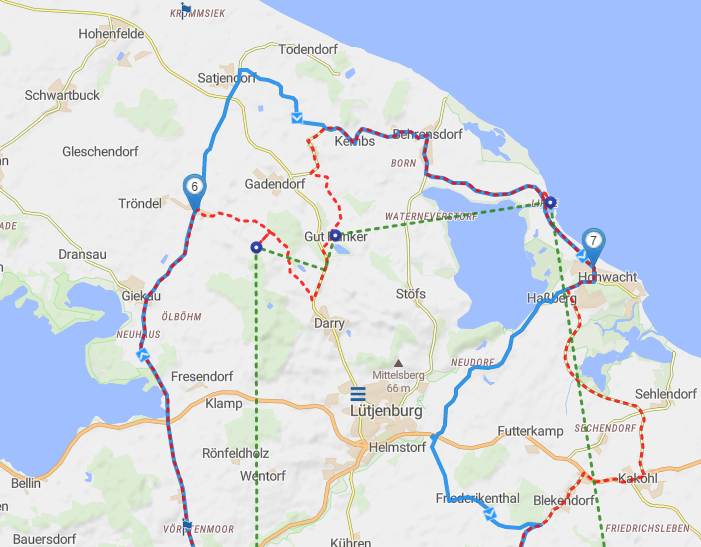
In der Web-app gibt es 3 Linien, die blaue Tour, der gestrichelte rote Track und eine gestrichelte rote “Fluglinie”. Letztere ist bei Android nicht zu sehen. Frage: Kann ich die “Fluglinie” entfernen oder verhindern?
Die blauen Kreise im Bild sind die Basecamp Wegepunkte. -
Zwischen Punkt 6 (Android 13) und 7 (Android 17) wurde die Strasse zu den BC-Wegepunkten nicht genommen, egal, welche Routeneinstellungen ich wähle. Liegt das an einer Strassencodierung? Ein Verschieben von 6 auf den Track und ein Hinzufügen eines weiteren Zwischenziels schafft aber Abhilfe.
Insgesamt bin ich mit der Konvertierung von Basecamp-Routen nach Kurviger sehr zufrieden. Etwas herumzupfen, einige wenige Wegepunkte hinzufügen und alles läuft. Dass Basecamp manche Strassen fährt, die Kurviger partout nicht routen will, ist aber schade. So zum Beispiel die mit dem Pfeil gekennzeichnete Strasse
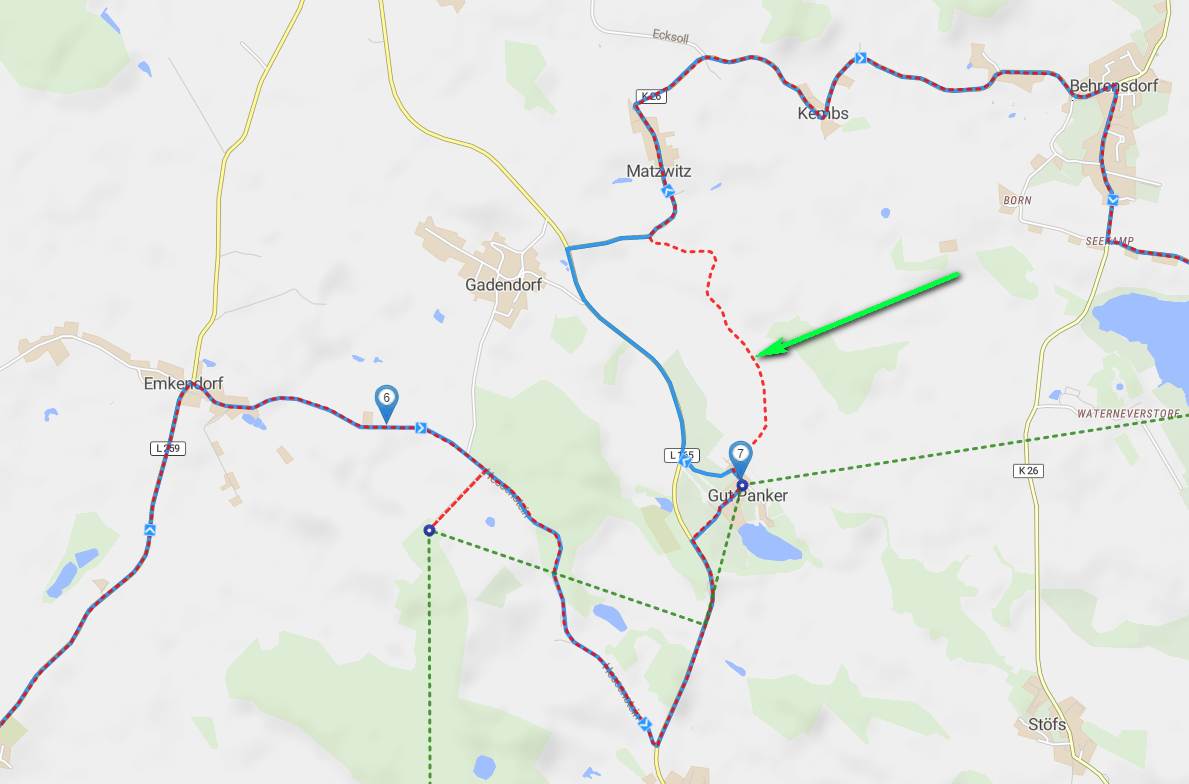
Es handelt sich um eine einspurige Feldstrasse, in der Mitte ein Grünstreifen.
Hello,
i planned a tour with basecamp and saved/exported the whole list with waypoints, route and track and then imported it in kurviger. A few questions:
First, the link: Kurviger
The import on the web page looks different than in the Android app, with the same setting (Automatic, Automatic, 25).
-
14 points are created in the web page, for Android 23 + start and finish.
-
in the web-app there are 3 lines, the blue tour, the dotted red track and a dotted red “airline”. The latter is not visible on Android. Question: Can I remove or prevent the “airline”?
[pict 1]
The blue circles in the picture are the Basecamp waypoints. -
between point 6 (Android 13) and 7 (Android 17) the road to the BC waypoints was not taken, no matter what route settings I choose. Is this due to a road coding? However, moving 6 to the track and adding another waypoint provides a remedy.
Overall I am very satisfied with the conversion of basecamp routes to Kurviger. A little bit of tweaking, adding a few waypoints and everything works. It’s a pity that Basecamp drives some roads that Kurviger doesn’t want to route, but it is a pity. For example the road marked with the arrow
[pict 2]
It is a single-lane field road with a green strip in the middle.