recently I had to find out that my favorite trip planner motoplaner is down. So as an “alternative” I found this kurviger.de. First impression is very disappointing though.
Main issue: the routing. Why does it try to be smart? Why are there no normal routing options like in motoplaner? I clearly dont need any assitance on picking the road for me.
In comparision to motoplaner the routing needs to be forced a lot more which is quite annoying.
For example: the standard activated routing sends me along side a highway through unattractive rural roads. Changing it for mayor road routing it starts to mess on roads that are small but attractive.
Same waypoints being entered in googlemaps, and oh wonder, the routing is as it is supposed to be.
@developers: motoplaner convinced with simplicity and pure functionality. You added useless features that make it more complicated to operate and use this page! It is a waste of time. Learn to keep stuff simple.
Also I am quite confused the routing wants to tell me which roads can be used for a motorbike and which not.
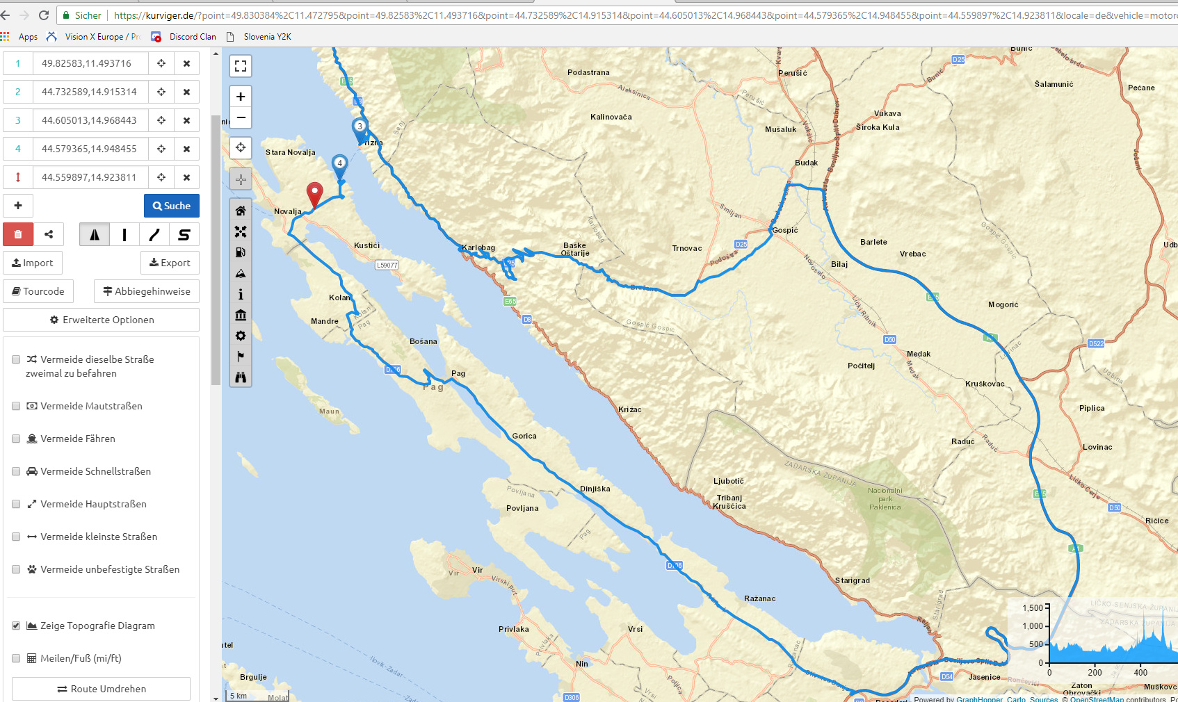
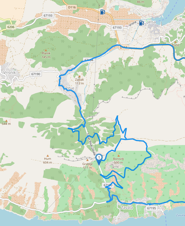
An Example how useless the rooting function is can be seen on the attached screen shot.
I want to go from waypoint 3 to 4 and the routing wouldnt let me take the ferry but it suggests to go like 200 kms extra despite having ferries and fast routing activated. What am I doing wrong? Do I try this routing to the wrong time and the stupid routing knows there is no ferry at that time or what?
Is this here early access?
It pretty much feels like it and it is not convincing at all To be honest I never wrote this before anywhere, but this page gets the biggest thumbs down I could ever post in a forum…
First of all, please read our forum guidelines and try to keep the discussion in a friendly and respectful tone. It won’t help your point nor the discussion to behave disrespectful.
Regarding the ferry, please have a look at our documentation that describes these issues in detail. I fixed the map data at this point and the ferry should work by next week.
Yeah I noticed the same on another occasion when I planned my trip. After I reached the end I looked over the whole trip again to check and noticed it had changed although I had not touched any of those way points.
Only cure is to set as many waypoints as possible to really force the routing to do what you want and to double check the trip kilometer for kilometer.
I converted the old motoplaner route to kurviger and I needed to put 52 routing-waypoints in. Motoplaner needed 6 for the routing.
As stated above kurviger wants to support on picking the road put it cant read anyones mind. If there are parts of a trip where you want to use a highway and have curvy routing active it doesnt what to route the highway. If you have fast road routing active it messes with the parts where you want to use little roads.
But there is no better alternative than kurviger right now, so you have to take what you get…
The Openstreetmap layer is highly appreciated since I use OSMAND for the navigation…
… Well the same would apply to your bike.
If you want to ride on the highway and have first gear selected
I have used TomTom and OSMAND in the past, but IMHO Kurviger is way better - For Navigation and for planning. The combination of the web site and corresponding APP is simply unique.
This is an issue with the data ad not with Kurviger . If you look on OSM, the other road is tagged as tertiary with no speed limits, the other road is a secondary with speed limit of 50. Therefore, due to the data, the tertiary is faster.
This is not true for the fastest route, it simply calculates the fastest route.
Please, when posting a routing issue, post short Kurviger route link to the issue.
The main road is limited to 40, the residential road is a shortcut and saves ~100m or ~25% of the distance. I looked at the road on Google Streeview, it’s not even on GMaps, you wouldn’t be able to be faster through that road, but the data looks a bit like one would be faster. So I think this could be an option to fine tune our fastest profile. For example the curvy modes, avoid this road as expected as one would expect. So the data is not really wrong, but it’s just an unfortunate combination. If you know the road, you could have a look at the data and see if there is something to improve.
In general, the road data outside of Central/Western Europe can contain some issues, this is also documented here. This is expected, OSM is a community project, the more people help to improve the data, the better it gets.