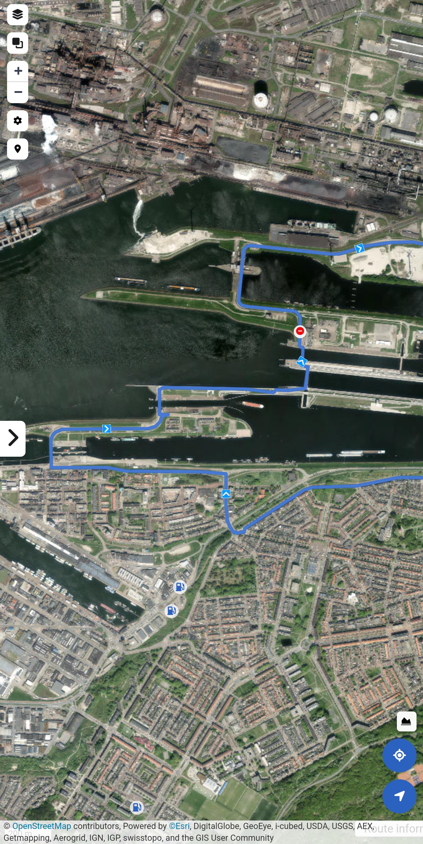
You can’t drive over this road, it’s closed off for everything except peds and bicycles.
Kurviger always routes me over this.
You can’t drive over this road, it’s closed off for everything except peds and bicycles.
Kurviger always routes me over this.
You can correct this in OSM, a few days later Kurviger will consider this.
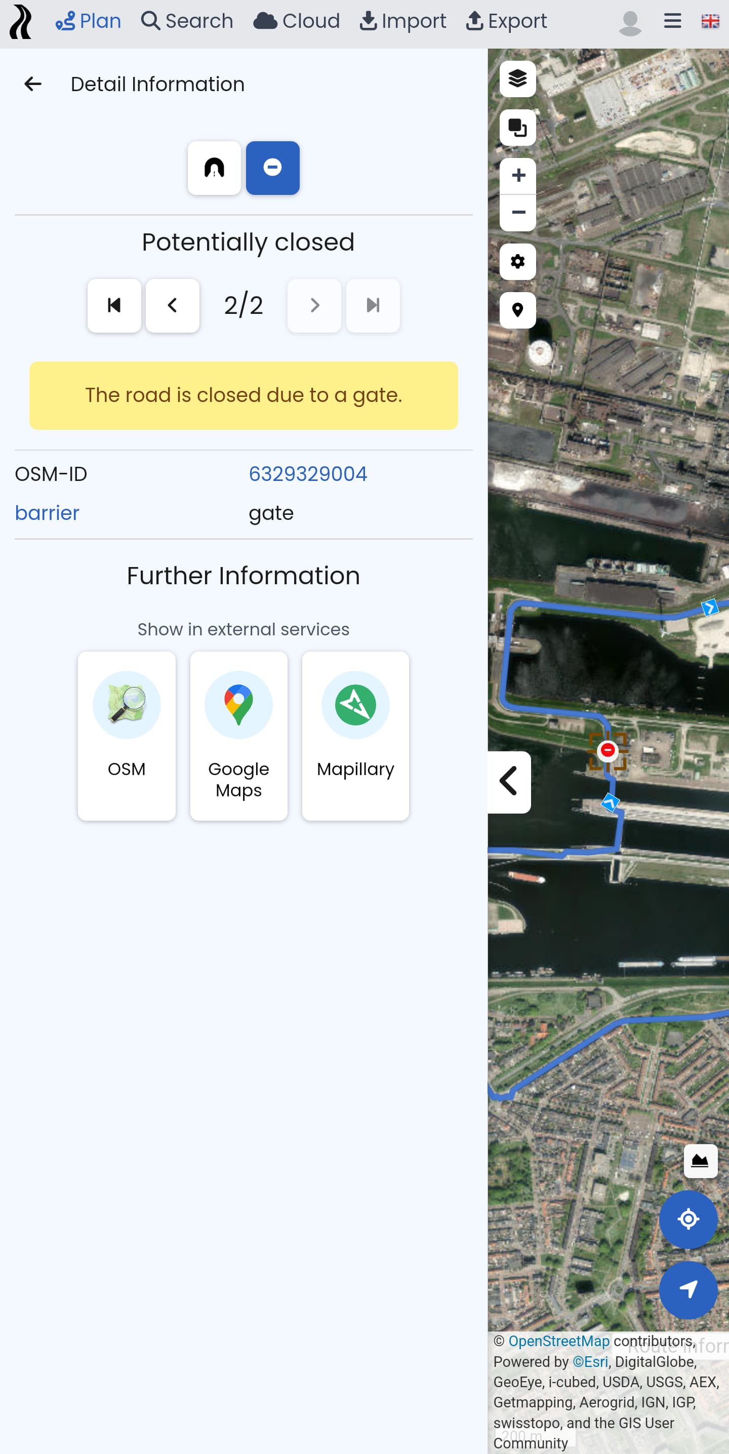
Is just the gate
closed, or is the complete Noordersluisweg closed for motor vehicles?
The entire road that goes over the sluices, from the gate onward.
I wasn’t sure where exactly the blockage is. I have blocked that one gate, to at least fix the routing there, but probably some more detailed local knowledge is needed to actually fix this.
I reverted my change again, looking closer at the data. I have no local knowledge and it seems that the two bridges are kind of under construction. There are notes about this and it seems people are looking into this, so without local knowledge I shouldn’t interfere.
@Le_Koffie if you have the local knowledge and would like to get involved with OSM, this bridge might be under construction or not (I don’t know): Way: Middensluisweg (33185322) | OpenStreetMap
Here is a note on the other bridge: Note: 3703010 | OpenStreetMap and I created a note here: Note: 4411554 | OpenStreetMap
Thank you, this should fix round trips for me ![]()
What local knowledge do you need exactly?
The road over the sluices is closed off for cars and motorcycles (motorized traffic except traffic that has to be there for other reasons)
Yeah, so I don’t know exactly where and how this is closed. Is this closed for good or only temporary (as there seems to be some sort of construction site). As there are discussions happening I feel like I shouldn’t interfere in OSM, as I don’t have any local knowledge, I only looked at old Mapilary imagery and saw the discussion.
It would be grand if Kurviger had a feature where you could manually avoid certain roads by marking them.