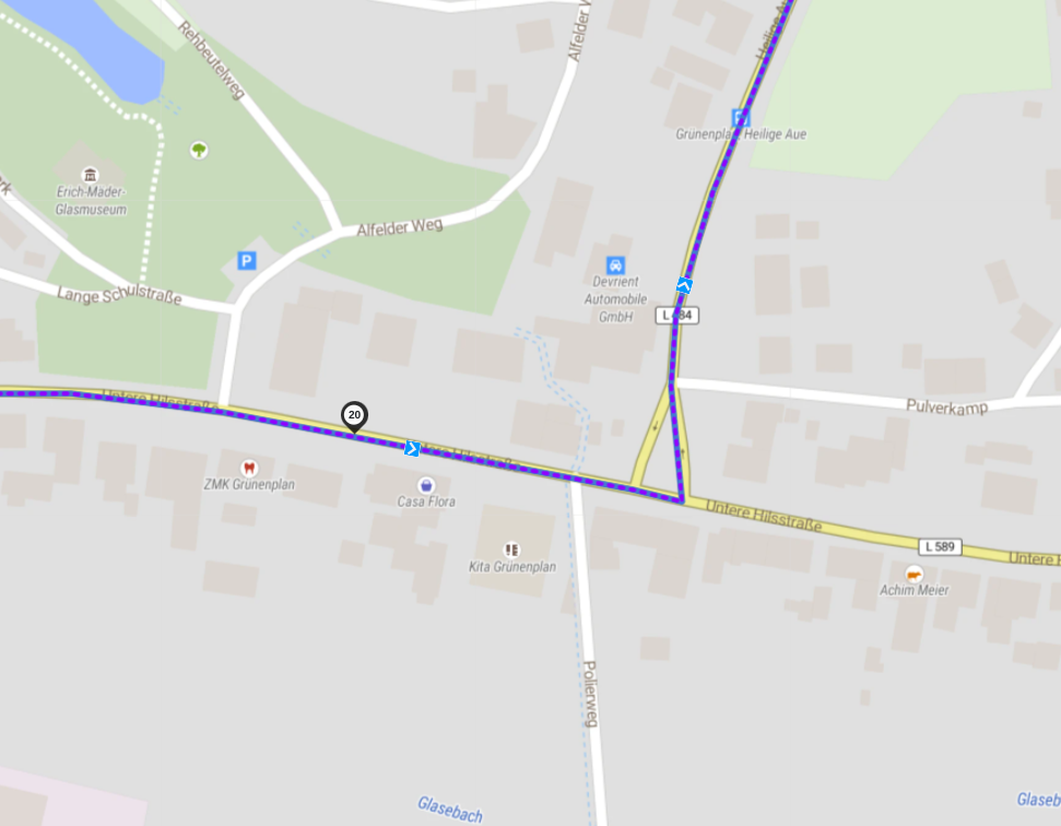
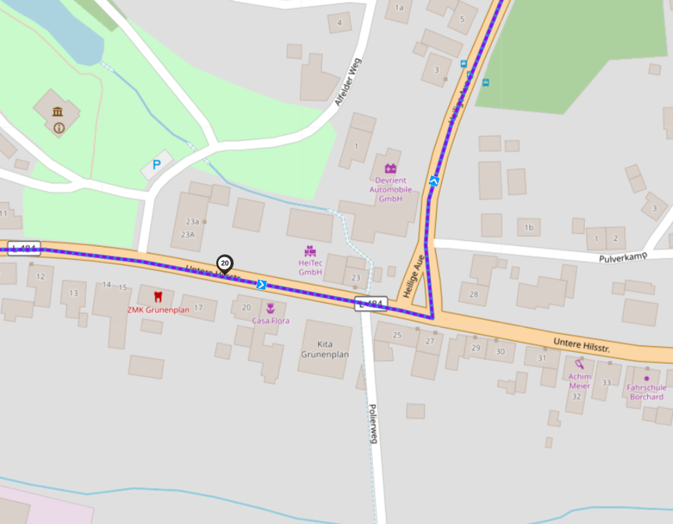
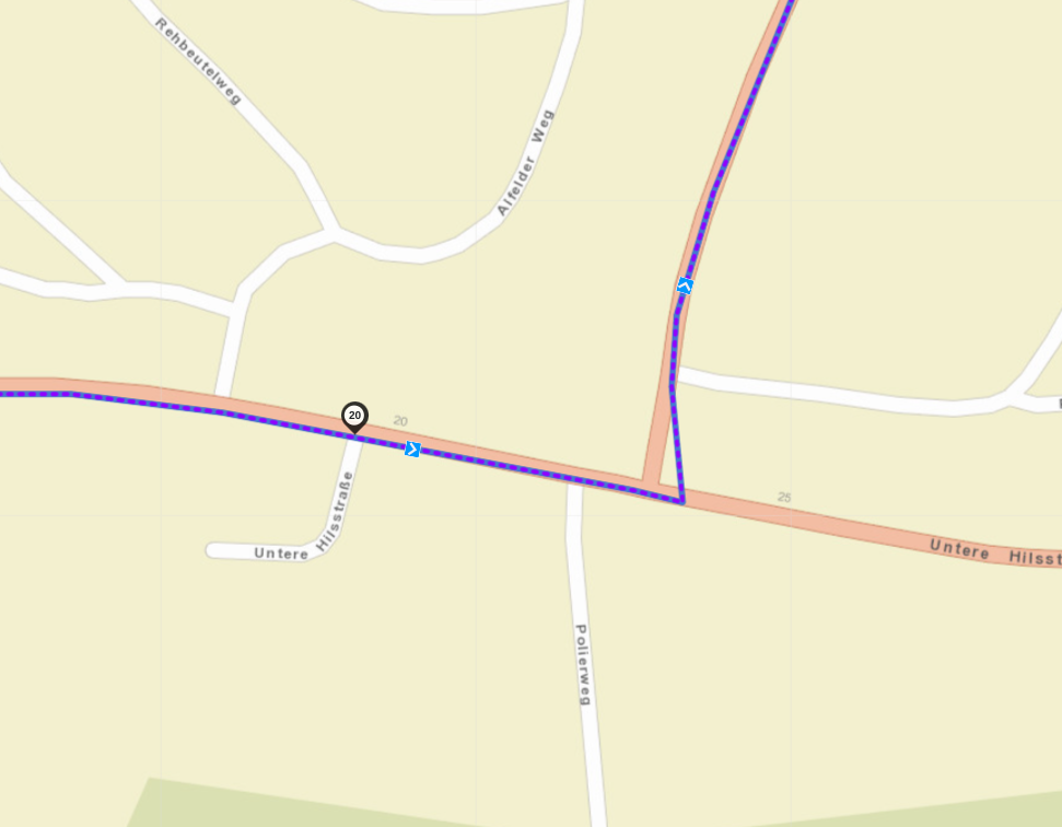
I have driven a planned route that has been checked beforehand to ensure that all waypoints are correctly placed on the road. The route was imported as itn (Navcore 9.5) on TT550.
However, at waypoint 20 (village: Grünenplan) there was a spur road to the right and my TT indicated to drive into it to reach the waypoint.
I knew that my waypoint setting was correct and so I was looking for that problem.
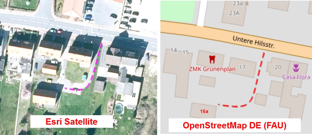
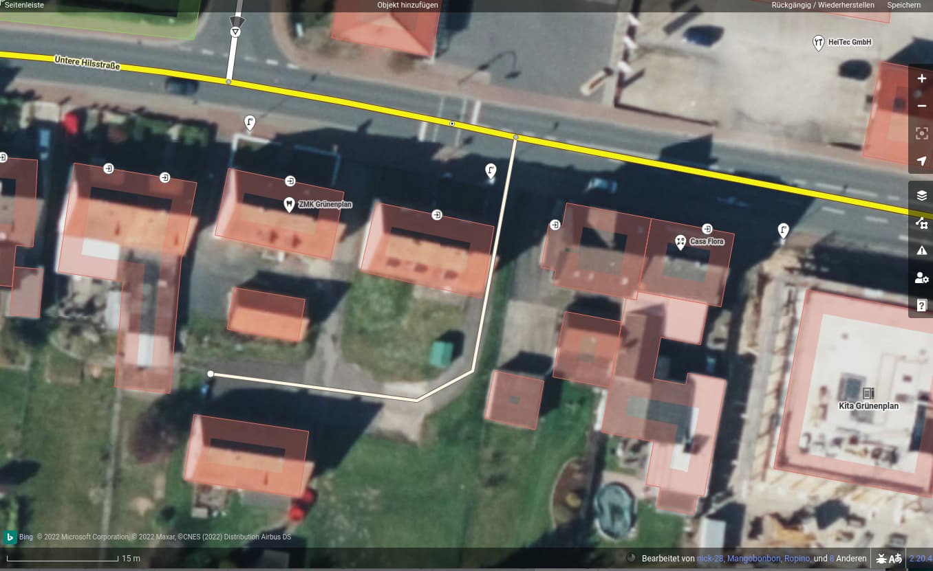
Bei verschiedenen Kartenansichten (“Esri Satellite” und “OpenStreetMap DE (FAU)”) in Kurviger (und OSM) ist zu erkennen, dass bei der “Untere Hilsstrasse” die Zufahrt zum hinteren Haus sowie die Hausnr. des hinteren Hauses (Nr “16a” lt. Google Maps) fehlt. Kurzlink: Kurviger
Edit: In obigen Screenshots wurde von mir die Hausnr. 16a sowie die fehlende Zufahrt (Strasse) gestrichelt hinzugefügt.
Edit2: Zufahrten (Straßen, Wege?) zu Häusern in zweiter (oder dritter Reihe) sind in OSM häufig nicht eingezeichnet. Habe jetzt nicht geprüft, ob das bei anderen Kartenanbietern öfter oder besser geregelt ist.
Sure
As you can see my WP 20 was set on the main street. I don’t know why… the waypoint was shown in that small road. My friend, who use a Garmin XT had the same display…
It always makes sense to store everything in OSM. It was just unclear to me that also new roads are a part of it.