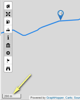
Manche Karten lassen sich nur bis zur Zoomstufe 400 m / 500 m zoomen, Stufe 200 m wird nicht mehr angezeigt, die Routen mit den Wegepunkten bleibt sichtbar, der Hintergrund ist grau. Das ist bei Mapsurfer so und auch bei Top Plus. Ich muss dann auf andere Karten umschalten, z. B. Open Street Map DE. Woran liegt das?
P.S. Ich muss noch hinzufügen, dass das in der Deutschlandkarte nicht ist! Aber ich plane gerade in Polen, Masuren, dort ist dieser Effekt!
Some maps can only zoom up to the zoom level 400 m / 500 m, level 200 m is no longer displayed, the routes with the waypoints remain visible, the background is gray. That’s with Mapsurfer and also with Top Plus. I have to switch to other maps, such as Open Street Map DE. Why is that?
P.S. I have to add that this is not in the Germany map! But I am planning in Poland, Masuria, there is this effect!
TopPlus is provided by a German agency so they only provide Germany with very high zoom levels. The farther away from Germany you go, less detailed zoom levels are available.
OpenMapSurfer seems to have a technical issue right now. I assume it should continue to work anytime soon.
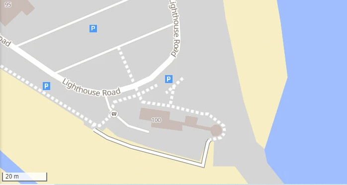
I have the same issue in the US. Look at the Boston area as an example (100 Lighthouse Rd, Scituate, MA 02066). I know I am in the minority here, but it would be great if you could fix it.