Renfrew, Ontario, Canada as any point, Start, End or Intermediate is totally wrong. It is nowhere near Renfrew.
Hi, thanks for the report, next time please include a link and/or screenshot to the place to identify the problem more clearly
I assume you’re talking about this county / town?
Seems that the search engine is preferring the county centre over the town. We’ll look into it
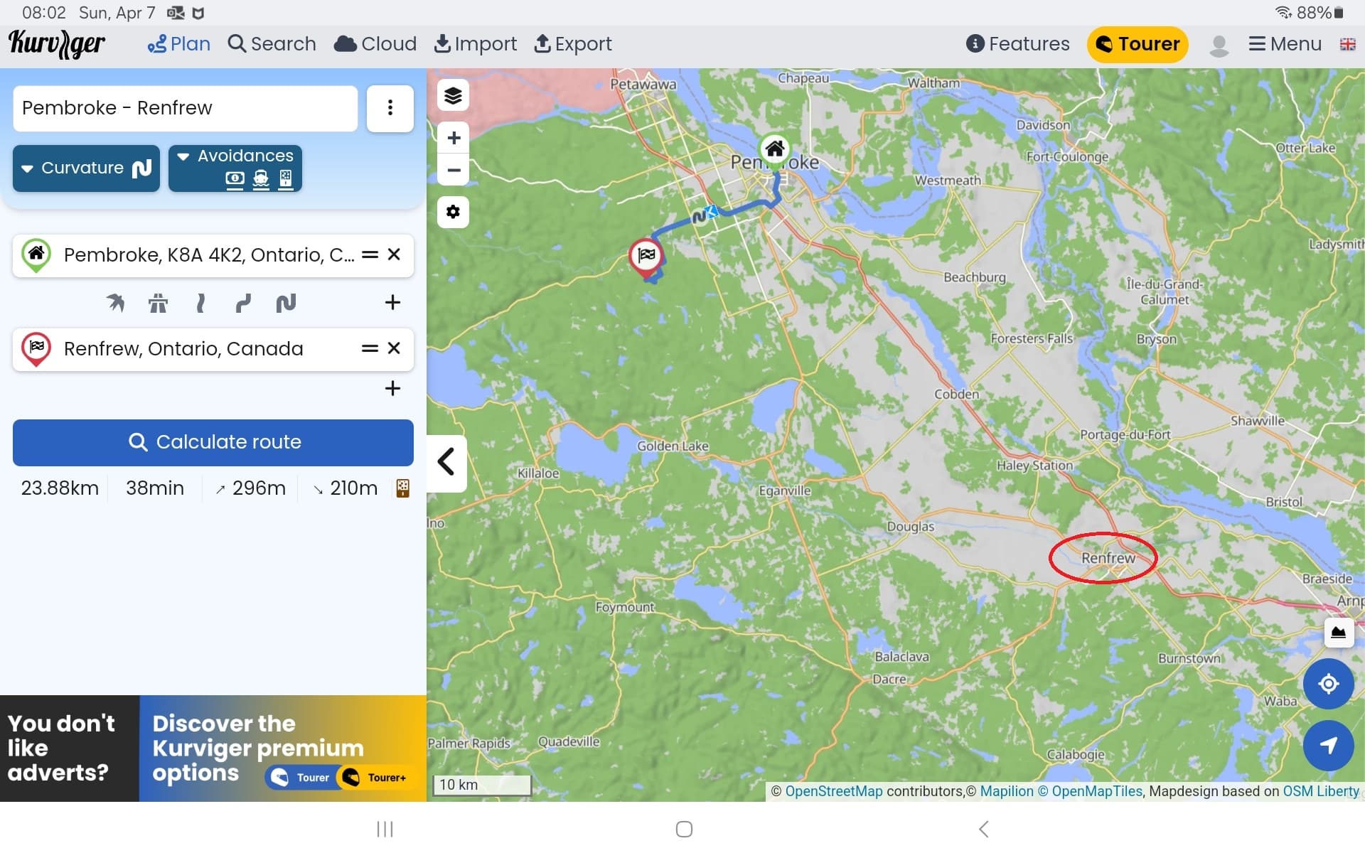
Here is a screen shot. I just picked Pembroke as a starting point to keep it all on one map.
Note the red circled Renfrew, my distination. By the way, when you enter “Renfrew”, it comes up will many “Renfrews” and the one that indicated “Renfrew, Ontario, Canada” is the one I pick. I should not have to include a physical address; I don’t when I use Google Maps.
Google Maps and Kurviger use veeeeeeeeeeeeeeery different location / maps / address providers (Google has their own data, Kurviger uses OpenStreetMap.org), so some differences are to be expected ![]()
The advantage of OSM is that we can usually fix stuff really quickly when we find a problem
You can chose between 2 different Address search providers
GraphHopper and OpenRouteService.
In this case “OpenRouteService” seems to find the right “Renfrew”
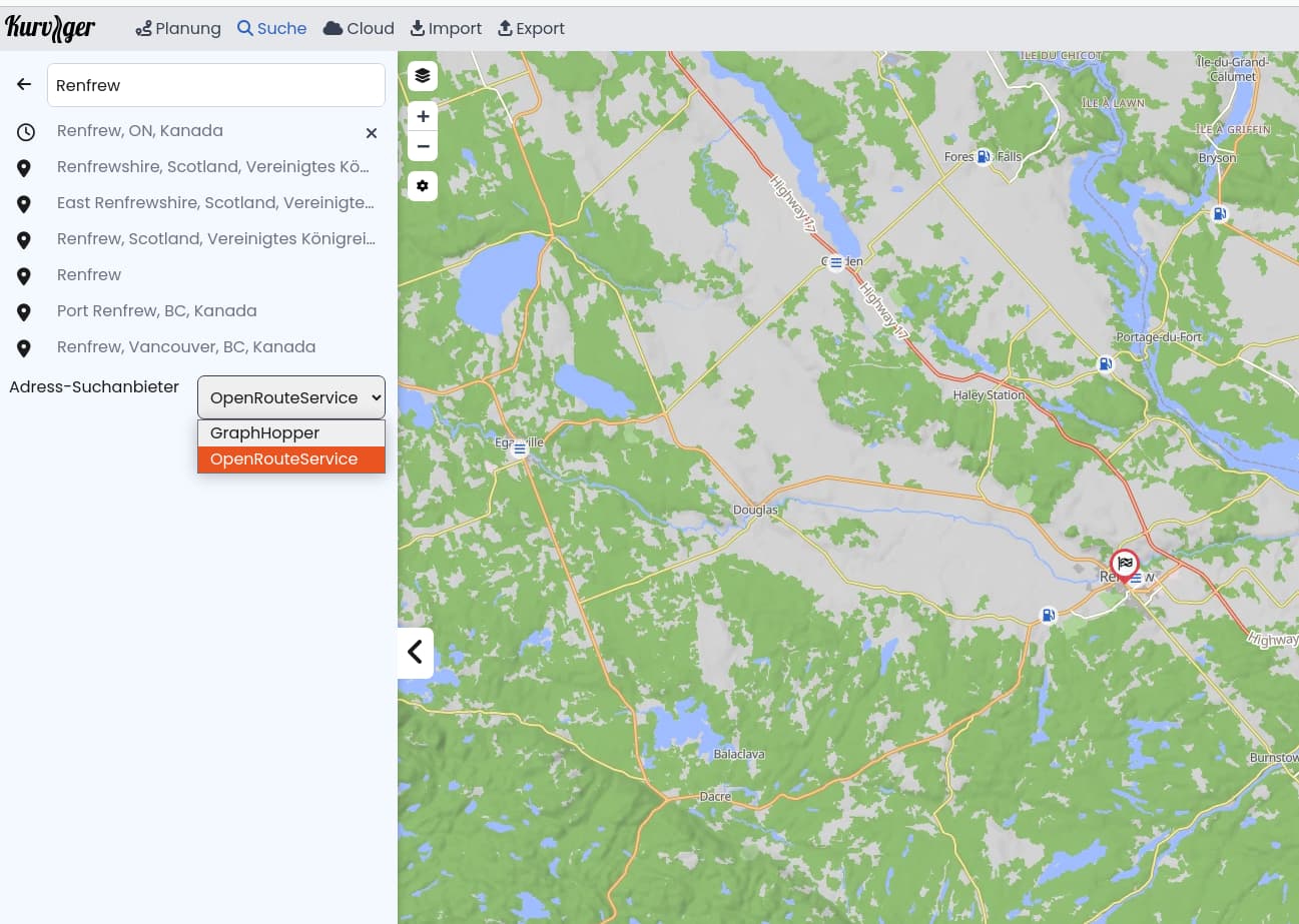
I noticed GraphHopper has Renfrew in the wrong location.
I think the guys at GraphHopper were drinking a bit too much Augustiner Edelstoff when they entered Renfrew. ![]()
A big thanks! And I will give this app a chance and try a few downloads to my GPS which will be a first for me since I’ve always used maps and my memory, even though I’ve had a GPS since about 2000.
Time to ride my local area after 27 years of riding Europe and the Alps. Really, 11 passes in a day in the Dolomites at my age is too much anymore. Time to ride the less technical roads in North America.
1 Like
Since I’ve been using Kurviger, I’ve gotten to know my hood in a new way. Have fun and always save ride.
Fortunately I know all the great roads in my area for about 300 km from home.
And using any computer based software, there are always “issues”. For example, I wanted to put together a roughly 600 kms day ride through nothing but twisties and not have to pull the maps out to refresh my memory. In Advoidances I have Avoid Toll Roads, Avoid Ferries and Avoid Unpaved Roads turned ON. And sure enough on one twisty section of road which has been paved for well over 5 years, it avoided and planned a boring straight road around it. I turned the Avoid Unpaved Roads to OFF and it then took it.
The trouble is with on-line maps and there are many, things are not up-to-date.
1 Like
The quality of the data is always due to the efforts of the OSM community, everyone can / should improve the data. ![]()
Well obviously they still think it is a gravel road which it hasn’t been in well over 5 years.
So how does one go about advising them.
Ooh I’m very happy to be the one to tell you something really cool which it seems you did not know before: “OpenStreetMap.org” is called “open” because anybody can edit it, just like Wikipedia
I highly encourage you to go make an account and do the basic tutorial on the website, it’s quite good. If you have questions on how to edit something you can always come back to this forum and you will find a lot of people happy to help you get started ![]()
3 Likes
For some reason, my UN and PW got me on OSM and I have been a Mapper since 2015 (news to me).
So where on that site do I find the “basic tutorial”. I’m a believer in simplicity, usually the case when things are designed right and self explanatory without having to read a novel. Lets hope.