What does this mean ?
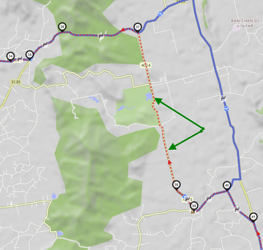
You properly imported a track and kurviger.de created a route out of it. But the road 4014 is in OSM not allowed for motorvehicle, so kurviger takes an alternative road (pure blue). The red dotted line shows the original track. It seems, that you reverted the route as well.
With nothing as your screenshot we only can make an assumption …
3 Likes
Hi mate,
Thanks for reply ![]()
I did actually reverse the map.
Is there a legend to the different markings on the map… Like Red Dotted Line = Original Track ?
What is OSM ?
Sorry, only new to all of this and trying to get my head around it all ![]()
OpenStreetMap, it’s the map data which Kurviger uses to calculate routes. It’s like Wikipedia for maps, anybody can edit it, which has advantages and disadvantages ![]()
Yes, you can find a lot of information here: Terms and Definitions about Kurviger [Kurviger Knowledgebase]