I am requesting some feedback on a routing issue. My mate uses Google Maps on his phone and I use Kurviger and a Garmin Zumo XT.
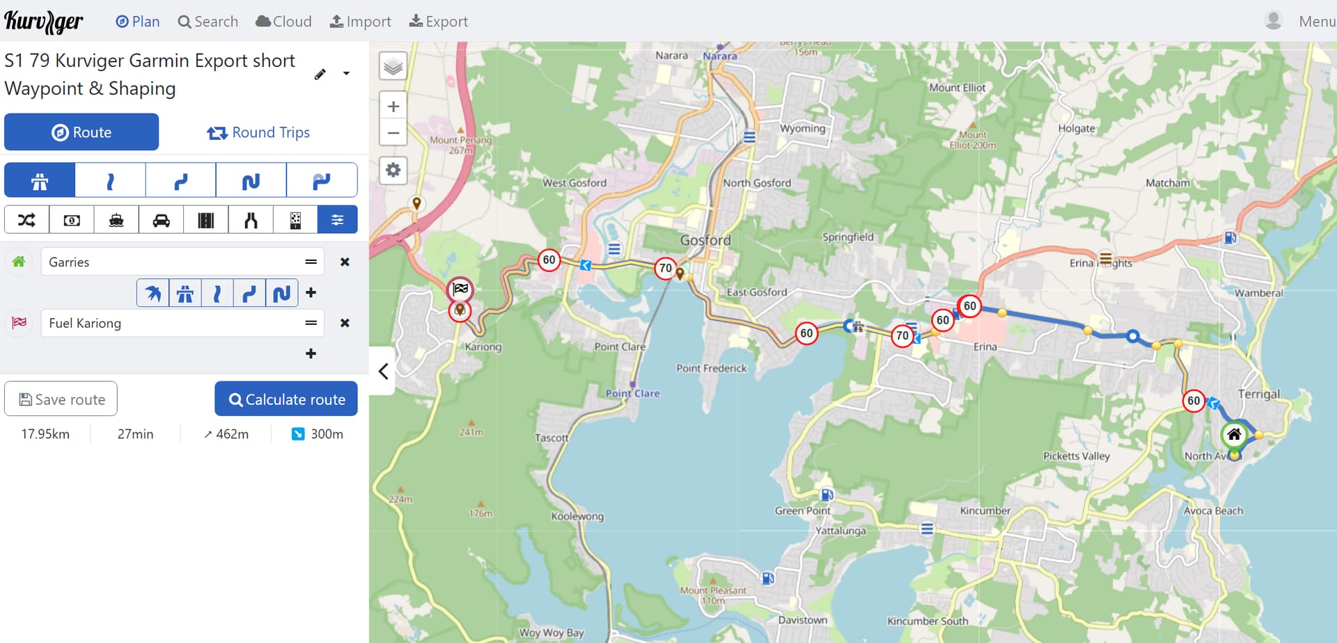
He is the lead for an upcoming 16 day and he has done all the routes in Google Maps. He sent me Google Maps links for each day and I use MapsToGPX to convert them for Kurviger and then export as Garmin Shaping Point files. My routes always end up much longer as they include different turns.
I understand mapping software is complex but I have become very comfortable with Kurviger and Garmin over the last 18 months.
In this case we can ignore MapsToGPX and also Garmin Zumo as I can reproduce the effect without those two elements.
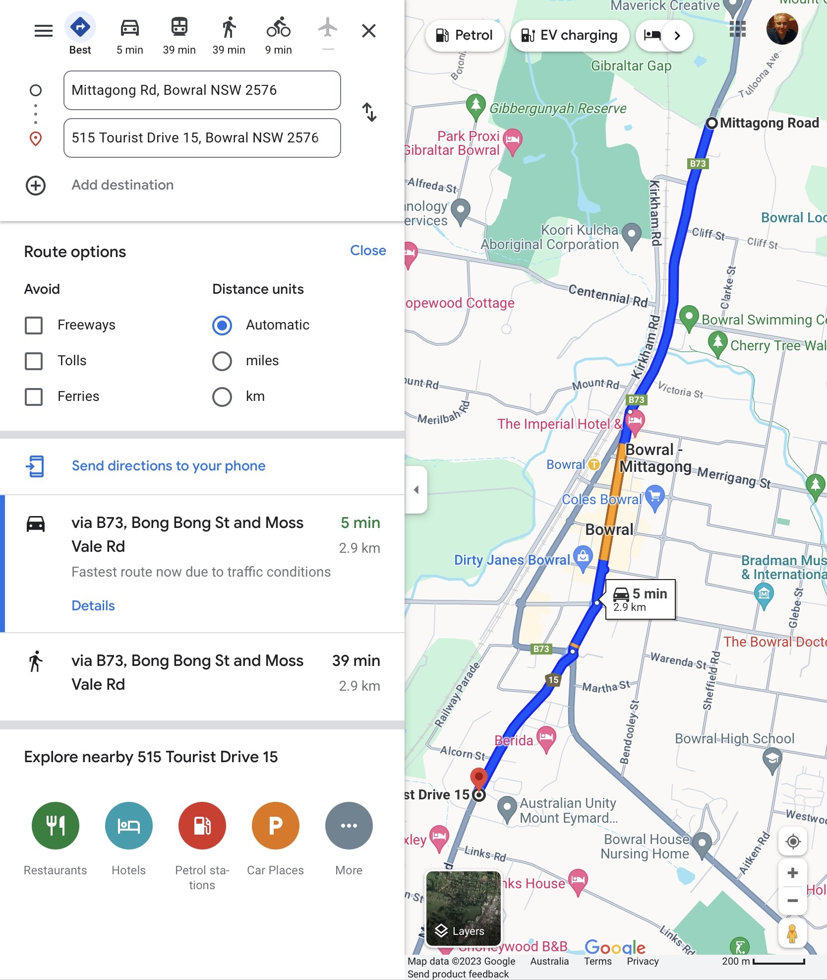
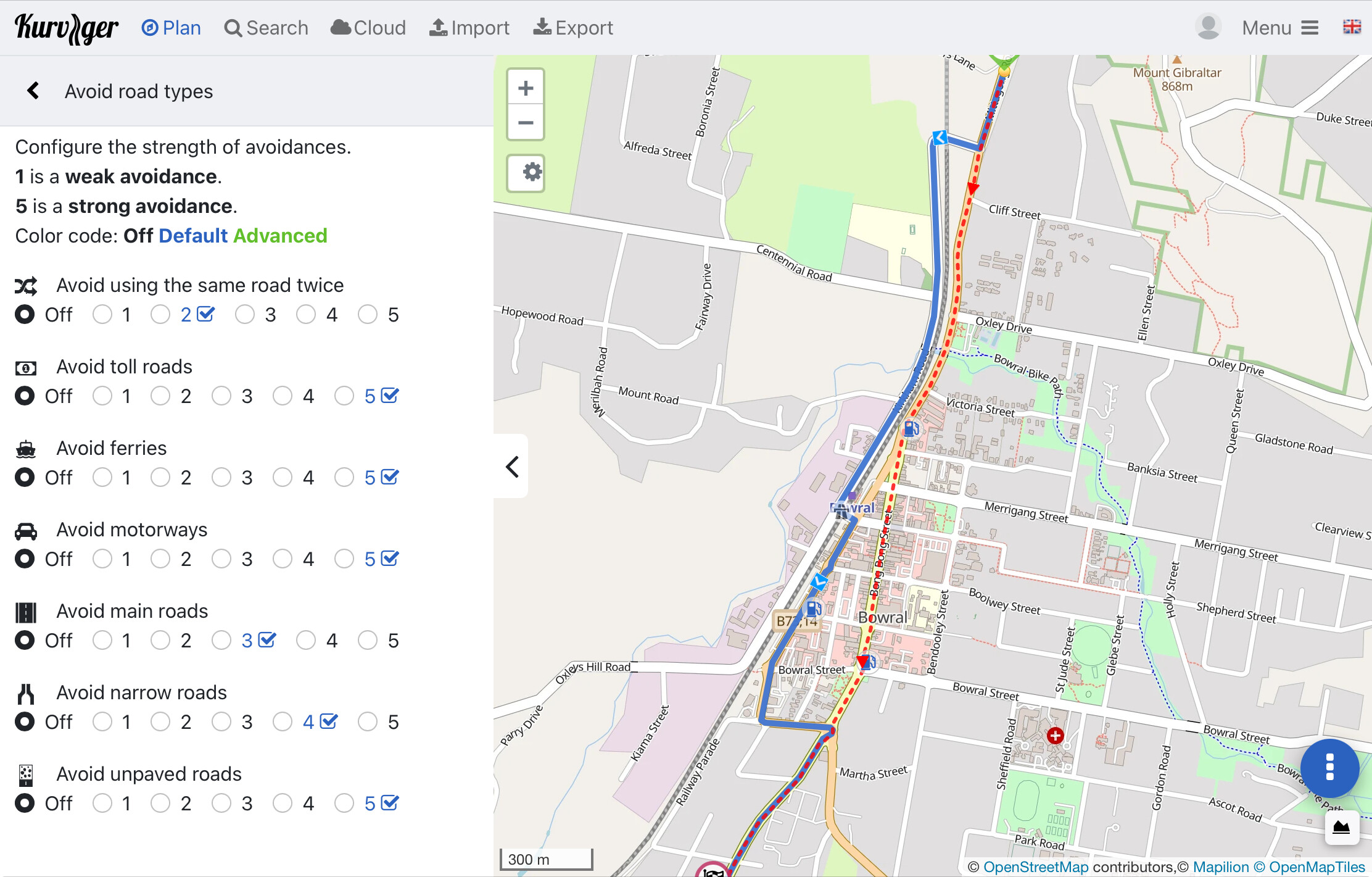
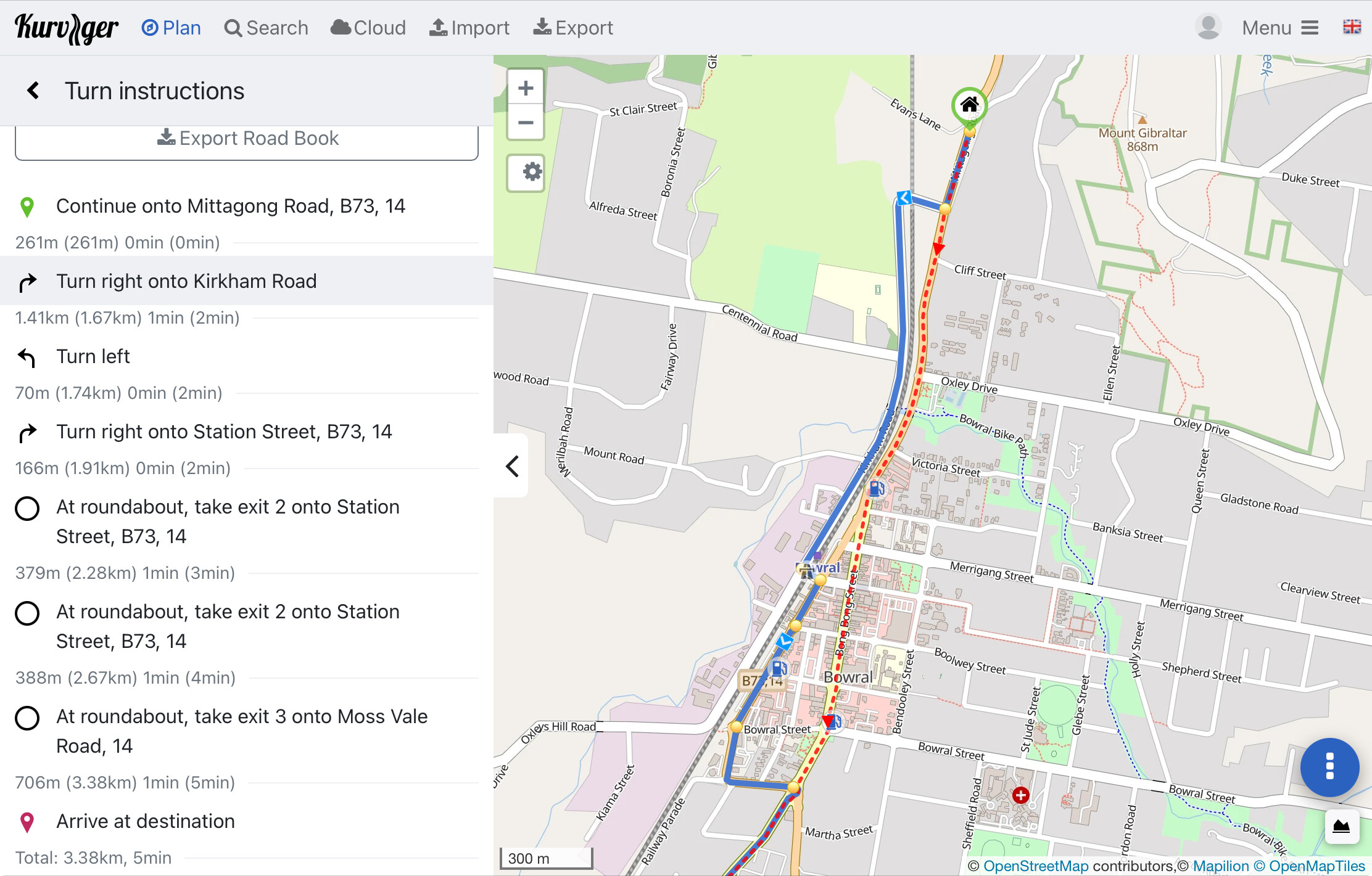
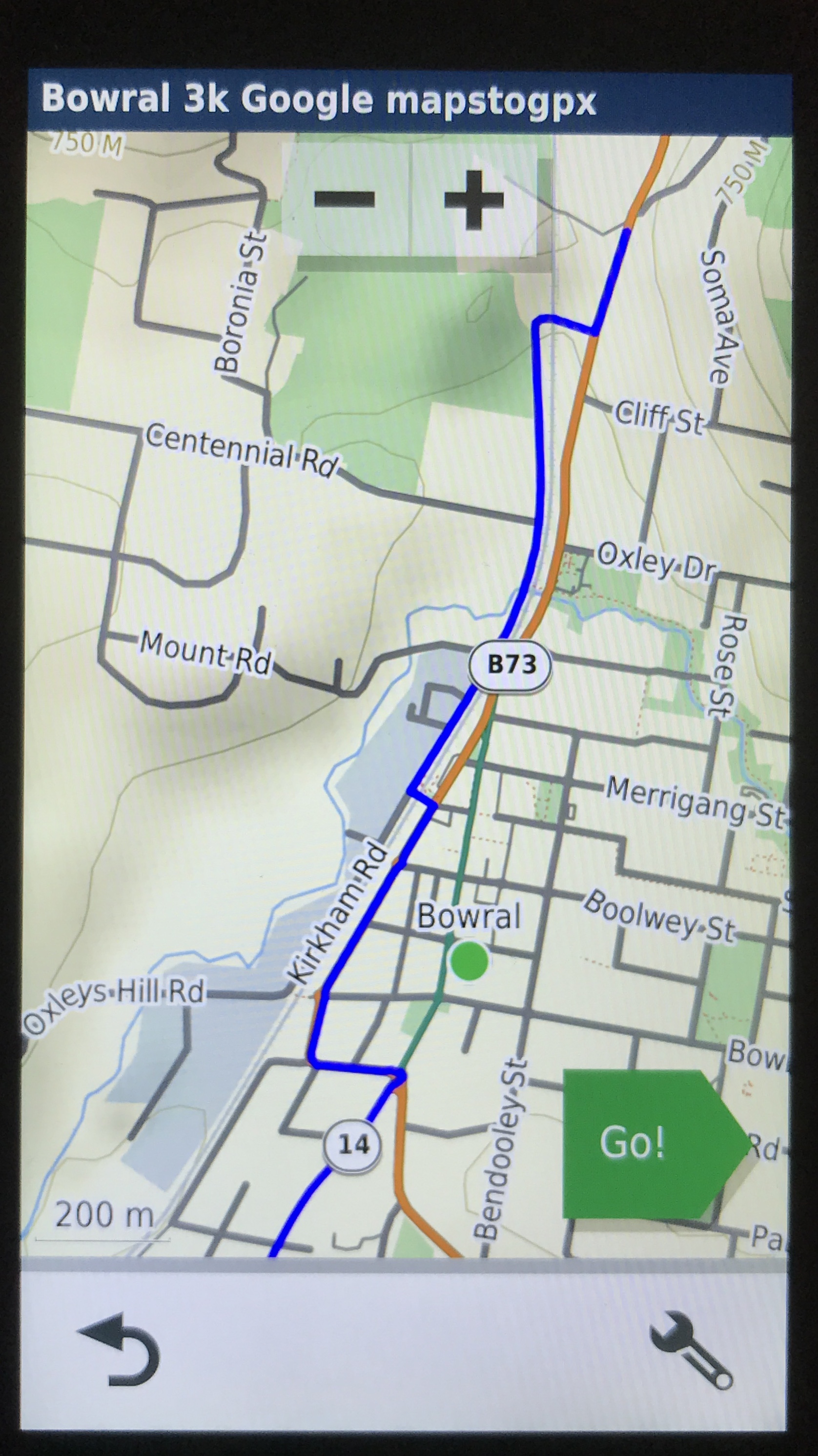
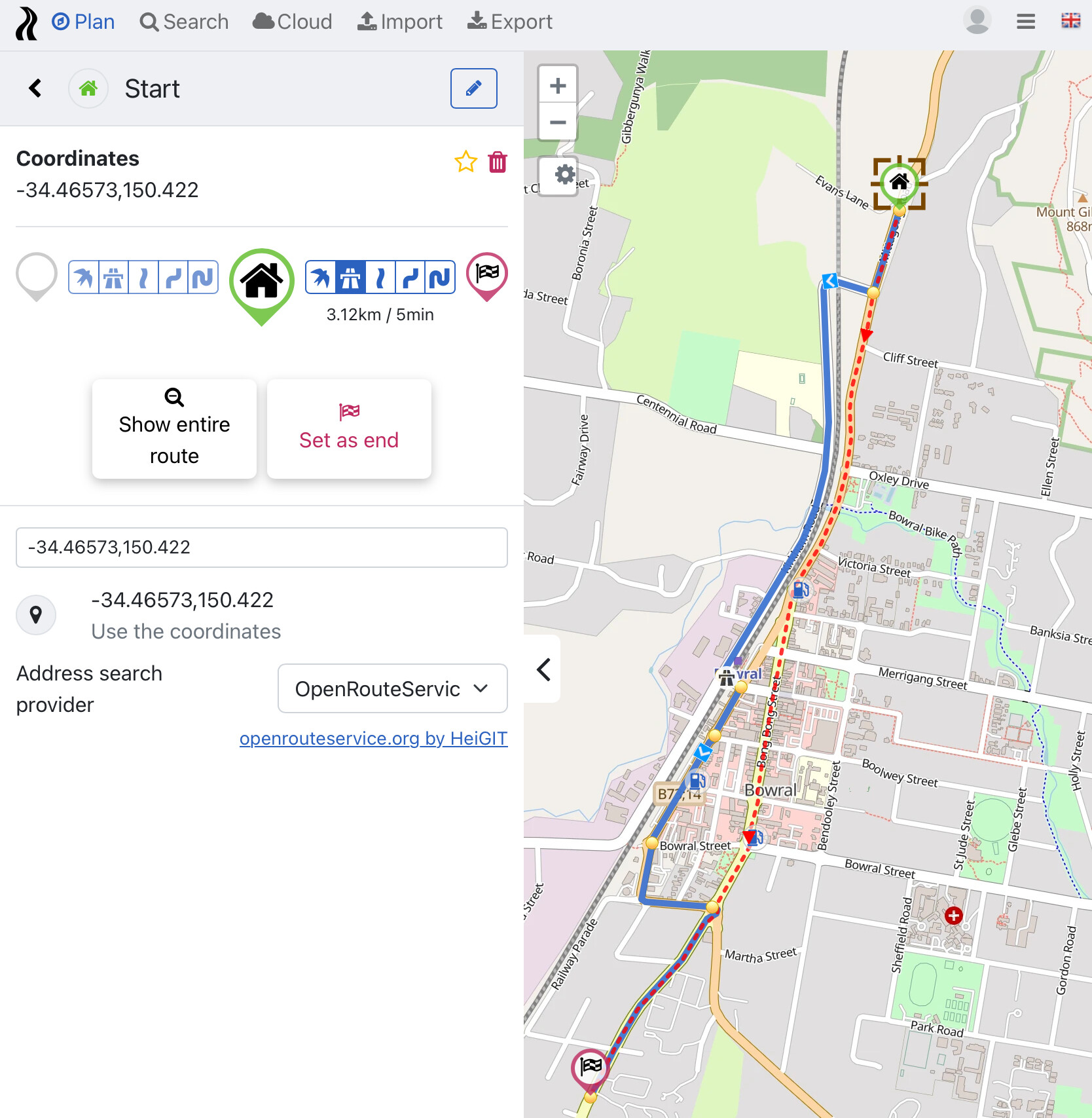
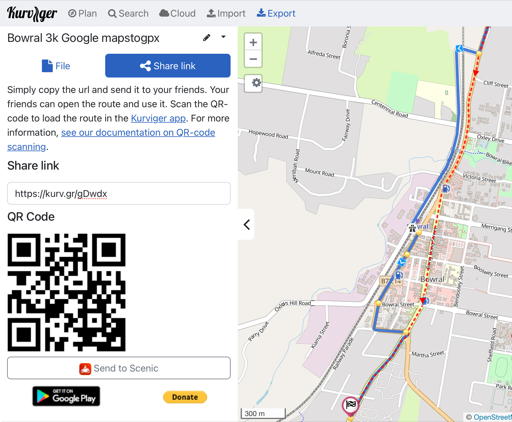
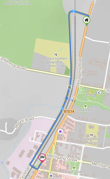
Attached are some images / screen shots to show the issue for a 3 kilometer section of the ride:
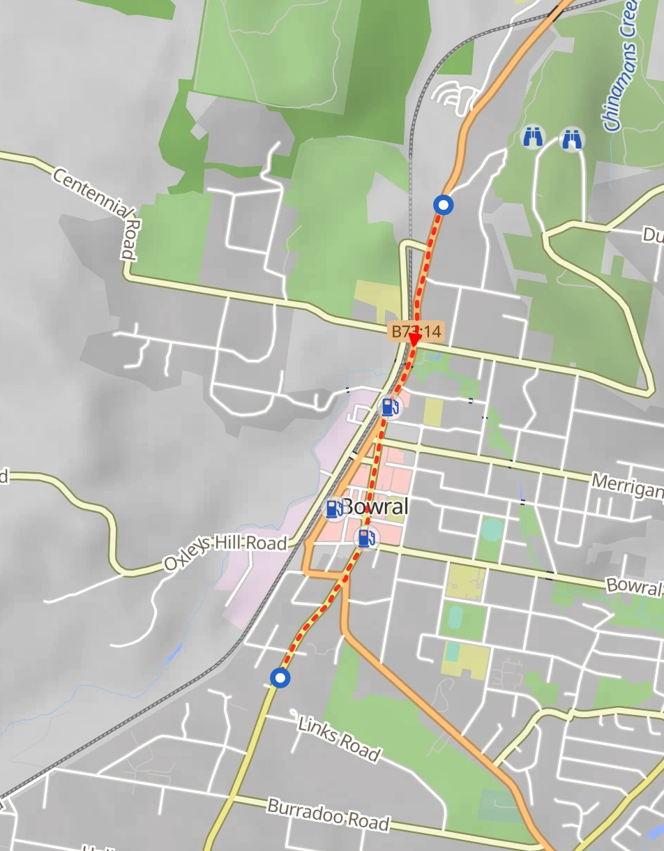
On Google Maps the route is straight through the town. If I choose the same start and end using Kurviger the route has a left turn off the main road and then right back on the main road after the town. I have all my filters turned OFF !
When I export as Garmin Shaping Points and import to my Garmin Zumo XT it shows the same route with the left and right additional turns BUT shows a RED track as per the Google Map straight through the town.
Kurviger mag die Bundestrasse dort nicht! Ist bei mir auch so, natürlich. Sogar, dass es lieber zurückroutet als den schnelleren, direkten Weg zu nehmen:
Thank you, that seems to be the reason for Kurvigers behavior and there does not appear to be a way around it other than put a shaping point in the middle … but I can’t do that for a 5,600km trip to replicate Google Maps.
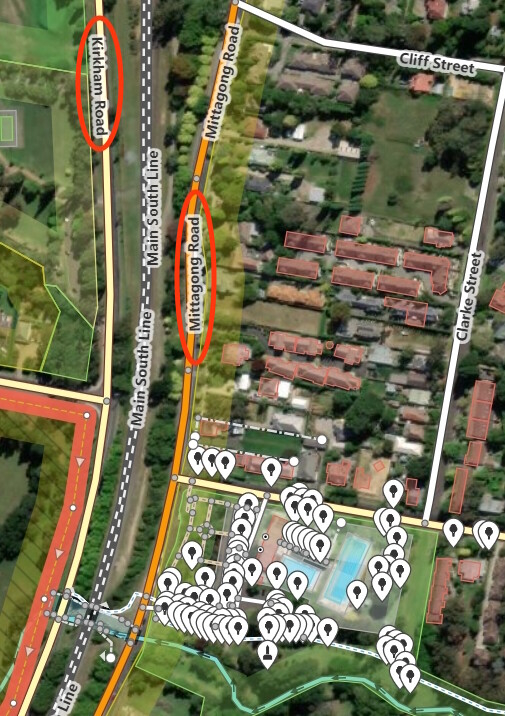
Hi Emu, OpenStreetMap is free to edit for everybody, if you change the speed limit on the other road to what it actually is in reality, then Kurviger will probably behave as you expect If you have any questions about editing OSM there are a lot of people here on the forum willing to help
The speed limit on the other back road is likely higher than through the town. So it will likely continue to go the back way. Any idea on how Google Maps processes this logic.
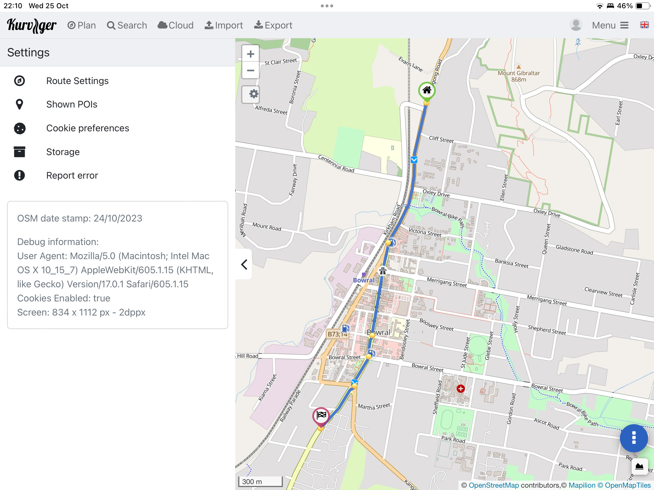
… and is there an issue in general at the moment - I cannot import any of my GPX files in to Kurviger - it will only provide Start and End points and gives me blue circles for all the Waypoints and shaping Points
The GPX text is;
<wpt lat=“-33.4565” lon=“151.4383”><name>Garries</name><desc>Continue onto Tramway Road</desc><sym>Flag, Green</sym><type>start</type></wpt>
<wpt lat=“-33.438413” lon=“151.419754”><name>Stop 1 is Waypoint 1 name</name><desc>Waypoint 1</desc><sym>Flag, Blue</sym><type>via</type></wpt>
<wpt lat=“-33.436833” lon=“151.368004”><name>Shaping Point 2 name 2222</name><desc>Waypoint 2</desc><sym>Waypoint</sym><type>shaping</type></wpt>
<wpt lat=“-33.434442” lon=“151.296771”><name>Fuel Kariong</name><desc>Arrive at destination</desc><sym>Flag, Red</sym><type>destination</type></wpt>
</gpx>
Ah alright, in that case let me quickly tag @boldtrn here so we can collect this into our list of examples where Kurviger shouldn’t leave the main road
See also the FAQ from OSM. If you contribute data, you are doing this under the license from OSM. If you infringe the copyright of Google Maps, you might be liable for this to Google Maps. (I am not a lawyer, if you are unsure, I would recommend contacting one)
That said, contributing your local knowledge is not a problem at all. The problem is when you use other sources instead of local knowledge.
On the 23rd of October I used OSM TO edit the speed limits on the side street to be 50 kph as per Google Street View speed signs that I saw.
Today Kurviger picked up those edits and has rerouted me straight through the town as per the original Google Maps route from my friend.
Originally in OSM there was nothing entered for the speed limit. Perhaps Google Maps will select against that and take the shorter route where the speed limit is known ?
Please don’t use Google Street View to edit data on OSM!
Local knowledge means you have seen it for yourself locally. I know that for max speed this is a bit annoying as it is hard to remember where exactly a speed limit starts and ends.
Everyone can look at everything in Street View - after all, I pay with my data (Google now knows that I am interested in a city in Australia). I can freely use the information I have got from this.
So now I know that a certain street has a speed limit of 50 km/h with a high probability. And because I know that, I can define that in OSM without having to mention the source. I could have also called someone on the phone to tell me this information.