Hallo,
ich bin auf der Suche mit den Namen der aktuell gefahrenen Straße einzublenden. Ich kann nur die Straße einblenden die nach der nächsten Abbiegung kommt.
VG
Hallo,
ich bin auf der Suche mit den Namen der aktuell gefahrenen Straße einzublenden. Ich kann nur die Straße einblenden die nach der nächsten Abbiegung kommt.
VG
If the routing service provides such information, I could see it.
BRouter offline routing service does not include street names.
Note that this could only work when be on the calculated route,
not when be away from route, as only route data can be known.
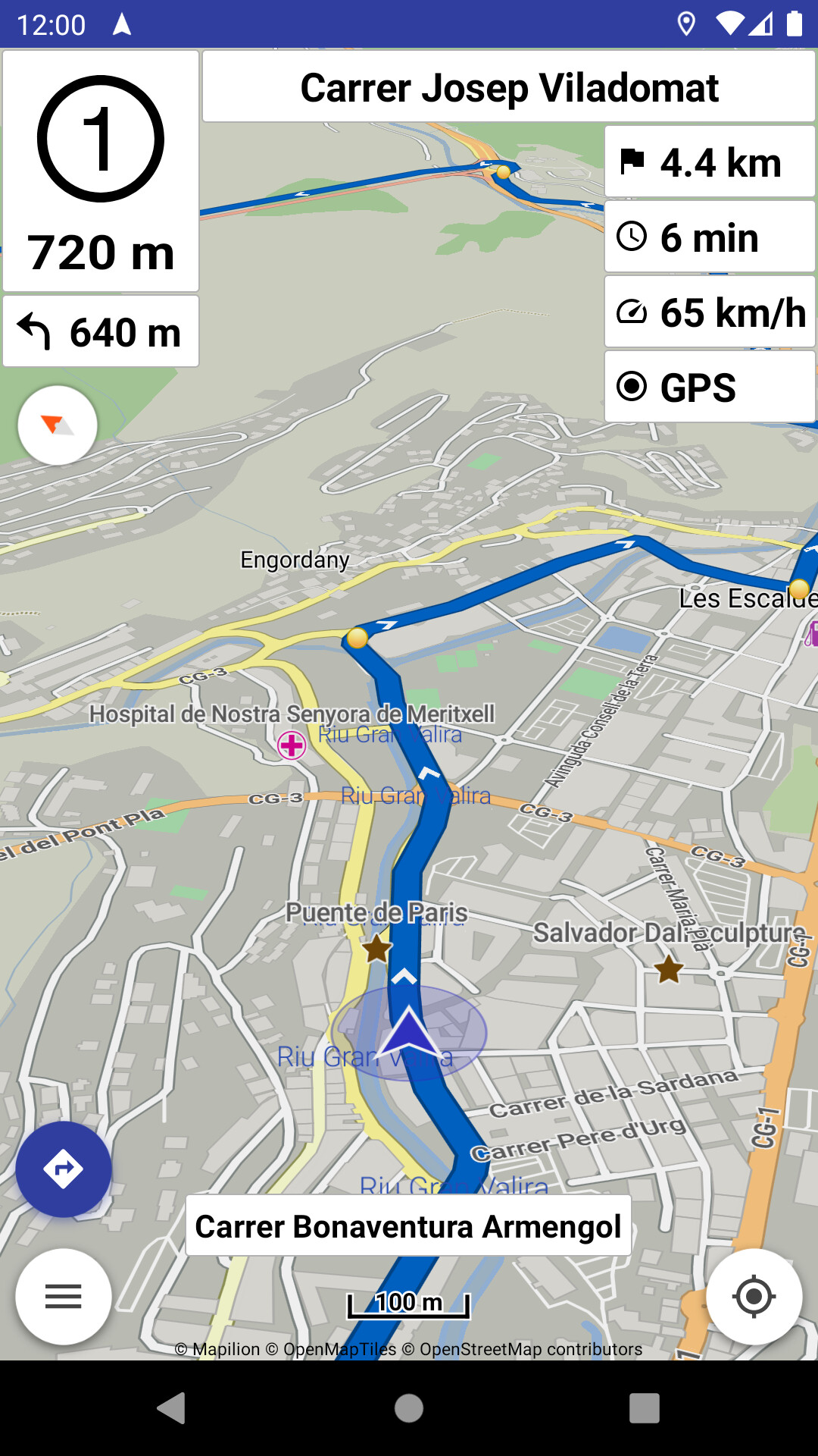
+/- As in picture ? Source: Kurviger file: Street panel tap toggle switch “Actual <> Next”
Ich lass das online über Kurviger berechnen
where can i configure that?
Actually you can’t. Is not implemented. Wait opinion devemux86 pse.
A suggestion by simple tap on street panel. No extra (menu) button
I have a prototype working with e.g. (offline) GraphHopper (on and off route).
It does reverse geocoding of user location and displays the street (at bottom).
With Kurviger that could make sense only on the route (if route contains that data).
Doing continuously online reverse geocoding does not seem a very wise solution?
By the way. That grahical presentation looks nice. But GraphHopper offline deprecation probably throws a spanner in the works?
It is the real application running.
See my answer in GraphHopper topic:
A post was merged into an existing topic: App: Offline routing (GraphHopper deprecation)
Kurviger website contains max speed details in its routes.
(needed in App: Display speed limit feature)
But Kurviger website does not contain street name details.
(needed in this feature)
And even if we change the url to request street name details,
they are not saved in the exported kurviger file.
The app can request street name details in its own routes.
How the app will display the current street name?
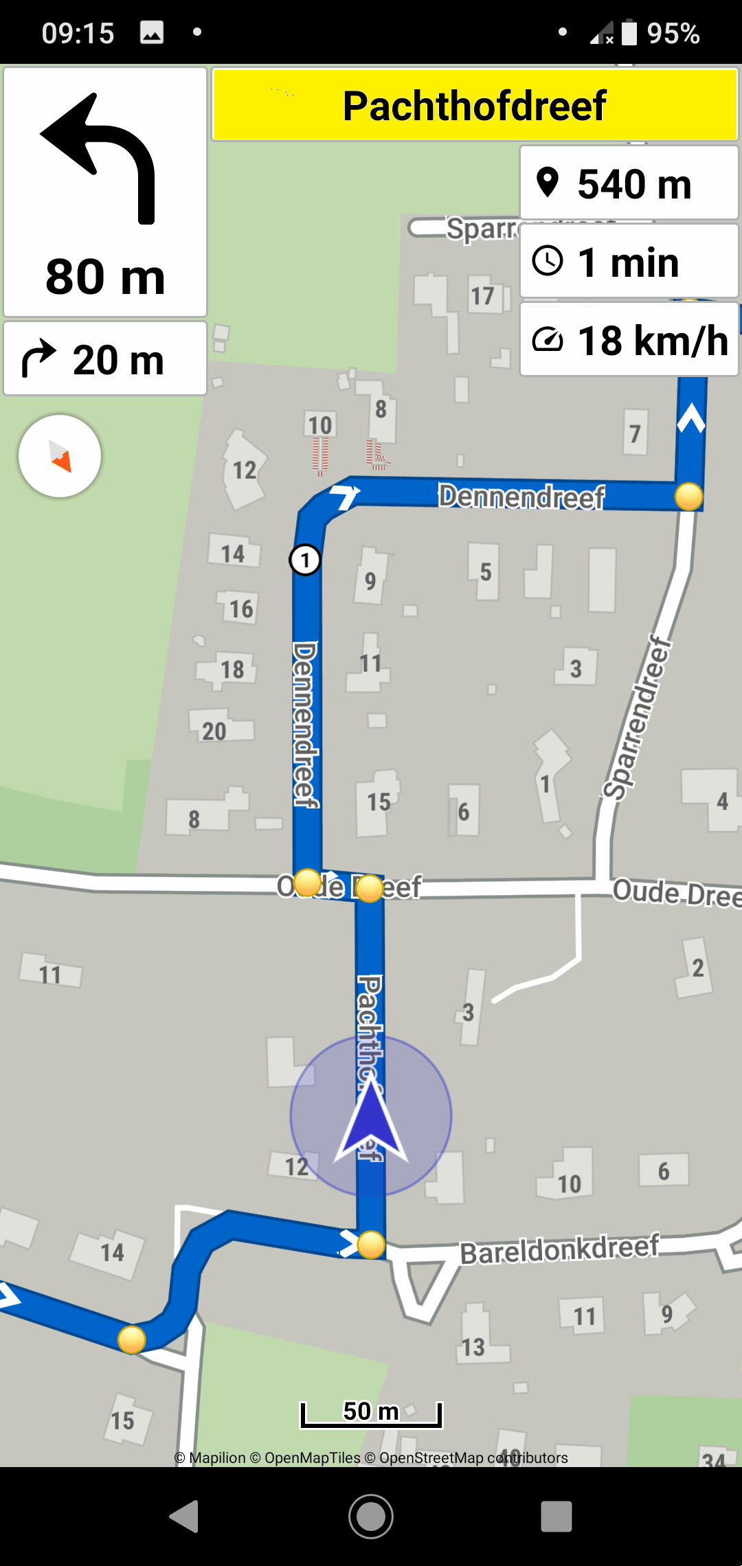
In my above prototype I displayed the street name at an extra panel,
but more panels seem too much and its example location is not right.
(it belongs at the top)
@0709 showed an idea to switch with a tap the street name panels,
between the current street name vs the next instruction street name.
(there will be an indicator for the differentiation of these panels)
Available for testing in Kurviger 2.0.11 (Beta).
Using an old .Kurviger file (2018) in 2.0.8, the panel with 2nd next turn instruction always shows “–” (simulation).
Bourne-Runde-01.kurviger (37,8 KB)
After switching to an other routing mode and back to previous one (to force an route request from server) 2nd next turn instruction was displayed correctly.
I wonder, why a new server request helps - I thought that the response from server is the same and the app just shifts the instructions by 1 for the display ![]() .
.
If a new route calculation by server is necessary for displaying 2nd next turn instruction, a hint in the app might be helpful - but I do not know how often this case happens (use of old .Kurviger file with option “2nd next turn instruction” enabled.
Do you mean the current street name?
(displayed second at the top)
The announcement mentions:
“Kurviger website does not currently export street names in kurviger files.”
@boldtrn has to update the website export and inform us.
Old kurviger files do not contain speed limits and street names,
these are new features.
I mixed it up - shame on me ![]()
Sorry!
I really like showing the current street panel below the next maneuver name.
Maybe it is possible to display the name of the current location/sublocation (city, village) - e.g. interchangeably after pressing this panel? It is not always easy to read this information directly on the map.
Navigation information such as speed limits, street names, etc. come from routing.
It is provided inside the route, I do not know if more information could be available.
The provided street names are simple, without the extra information of area, city, …
OK I understand. Thanks for the clarification. But perhaps this panel could disappear instead of showing two dashes in the absence of a street name? (in such a situation today I thought about the name of the location in this panel).