habe gerade eines Dreitagestour mit 1.13.9 hinter mir und bin schwer begeistert.
Folgende Fragen haben sich aber noch ergeben, auf welche ich bislang keine Antwort gefunden habe:
Was ist die schnellstmögliche Art die Wegpunktliste während laufender Navigation zu öffnen? Muss man dazu tatsächlich jedesmal ins Menü / Routing / Wegpunkte klicken? Schön wäre es die Wegpunktliste z.B. durch langes Drücken auf einen Wegpunkt öffnen zu können. Bzw. öffnet sich nach langem Klick auf einen Wegpunkt ja bereits dessen Wegpunktmenü, hier wäre dann ein zusätzlicher Punkt “Wegpunktliste” schön. Aber evtl. gibt es eine ähnlich komfortable Möglichkeit bereits und ich habe sie lediglich nicht gefunden?
Besteht eine Möglichkeit sich während laufender Navigation anzeigen zu lassen, wie weit und wie lange es noch bis zu einem bestimmten Wegpunkt (oder im Optimalfall bis zu einem beliebigen Punkt auf der Route) ist?
Kann man in der App das Höhenprofil einblenden? Öfters stellte sich während der Tour die Frage, wie hoch es im weiteren Verlauf der Tour noch hinauf geht. Dazu wäre das Einblenden des Höhenprofils (z.B. durch langes klicken auf die Anzeige der aktuellen Höhe) ein schönes Feature.
The weather changed during navigating and we wanted to change the route. I have set a new waypoint off the previous route and deleted some of the existing ones. For the latter, I opened the waypoint list and deleted a few existing waypoints, the rest of the waypoints remained active. Since I had activated automatic rerouting, the new route was calculated and displayed immediately. I have therefore never left the navigation mode and changed the route while the navigation mode was active by setting additional and deleting existing waypoints. For that it would be nice if it were possible to open the waypoint list comfortably while active navigation.
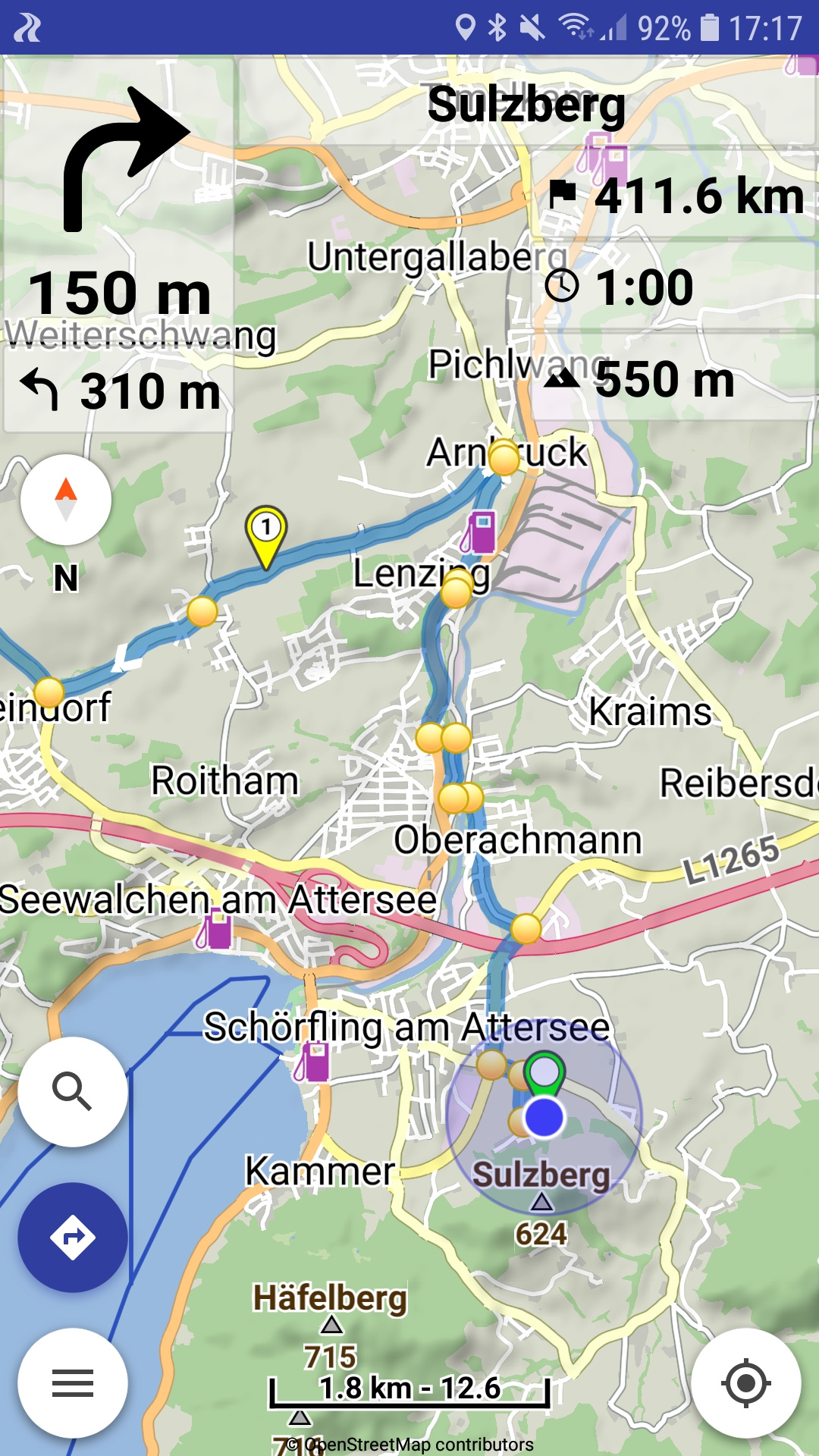
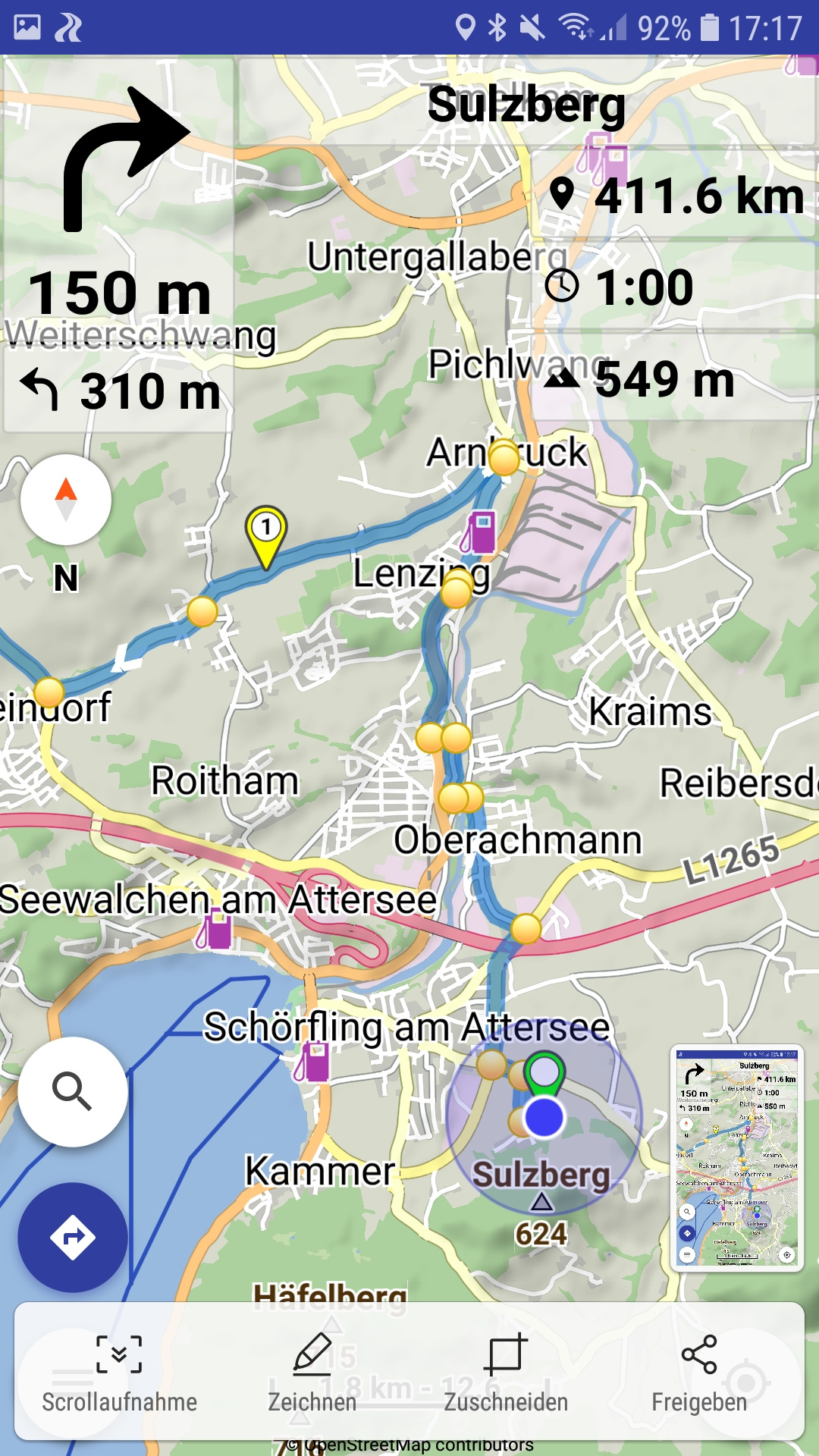
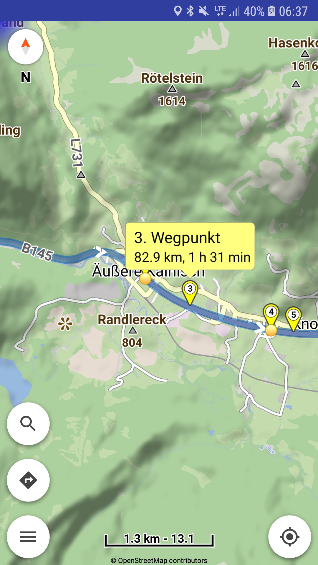
I tried that: Here is a route with several waypoints, total length 411.6 km. When I tap the “411.6 km”, the symbol changes, but the value always remain the distance to destination and not to the next waypoint:
Apart from that, the wish would be to be able to read the remaining route and travel time not only to the next waypoint, but to any later waypoint. For example by opening the waypoint list during navigation (upper point 1) and to display the associated distance and travel time next to the waypoints. Just as an idea …
If waypoints have names and the “Settings | Routing | Waypoints in instructions” is enabled,
then the waypoints can participate in turn instructions (yellow dot) and so in navigation too.
That is already discussed, but being more complicated I could see it in the future:
When app’s waypoint names and waypoint types were implemented,
most users expressed that they did not like instructions in waypoints,
unless they explicitly name the waypoints and enable the preference.
My main use case does not actually refer to waypoints, but to any points on the route.
For example, if I decide to take a previously unplanned break during navigation. Then it would be great to be able to click on any point on the route that has not yet been created as a shaping point or waypoint, and to display the distance and expected duration to this point.
Or, for example, click on a POI (petrol station, …) and get its distance and duration displayed.
So you can decide whether to take the next break there or look for another place on the route.
But it would be optimal if it were not necessary to create a new waypoint, but rather to be able to find out this information for any point along the route without creating a waypoint.
A route consists of waypoints: via points (named or not) + shaping points.
Everything else is a line geometry, with distance / time in turn instructions.
Or mean specific POI along the route, as discussed elsewhere:
Yes I see, you are right! So I think the best way would be first to set a new waypoint and then get information about distance and duration for this waypoint like you suggested here:
I have only just discovered the possibility of the info bubble at waypoints - sorry, didn’t see this before. I am already satisfied with this, I can do the following:
Set a new waypoint during navigation (e.g. at a petrol station or at a point where I would like to take a short break)
The route is updated automatically
Tap the new waypoint
Info Bubble indicates distance and travel time
If not suitable, delete the waypoint and set it again at another point
Perfect, that’s enough for me!
And the great thing is that it works without giving names to waypoints!