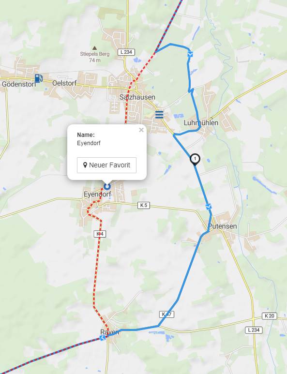
Wenn ich eine Route plane, besteht sie zunächst aus POIs, also interessanten Zielen, die ich anfahren möchte. Aber nicht immer Routet kurviger so, wie ich gerne fahren möchte. Deshalb setze ich in diesem Fall einen Zwischenpunkt und verschiebe den Routenverlauf. Das Blöde ist nun, dass dieser Zwischenpunkt genauso aussieht wie alle anderen Punkte. Das macht die Tour in der Ansicht sehr unübersichtlich. Deshalb hätte ich einen oder zwei Wünsche:
Am liebsten hätte ich es, wenn ich die Route verschieben könnte, ohne ein neues Zwischenziel einzugeben, so wie bei Google maps.
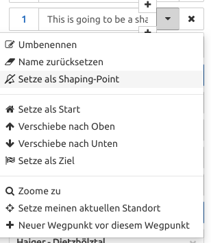
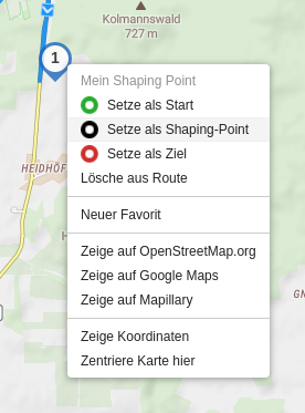
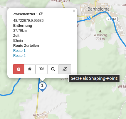
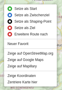
Wenn 1. nicht sein soll, hätte ich gerne einen optisch unscheinbares Symbol für das “Zwischenziel”.
Es wäre auch ok, wenn ich hinterher entscheiden könnte, ob es sich bei dem Zwischenziel um ein POI handelt oder um einen untergeordneten Wegepunkt. Bei Basecamp etwa kann man entscheiden, ob es sich um einen Punkt mit stillem Alarm handelt, der dann vom Navi nicht angesagt wird.
In einer weiteren Ausbaustufe könnte man sogar nach einem Rechtsklick auf das Zwischenziel aus einer Liste heraus entscheiden, welches Symbol und Eigenschaft der Wegepunkt haben soll, z.B. Hotel, Sehenswürdigkeit, Pause, etc.
Und natürlich sollten diese Merkmale beim export auch auf die App übertragen werden!
When I plan a route, it initially consists of POIs, which are interesting destinations that I want to approach. But not always routes .kurviger the way I would like to drive. Therefore, I put in this case an intermediate point and move the route. The stupid thing now is that this intermediate point looks exactly like all other points. This makes the tour in the view very confusing. That’s why I have one or two wishes:
I would prefer if I could move the route without entering a new stopover, like on Google maps.
If 1. should not be, I would like a visually inconspicuous symbol for the “intermediate goal”.
It would also be ok if I could decide afterwards whether the intermediate destination is a POI or a subordinate waypoint. At Basecamp, for example, you can decide if it is a silent alarm point that is not announced by the Navi.
In a further stage of development, one could even decide from a list, after a right-click on the intermediate destination, which symbol and property the waypoint should have, e.g. Hotel, sight, break, etc.
And of course these features should be transferred to the export export to the app!
I am not sure if this is the right place - if not, feel free to move my remarks, of course.
Would it be possible to export Waypoints/Wegpunkte as ViaPoints and Shapingpoints/Formpunkte as Shapingpoints in Garmin GPX Export?
Without Shapingpoints/Formpunkte that is not useful, because up to now you need Waypoints/Wegpunkte to modify the Route - but with Shapingpoints/Formpunkten you can use them and use Waypoints/Wegpunkte to generate ViaPoints in Garmin Export…
I have stored some routes. I tried to change waypoints to shaping type, save to my routes. But after opening the points are waypoint type again. Change of name is OK, it’s stored well.
Wenn ich jetzt eine Tour im kurviger Format speichere und wieder importiere, wird auch ein Track angelegt. Wenn ich dann einen Punkt verschiebe, wird der Track (natürlich ) nicht geändert.
Ich frage mich auch, ob es mehr Sinn machen würde, den Wegepunktnamen beim Verschieben automatisch zu löschen. Denn die Bezeichnung dürfte in der Regel nicht mehr stimmen.
[EN]
Great stuff! Great!
Now when I save a tour in kurviger format and import it again, a track is created as well. If I move a point, the track (of course) is not changed.
Bitte nicht!
Sonst löscht es den Namen, wenn man einen Wegpunkt genauer positioniert
und z.B. um 20m verschiebt.
Nur wenn Du auch “Anzeige als Overlay (visuelle Darstellung auf der Karte)” angewählt hast
Dieses Feature gab es meines Wissens bisher nur für *.gpx Format.
Jetzt kann man sich auch für *.kurviger das Overlay anzeigen lassen

 .
.