IMHO Waypoint is waypoint. Why shouldn’t a user change the profile between Shaping Points? We also allow to name Shaping Points and do everything that you can do with a Via Point.
For me a via point is a point where I want to stop. A shaping point is used to change the route to a different road. If at that point I want to change the profile, why not?
Robin, sure you are free to do this. It’s just a bit unusual. Since from what I read here, you do attach a great deal of importance to some uniformity with other software, so I mentioned this.
Exchange of ideas (free) isn’t that what this forum is for?
It’s good to discuss about these things. If there are good reasons to do something similarly to how other systems work, we should do it. But I am hesitant to do something just because some other system does it that way.
That’s why I was asking you “why” .
The other point is, to be compatible with other systems in regards to export formats. And yes I think we should be compatible, when this is possible.
Sure absolutely! I already noted your proposal to include the routing mode in the waypoint type. I think this makes sense and should not break other applications. But I like to ask questions if I can’t understand an idea. And before doing anything, we need a valid use case.
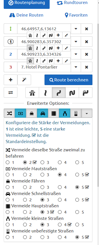
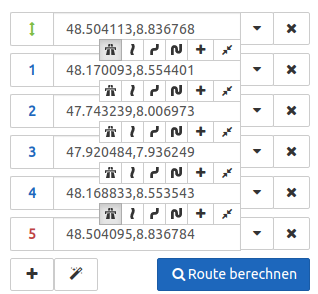
As a Christmas surprise we just added the feature to select different route options per segment. That allows you to plan a tour that consists of different riding styles. The feature is available for Kurviger Tourers. You can select the option either in the sidebar or on the map.
Please let us know what you think about the feature.
Merry Christmas
Was versteckt sich denn da hinter dem 24. Türchen? Als Weihnachtsüberraschung gibt es dieses Jahr die Option verschiedene Routenoptionen für Abschnitte der Route auszuwählen. Die Funktion kannst du als Kurviger Tourer auf der Karte und in der Seitenleiste verwenden.
Wie immer sind wir gespannt auf eure Rückmeldungen.
Absolutely pefect. I just recognized the change while planning a tour for next year.
A suggestion for a New Year’s gift would be the already mentioned direct jumping to the first occurrence on the map when clicking on the map symbols, e.g. dirt road or ford (I even didn’t know what a “Furt” is before I saw the symbol .
This would help to find and correct the unwanted passage.
Als zukünftige Verbesserung würde ich noch vorschlagen, dass man die Vermeidungen auch unabhängig, pro Abschnitt, anpassen kann.
z.B. erster Teil Autobahn bis Abfahrt, dann das kurvigste Profil für den Rest der Strecke unter Vermeidung von Bundesstraßen/Hauptstraßen.
Das klappt im Moment noch nicht, oder hab ich was übersehen?
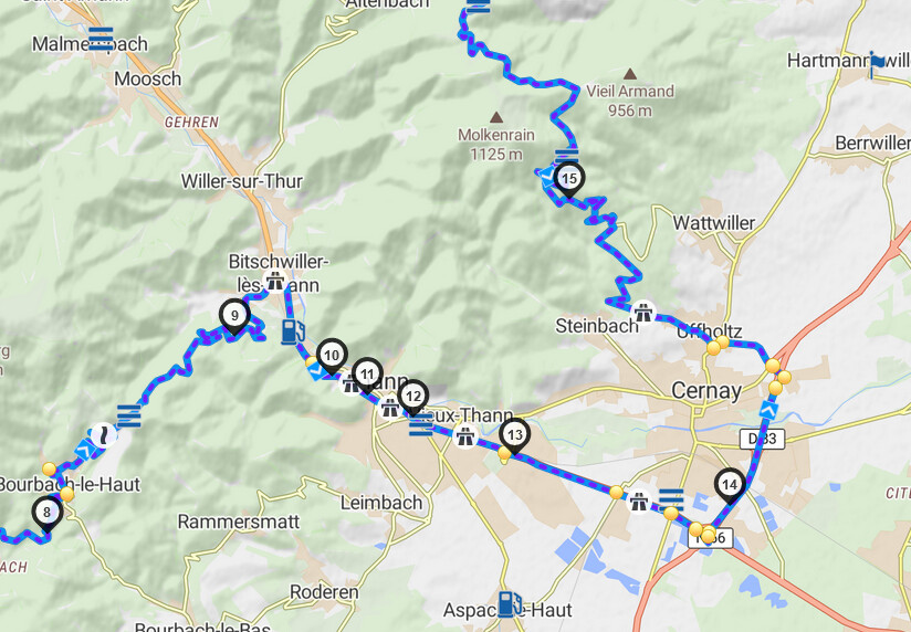
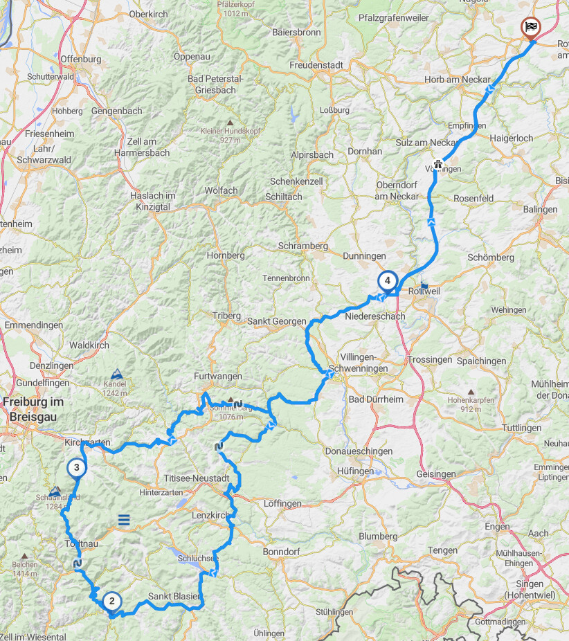
In this situation the route calculation is not comprehensible.
Sample
Settings: I have put the WP1 and WP2 to the quickest calculation and I would expect that then the quickest route on the N57 would be taken to the hotel, but instead the route through the centre of the town is calculated which is for sure not the quickest.
The interplay with the avoidance strategies seems to somehow interfere with this. I would say if a section is changed to the quickest way, then if an avoidance strategy is set to no highways or fast roads, then ignore the avoidance strategy.
The new features in web are great (maybe as mentioned a better harmonization with the avoidance strategies), but the kurviger app calculates differently and the effect in some situations is quite different which requires a re-shaping on the app after importing it.
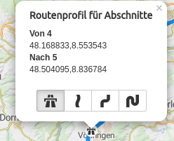
I think this is not concerning “Multiple route modes”: If you do not use the new feature, set the whole routing profile to “fastest” and set the extended options to default, it looks similar:
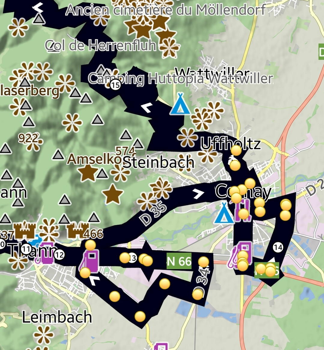
Beim Knopf “Erweiterte Optionen / vermeide Schnellstraßen” wird der erste “Autobahn” Abschnitt mit verändert.
Bei “Erweiterte Optionen / vermeide Hauptstraßen” seltsamerweise nicht!?
Dies bedeutet, dass Sie keine freigegebene Curviger-Datei von einem Premium-Mitglied als Standardbenutzer zur direkten Verwendung herunterladen können ?
(Dieser Vorgang ohne eigene Änderungen natürlich) Es gibt also nur eine Möglichkeit, dass das Premium-Mitglied die kurviger Datei selbst herunterlädt und sie dann nur als Datei freigibt?
Richtig? Puh …das Herunterladen als regulärer GPX-Track funktioniert nicht einmal. Lame.
 .
. . Really well done!