Die möglichkeit Verkahrsdaten in die Routenplanung einzubeziehen ist nicht zu unterschätzen. ich stand schon oft genung vor Sperrungen die ich nicht durchfahren konnte.
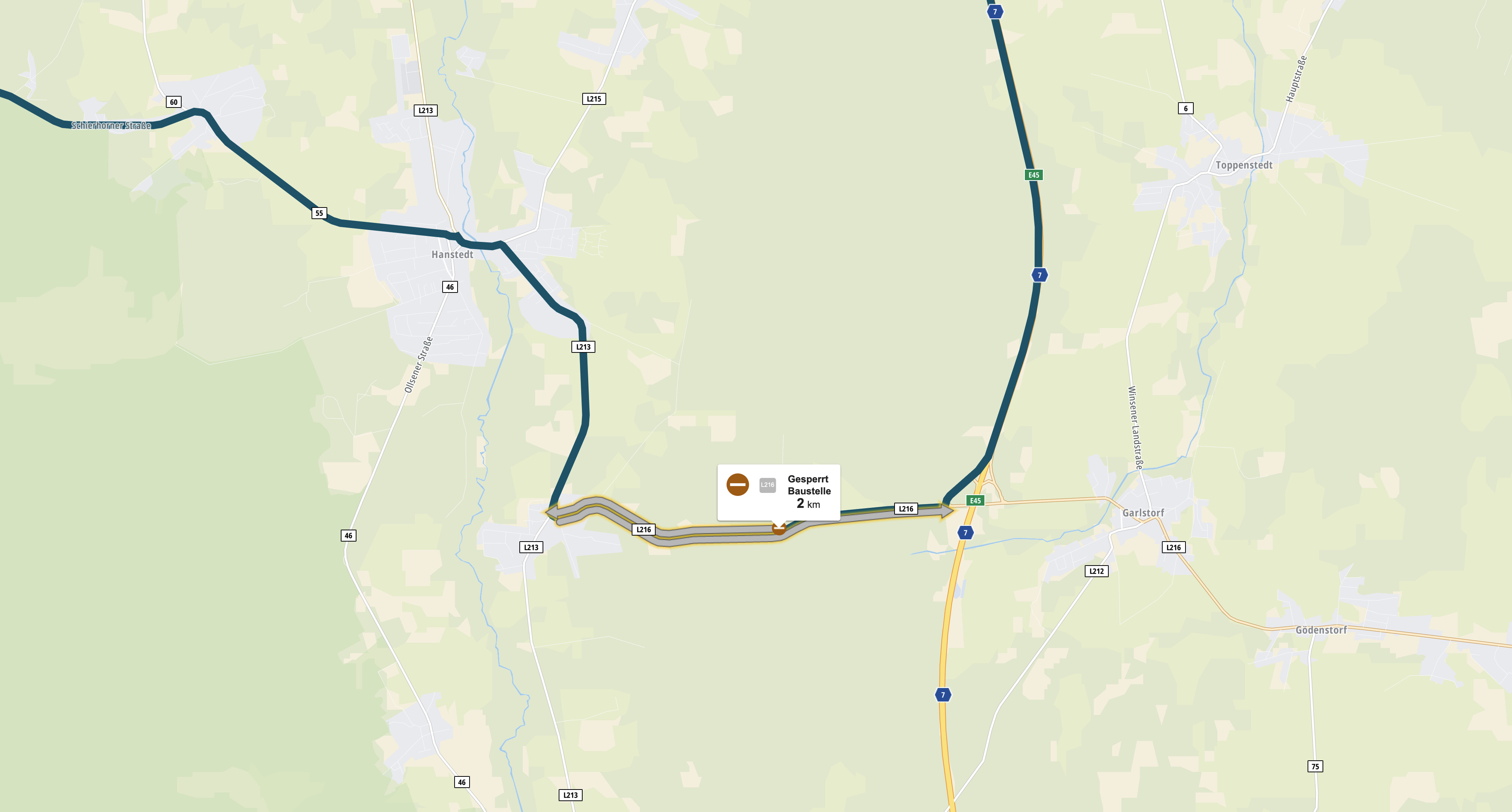
Ein Beispiel sieht man auf den Bilden:
Laut Kurviger und OSM ist die Abfahrt von der BAB 7 möglich
Das sind doch Live Daten. Live Daten sind nicht nur aktuelle Staus sondern auch Tagsesbaustellen und kurzfristige spontane Sperrungen (z.B. Radrennen). Live ist aus meiner Sicht alles das was nicht fest ist und sich im Status flexibel ändern kann.
A question for those who request live traffic data, purely out of interest. What does your driving profile look like, or do you need it mainly for (large) cities and/or motorways? Since I usually only drive on country roads and always deal well with the traffic, I don’t see any benefit for my driving profile. But of course it can look completely different with a different driving profile.
But it’s exactly the moment when I’m riding on a highway or in a city - there is much traffic and nothing tells me which roads I should use and which one I should avoid. So mostly I’m taking the wrong one and have to deal with it.
Yeah totally agree with you, most of the times it won’t be needed. But I can also 100% see the other side of this, it has happened so many times the google maps backup has saved my ass when I eventually had to cross Genova on the way to Cinque Terre or something like that. Road blocks and traffic can happen even on the most beautiful tours, at least here in europe. Maybe western US or Australia doesn’t have that problem
Hi, I use Kurviger-App since a few weeks. It’s a nearly perfect app for motorbikes. My respect to the developer, really great work!
One thing I miss from other devices is actually the display of LiveTraffic or construction site closures. It also happened to me that I came from one road closure (on a country road) to the next road closure and then drove around towns in circles.
@devemux86: do you see any chance to integrate this as an additional function or layer?
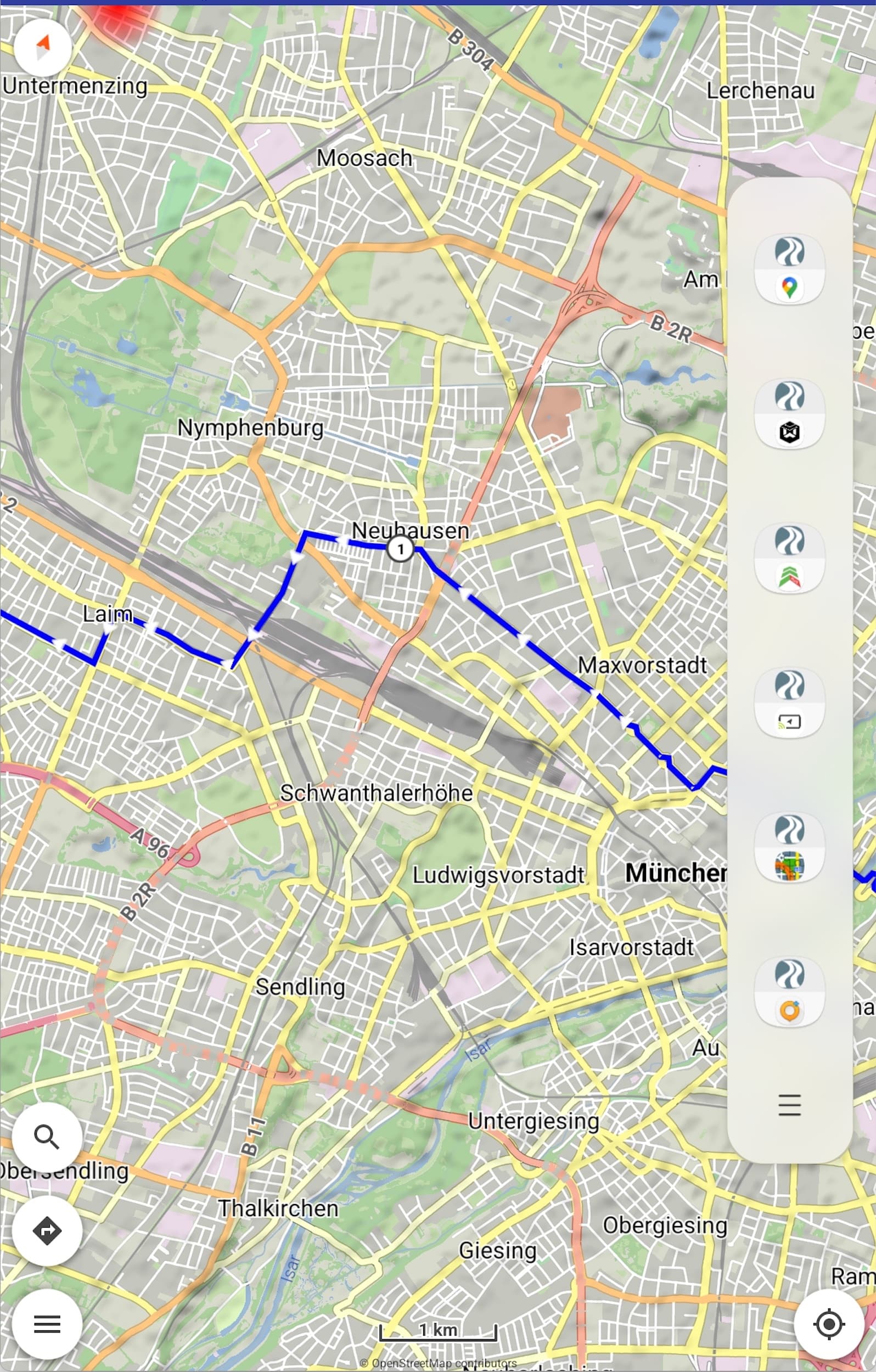
By now - as a workaround - I export the planned route as track, import it into GMaps (mymaps) and check with the google traffic-layer if there are any current closures/construction sites along the way.
For me it is not necessary to use the closures for calculating the route. It would be enough to see where a closure is and then set two or three new shaping points for another route by myself.
Traffic data is provided and used by routing services and is not free:
“Mapbox Traffic Data is only available through an Enterprise plan, and is licensed annually for a specific geographic region (city, state, or country). Contact our sales team for more information.”
“Data Sharing: Because traffic data relies on anonymized data generated by customers, Mapbox requires that location data generated by an applications powered by traffic data be shared back to Mapbox. For instance, if traffic data is used in a route planning application in the United States, you must share back (in anonymized format) GPS data generated in the normal course of business from the same data.”
No need for traffic data from my point of view. I like road blocks that I can drive through on a motorcycle. It frees up my mind. In 99% of all cases I find a gap to drive through and a bit of gravel on the track doesn’t hurt anyone.
I also usually drive through construction sites and there is usually a way through or over dirt roads around it…but thats only possible on Sundays.
If you drive on a weekday and the construction workers are working there with their machines or the road is just gone or a hole with 2m, then even a Enduro can’t drive throug it.
Or if you’re on a tour with newbies or with Harley riders…and so on…
This is all true and I can certainly understand the desire for traffic data. I’m just saying that it’s unnecessary for me. My day trips are only on Sundays and I don’t drive with novice drivers. I don’t mean that disrespectfully, but factually. All types of motorcycles and drivers have their justification. We drive mainly on adventure motorcycles and pretty much sporty and there are no mimosas in the group or at most 2 times, the first and last time .
Same for me. For motorcycling not necessary.
Less Autobahn and if there is a traffic Spam, then i decide what to do in this case when i’m there.
There realy not many and in most cases i can driv through.
For Long Distance drive on Autobahn, yes a detour will be good.
But i have this only by car!
And if it will happen that i do this on Motorbike, then i will use an App that is progrmmmed to be good for this case (Google, Here we go) and later i switch to the specific App kurviger!
Hallo,
ist es eigentlich möglich sich aktuelle Verkehsstörungen während der Navigation anzeigen zu lassen.
Zum Beispiel Staus ,Sperrungen duch Unfälle u.s.w.
LG Armin
Technisch ja, aber das würde Kurviger nur teuerer machen, weil ein solcher Dienst nicht kostenlos zur Verfügung steht. Das will so gut wie keiner. Der aktuelle Preis ist vollkommen in Ordnung.
Verkehrsdaten basiertes Routing braucht man beim Motorradfahren auch nicht wirklich. Ich finde z.B. in 99% aller Fälle eine Lücke durch eine Baustelle und fahre durch, lustiger Schotteranteil, geht mit jedem Motorrad, auch mit nem fetten Tourer. Und wenn’s mal gar nicht passt, dann sucht man sich halt einen Weg drum herum. Fördert den Orientierungssinn und den Spaßfaktor .
Wenn ich Live Verkehrsdaten basiertes Routing zu kurviger benötige
lege ich mir MyDrive und kurviger auf das Display.
Auf dem Dorf fahre ich oft durch Baustellen
aber in größeren Städten kann ein einfaches drauflosfahren sehr zeitaufwändig werden.