Hello, I am new to your app which I really appreciate. ![]()
Only I do not understand a particular point: I download a GPX file that includes off-road paths, and when I click on import, does it create another route in blue for me, as if he doesn’t want to go through the paths? Thank you for your help
Hallo Motardebase, können Sie die Route, als Link von kurviger, hier teilen?
Ansonten ist es sehr schwer zu helfen…
Hello Motardebase, can you share the route, as a link from kurviger, here?
Otherwise it is very difficult to help…
1 Like
Hello! Thank’s you for the responce, i understand the point of vue kuviger for the off road, to bad for me.
Lucky, this is the link with the gpx
Thank’s you
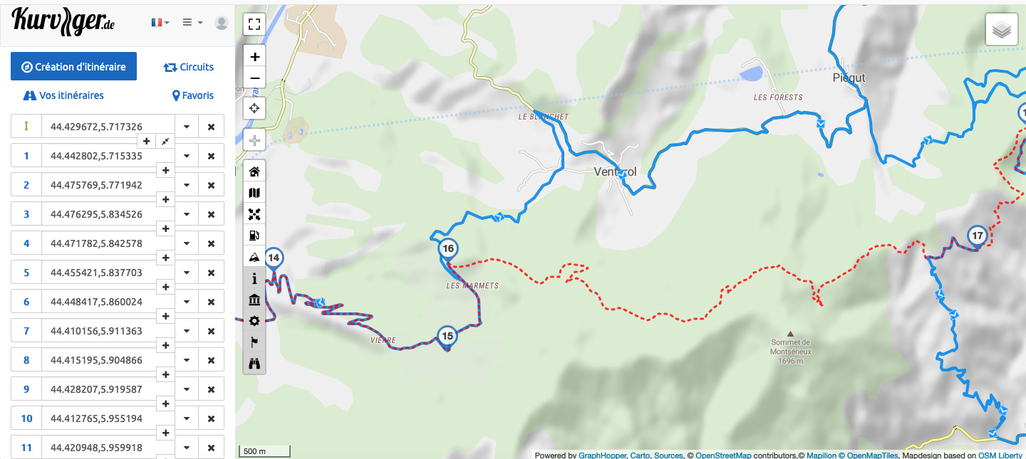
Bei allen Doppelpunkten, zum Beispiel 17 - 18, sind barrier eingetragen, ohne Zugang für Motorräder. Beziehungsweise sind keine entsprechenden Tracks vorhanden, nach Datenlagen Openstreetmap. https://kurv.gr/AJRUB
For all colons, for example 17 - 18, barrier is entered, without access for motorbikes. Or there are no corresponding tracks available, according to data Openstreetmap. https://kurv.gr/AJRUB
If you know the area, you can improve Kurviger’s routing. Planning offroad routes with Kurviger is possible to some extend, but the data needs to be set accordingly.
If you would like to improve the routing, we are happy to help you with your first steps on OSM, so that you can get started.