I am new with the Kurviger Pro App and I think it is a great tool.
But the first routing test offers a strange result at two points.
The routing options are “fastest” and without “Maut” and without “unbefestigte Straßen”.
The route should leave" L605", which is like an highway, only to route back on it after crossing the next street.
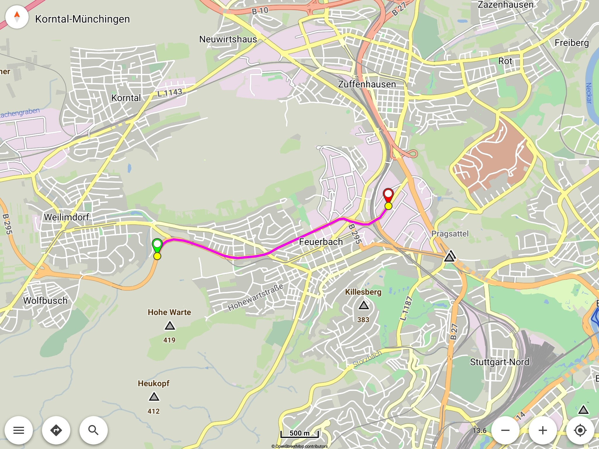
Similar routing please see “Feuerbach”. The route leaves B295 and I should drive through the village, but it is very faster to drive along B295.
In both cases the routing makes no sense to me, for the option “fastest” should use the fastest way, should’nt it?
How can I avoid such a strange routing?
I noticed, that if I select “curvy”, the routing seems to prefer streets in cities and villages additionally, just to drive some corners (not curves!).
If I select the restriction of smallest roads, it restricts smallest roads everywhere.
But I want to drive them outside of villages and cities.
How can I fix the problem, or have I to check every km of a route and set shaping points if necessary?
Die Routenführung in Karlsruhe (48.982583,8.372234) liegt m. E. an falschen OSM-Definitionen, z. B. ist die Schnellstraße mit 70 km/h ausgewiesen, während die Ab-/Zufahrt teilweise 100 km/h bzw. keine Höchstgeschwindigkeit berücksichtigt.
In Feuerbach ist die Tunnelstrecke der B295 mit 50 km/h definiert und die gewählte Route ebenfalls - letztere ist allerdings um 50 m kürzer! Algorithmen rechnen halt total digital …
The routing in Karlsruhe (48.982583,8.372234) is in my opinion due to incorrect OSM definitions, e.g. the expressway is shown with 70 km/h, while the exit/entrance partly considers 100 km/h or no maximum speed.
In Feuerbach, the tunnel section of the B295 is defined with 50 km/h and the selected route as well - the latter, however, is 50 m shorter! Algorithms calculate just totally digitally …
Thank You very much.
So the problem is fixed.
If card infos are wrong Kurviger has no chance to “correct” it by routing.
Clear
So the thing is to check the routing results before driving.
Thanks again for Your support.
Henni
@WalterG
Thx for Your warm welcome.
I am familiar with most of the functions of Kurviger.
My last routing device was a Garmin 590, but I am dissapointed (the list of failures and not satisfying features is too long to communicate here an OT) and service by Garmin is none at all.
I will check it out, if Kurviger with a smartphone is an alternative.
Menu ¦ Share ¦ Route ¦ Clipboard
Afterwards paste the link here.
Remark: My link above was wrong, if I use the route in your .Kurviger file and force a new calculation, I get the same result


