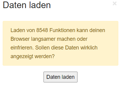
When displaying a point of the map on OpenStreetMap.org on the web page, the overlay “map data” is immediately shown as well, because “layers=D” is set in the querystring. I always turn the overlay off immediately, because it bothers me more than it helps.
Therefore I suggest to omit the parameter “layers=D”, so that in the default case the layer is first hidden (I think it used to be like that) ?
What do you think ?
Wenn man auf der Webseite einen Punkt der Karte auf OpenStreetMap.org anzeigt, wird sofort die Ebene “Kartendaten” mit eingeblendet, da im Querystring “layers=D” gesetzt ist. Ich schalte das Overlay immer sofort wieder aus, da es mich mehr stört als daß es hilft.
Daher schlage ich vor, den Parameter “layers=D” wegzulassen, so daß im Standardfall die Ebene erst mal ausgeblendet ist (ich glaube, das war früher auch mal so) ?
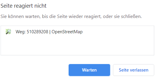
It seems that the problem of hanging browser occurs especially in cities, where - of course - the density of the map data is higher (in most cases I use the “Show on OSM” function outside cities - so that effect was new for me).
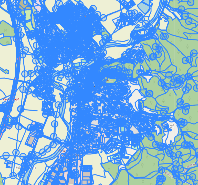
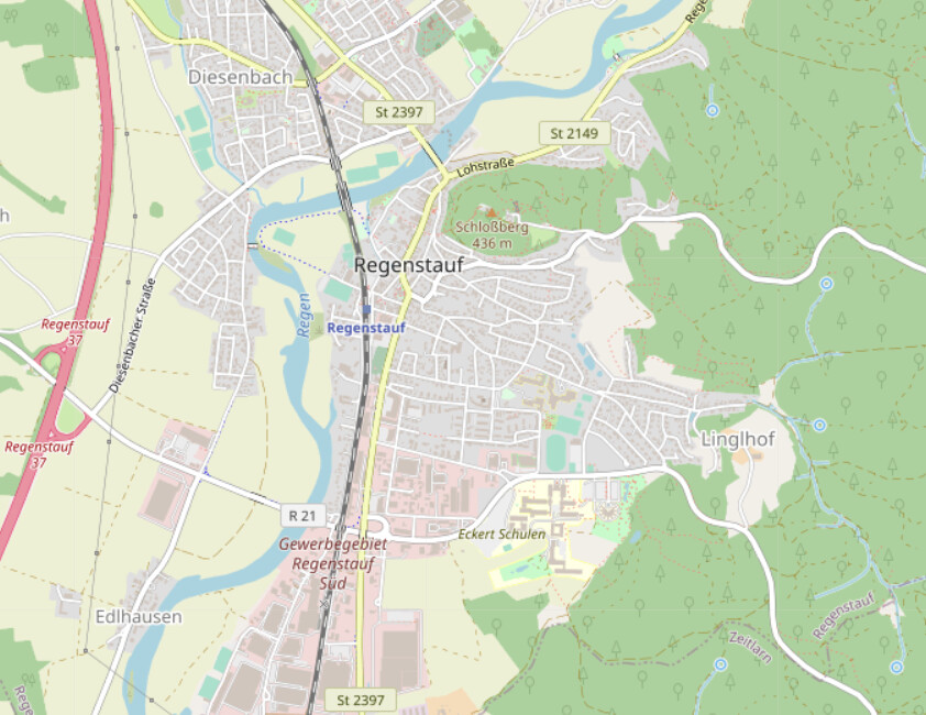
If zooming in, the map becomes “readable” also with map data overlay - so perhaps the zoom level could be used for the descision “show map data overlay or not”.
Trying zoom=17 in a city, I get frequent “hangings”, but the map is readable:
With zoom=18 I have to wait now and then a few seconds before the browser has updated.
So to be sure I would propose to show map data layer for zoom >= 19 and to hide it otherwise.
This will avoid to quench not so OSM experienced users (I have to admit I am one of them - first I did not know ho to get rid of that blue lines and circles ) - and I think switching on the layer manually is much less annoying than waiting for a hanging browser.
But - of course - I do not want to hinder the OSM pros, because the excellent map data is the result of their work!
 - will put it on the todo list if it bothers most users?