[DE] Ich habe mehrere Routen erstellt und möchte diese miteinander verbinden. Wie gehe ich dazu vor? Ich dachte ich könnte dies mit den Tourcodes machen, aber das geht nicht. Mit GPX-Dateien geht das, wenn ich
aktiviere. Es wäre doch sicherlich kein Problem, dies auch mit Tourcodes zu machen, oder? Jetzt muss ich die einzelnen Dateien zunächst in GPX umwandeln, um sie verbinden zu können.
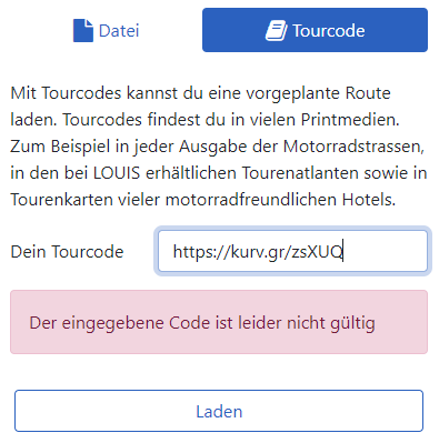
btw: Die “tourcodes”
sind nicht die Links, die man beim Teilen erzeugen kann, oder? Jedenfalls erzeugt ein Kurzlink eine Fehlermeldung:
[EN]
I have created several routes and would like to connect them. How do I do this? I thought I could do this with the tour codes, but I cannot. With GPX files it works if I
activate. Surely it wouldn’t be a problem to do this with tour codes as well, would it? Now I have to convert the individual files into GPX first in order to be able to connect them.
btw: The "tourcodes
are not the links that can be generated when sharing, are they? Anyway, a short link generates an error message:
Georg,
Dein eingegebener Code ist kein “Tourcode”, sondern ein “Link zum Teilen”.
Einen Tourcode kannst Du nicht selbst erzeugen, den bekommst Du nur aus Zeitschriften, z. B. MOTORRADSTRASSEN (motorradfreizeit) und der sieht z. B. so aus: 2102MS06.
Empfehlung meinerseits: Grundsätzlich alle Routen im .kurviger-Format abspeichern, denn nur .kurviger enthält wirklich alle Routenoptionen! Bei Deinem Weg über .gpx-Dateien geht schon das ein oder andere verloren.
Ob beim IMPORT neben den Optionen “Datei” und “Tourcode” nicht auch “Link zum Teilen” angeboten werden könnte, wäre eine Frage an Robin.
Georg,
The code you entered is not a “tourcode”, but a “link to share”.
You cannot generate a tourcode yourself, you can only get it from magazines, e.g. MOTORRADSTRASSEN (motorradfreizeit) and it looks like this: 2102MS06.
Recommendation from my side: Generally save all routes in .kurviger format, because only .kurviger really contains all route options! With your way over .gpx files already one or the other gets lost.
Whether at the IMPORT beside the options “file” and “tourcode” not also “link to share” could be offered, would be a question to Robin.
Wolfgang, guter Tipp, dass mit dem kurviger-Format. Ich benötige die gpx-Dateien jedoch für Mitfahrer, die die Route gerne auf ihr Garmin- bzw TomTom-Navi haben möchten.
Bisher speichere ich die Routen als Kurzlink in whatsapp. So habe ich die Routen immer parat, sowohl auf dem PC als auch auf dem Handy.
Wolfgang, good tip about the kurviger format. However, I need the gpx files for fellow cyclists who would like to have the route on their Garmin or TomTom navigation device.
So far I save the routes as a short link in whatsapp. This way I always have the routes ready, both on the PC and on the mobile phone.
Genauso geht es mir auch! Für mich gibt’s nur die .kurviger-Datei (kein Kurzlink, keine Kurviger-Cloud). Für Mitfahrer erstelle ich per GpxShaping.de eine .gpx-Datei mit genügend Wegpunkten, um Garmin/TomTom auf die Kurviger-Route zu zwingen. Diese Datei bekommen die Jungs per eMAIL.
Sämtliche Dateien sind in Dropbox abgespeichert und damit direkt auf meinem Smartphone verfügbar. Änderungen, die sich während der Tour ergeben, speichere ich allerdings lokal im Android und verteile sie dann wieder per eMAIL - ich weiß Letzteres ist ein bisschen “old school”, aber m. E. immer noch die vernünftigste Methode.
Ich habe mir zwar extra einen USB-OTG-Adapter zugelegt, aber die erfolgreiche Übertragung einer .gpx-Datei direkt in den BMW-Navigator steht noch aus.
I feel the same way! For me there’s only the .kurviger file (no shortlink, no kurviger cloud). For followers I create via GpxShaping.de a .gpx file with enough waypoints to force Garmin/TomTom to the kurviger route. The guys get this file via eMAIL.
All files are stored in Dropbox and thus directly available on my smartphone. Changes that occur during the tour, however, I save locally in the Android and then distribute them again via eMAIL - I know the latter is a bit “old school”, but for my opinion still the most reasonable method.
I have bought a USB OTG adapter, but the successful transfer of a .gpx file directly into the BMW navigator is still pending.