That very old road is open for Motors. The OSM Modifikation is an explicit Suggestion from FAQS. But doesnt work. @ the developers: what about adding an additional road category i.e. any others even trails at own risk?
One possibility to circumvent all possible prohibitions: Use the FASTBIKE (racing bike) profile with the BRouter.
Thank you all for contribution I’d close this topic and won’t reply further. I feel the way to fix it is adding an additional road cagegory as suggested.
Thanks to [leeeb] - I will check BRouter
Kurviger uses:
highway=unclassified and highway=track, access=yes. So adding access=yes might be the right choice here.
This depends on the road characteristics. If this road is used to travel to a place, then it should unclassified. If it’s mostly used for agricultural purposes, it’s a track.
Es gibt hier schon mehrere Themen bzw. Anfragen Verbote zu umgehen, die dann tot diskutiert werden.
Eine zusätzliche Kategorie zmb. „Direkt“ oder „zu befahren auf eigenes Risiko“ würde reichen.
Da wäre eine klare Ansage von einem Betreiber hilfreicher als seitenlange Dialoge.
Du meinst sowas:
Es wurde von den Entwicklern schon bestätigt, dass so etwas wie “Luftlinie” kommt.
Manches ist schwieriger als es für uns Benutzer aussieht.
Ich bin sicher, das wird noch kommen.
1 Like
Das ist dann mal eine Ansage, Dankeschön.
Komisch finde ich’s nur, dass es lediglich 6 Stimmen für Straight-Line gibt. Und nur 9 Stimmen für die Multiple route profile (die Voraussetzung für die Luftlinien-Funktion) … (Bei beiden Abstimmungen bist Du übrigens nicht dabei.) …
Dagegen wird Display Space Limit mit 26 Stimmen bewertet. Seltsam.
Strangely, there are only 6 votes for Straight-Line. And only 9 votes for the Multiple route profile (the prerequisite for the direct line function) … (You’re not on either vote, by the way.) …
In contrast, Display Space Limit gets 26 votes. Strange.
1 Like
Do not worry, forum votes have little effect on the application implementation program. ![]()

What is the best way to give feedback that I would like to have the feature discussed in such a thread? I thought just voting for it would be a good option if I do not want to add further comments ![]()
1 Like
It is always helpful to express an opinion, why you think a request is useful for implementation.
App has its own category for discussions.
I move the topics in new features after I approve their implementation.
Gibt es schon etwas konkretes zu: eine zusätzliche Kategorie zmb. „Direkt“.
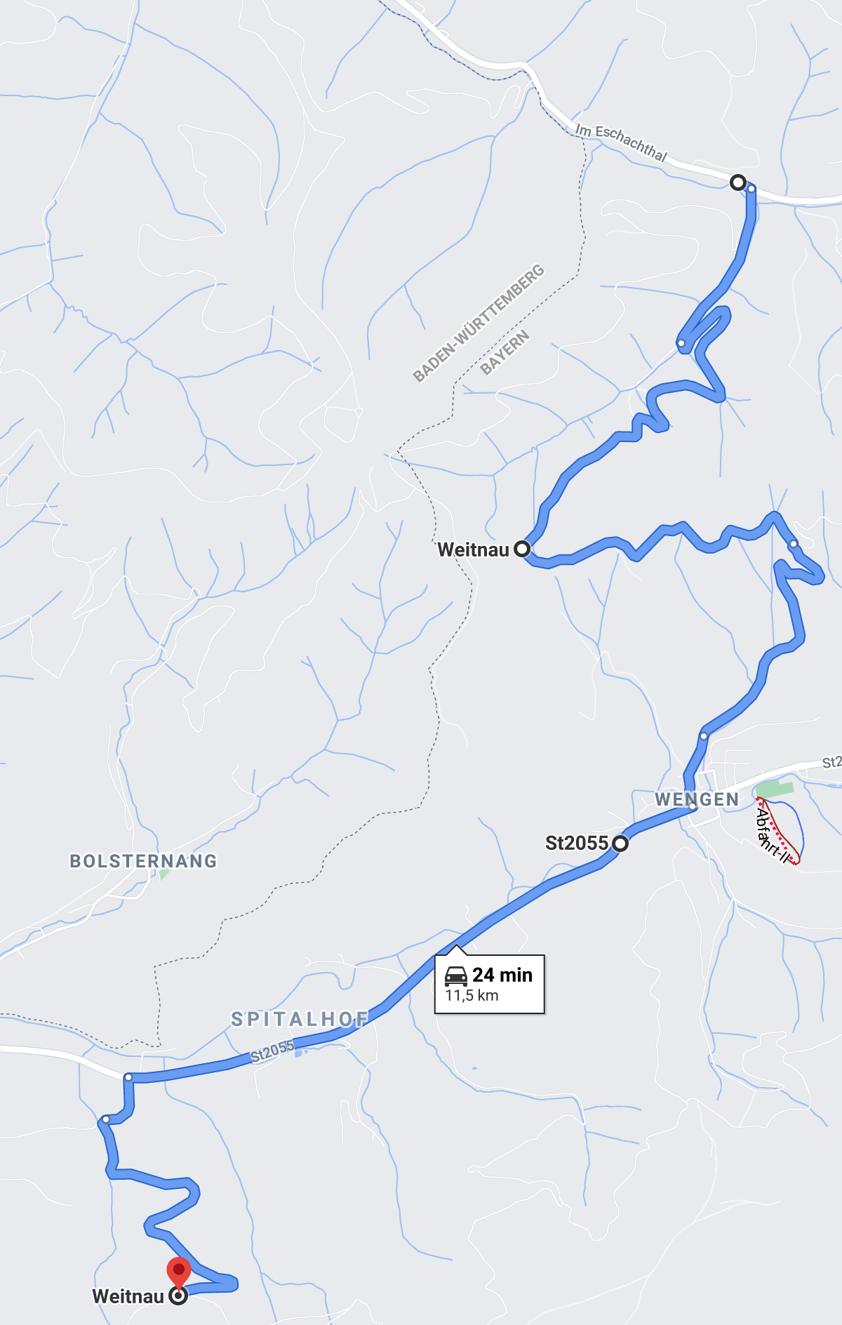
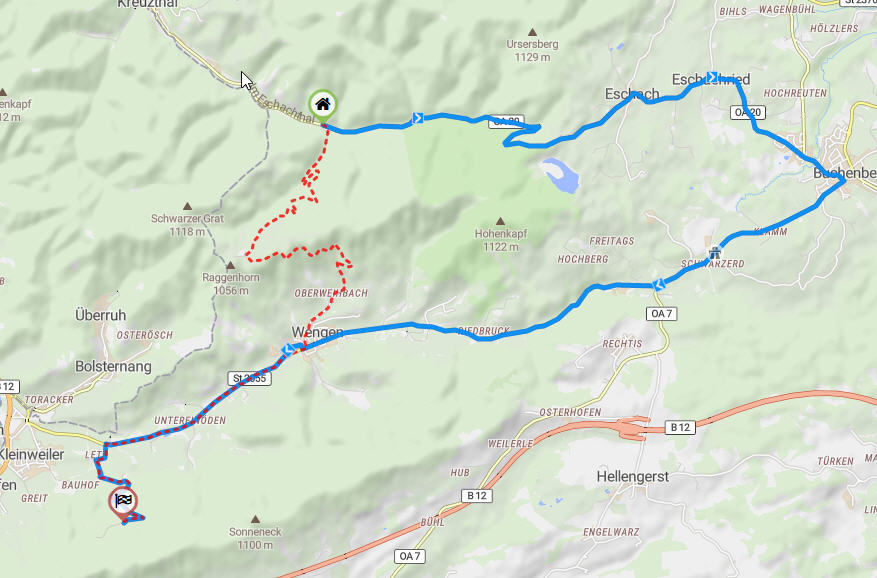
Aktuell komme ich so weit https://kurv.gr/gYhVU. Bis dorthin ist es highway service danach highway track. Das Google dort lang fährt kann auch ein Kartenfehler sein. Ich sollte mit dem Auto auch schonmal durch denn Wald fahren.
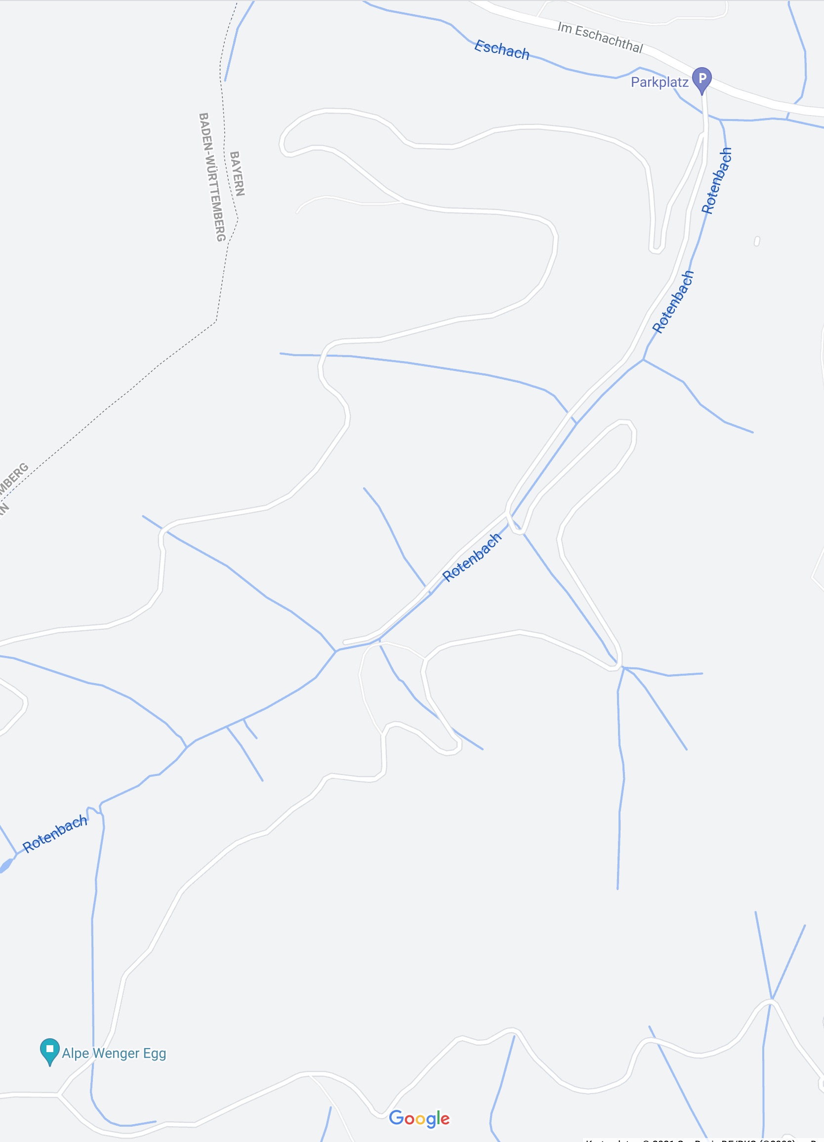
Richtig, die Wege sieht man auch sehr gut bei Google, dort sieht man auch das eher Forstwege sind. Wenn Du dort lang fährst kannst Du ja mal schauen bzw. Fotos machen. Ich denke mal das OSM mit track schon passt… Ich meine an der Abbiegung an der Alpe Wenger Egg Rechts und Links Schilder zusehen. 
You can export the Google Maps route to a gpx file and then import the file from Kurviger: the track and the route.
GaK.kurviger (2.9 KB)
Naja - wenn Forstwege nicht gesperrt sind, würde ich sie gerne fahren wollen. “Track” mag da durchaus passen, nur nimmt kurviger sie dann nicht …
Mit einem Freund zusammen habe ich vor einer Woche 7 fragliche Teilstrecken in Oberbayern geprüft (unsere OSM-Berichtigungstour ). Nur bei zweien davon war ein rundes Schild mit rotem Rand vorhanden. Die anderen fünf habe ich in OSM korrigiert.
Selbst die anderen beiden sind fahrbar, einmal lediglich 500m “Landwirtschaftlicher Verkehr” und einmal “Anlieger” mit einem Gasthaus am anderen Ende. Aber das soll jeder selbst entscheiden.
Well - if forest roads are not closed, I’d like to drive them. “Track” may well fit there, but kurviger does not take them then …
Together with a friend I’ve checked a week ago 7 questionable sections (our OSM rectification tour ). Only two of them had a round sign with red border. The other five are now corrected in OSM.
Even the two forbidden are ridable, once only 500m “agricultural traffic” and once “residents” with an inn at the other end. But that is for everyone to decide for themselves.
Tracks mit access=yes oder motor_vehicle=yes werden von Kurviger verwendet. Unterscheidung von track mit access=yes und unclassified ist fließend und kann durchaus etwas komplizierter sein ![]() .
.
In OSM sollte man nicht für “Kurviger” oder für ein anderes Programm taggen. Sondern man sollte die korrekten Werte eintragen und dann müssen wir sehen, dass wir die Werte auch richtig auslesen.
1 Like