I would like to propose a feature which allows you to measure the distance between two points along the route. You could either use the current location as point 1 and select another point as point 2. Or - alternatively - select both points. The result can then be displayed in a bubble. This would make planning tours a bit simpler. Obviously, the same also makes sense in the kurviger website.
The idea was - more or less - inspired by this discussion:
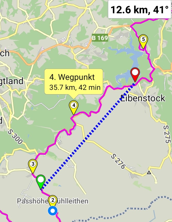
a workaround (not 100%, perhaps 70%): Add waypoints to the route and tap on them - this displays the trip distance of the waypoints, you have to subtract yourself:
On the website you can also use the height-graph in the bottom right. Just move your mouse over the height-graph it shows distances so you can calculate the distances quite flexible using this technique.
(A) I noted that adding a waypoint - even if it is (or looks to be) redundant - can change the route.
(B) You will need to add two waypoints and then manually compute the difference. Possible but a bit of a pain in the back.
How does this Measure Tool in the app for linear distance between 2 points work? I can’t move the end points. I never succeed to meet the wanted end points.