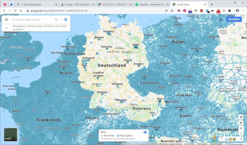
Wie benachteiligt wir in Deutschland (und Österreich) hinsichtlich Streetview sind (was wir uns sicher selbst zuzuschreiben haben) sieht man aus dieser Karte:
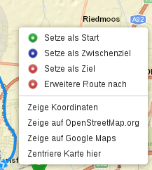
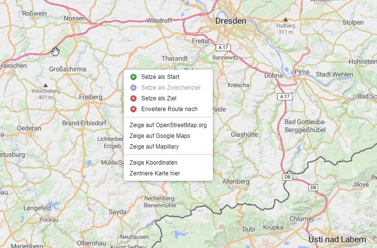
Nun gibt es eine (schwedische) Alternative, die sich am OSM-Gedanken anlehnt und das Thema selbst in die Hand nimmt: MAPILLARY - vielleicht kann zusätzlich zum “Zeige auf OpenStreetMap.Org” und “Zeige auf Google-Maps” auch “Zeige auf Mapillary” angeboten werden?
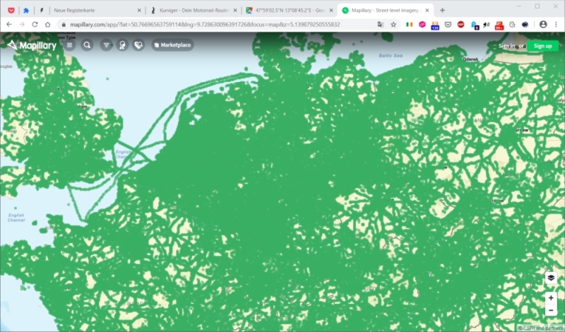
Zugegeben Mapillary ist noch nicht soooo verbreitet - aber es mausert sich langsam - siehe den ähnlichen Ausschnitt wie bei obiger Streetview-Karte:
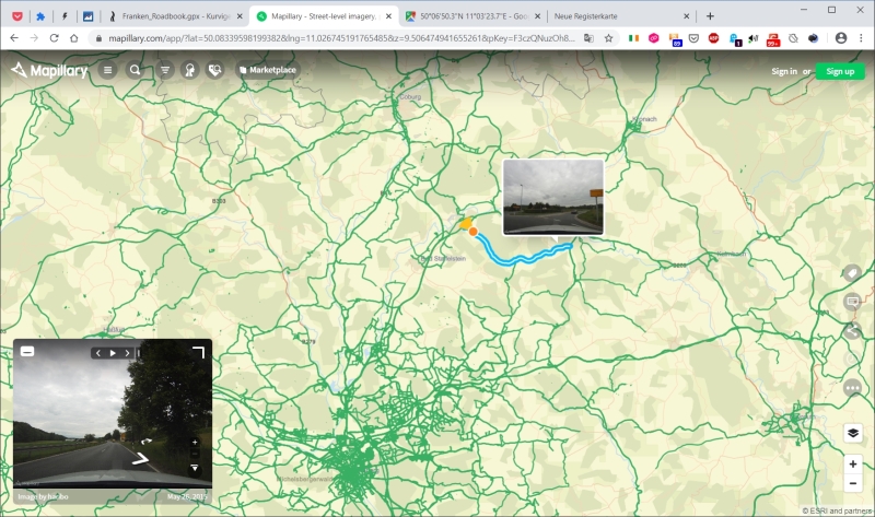
Bin anhand einer geplanten Franken-Tour auf Mapillary gestoßen:
während im Streetview keine einzige Straße verfügbare war, kann man in Mapillary doch das ein oder andere Sträßchen kontrollieren:
How disadvantaged we are in Germany (and Austria) regarding Streetview (which we surely have to blame ourselves for) can be seen from this map:
1
Now there is a (Swedish) alternative that follows the OSM idea and takes the topic into its own hands: MAPILLARY - maybe in addition to “Show on OpenStreetMap.Org” and “Show on Google-Maps”, “Show on Mapillary” can be offered?
Admittedly Mapillary is not yet soooo widespread - but it is slowly moulting - see the similar section as in the Streetview map above:
2
I came across Mapillary on the basis of a planned tour of Franconia:
while in Streetview there was not a single street available, in Mapillary you can control one or the other street:
3
Does it provide an API like OpenStreetMap so can open it in any location / zoom?
Doesn’t it have void areas, leading to “strange” redirection results?
Street view has void areas too, that’s why we avoided it and preferred Google Maps.
It has a lot more void areas than Streetview but it covers other areas that are not covered by Streetview. It’s a community project after, so it varies heavily.
The question will be what happens when there’s no image available at that linked location. Does it have a graceful fallback like Google maps (just showing a flag on the map) or does it simply lead to a dead link or blank page (which could annoy users and make them think kurviger did something wrong)?
I would do it similar to GMaps, it simply shows you the map. If there is imagery available, you can click in, if there is none, you can only browse the regular map. I wouldn’t go directly into “street view” mode.
Thanks again for your proposals. I added the option to show the current map area on Mapillary via right-click. Please let us know how this feature works out for you and if you find it helpful.