Yes, that is most probably the issue, thanks for finding this!
If you look at the surrounding ways, there is maxspeed:backward=80. Maybe it would make sense to “hot fix” this like that and keep the note open? 80 is probably more correct than 1.
Yes, that is most probably the issue, thanks for finding this!
If you look at the surrounding ways, there is maxspeed:backward=80. Maybe it would make sense to “hot fix” this like that and keep the note open? 80 is probably more correct than 1.
Hi,
leaves me w/ a few questions:
Max speed in France is 80Km/h ? Wasn’t there an issue w/ setting Maxspeed for all roads (Non Highway) to 80Km/h as a general override?
What means back or forward? everything is relative? We talk about roads, not lanes??
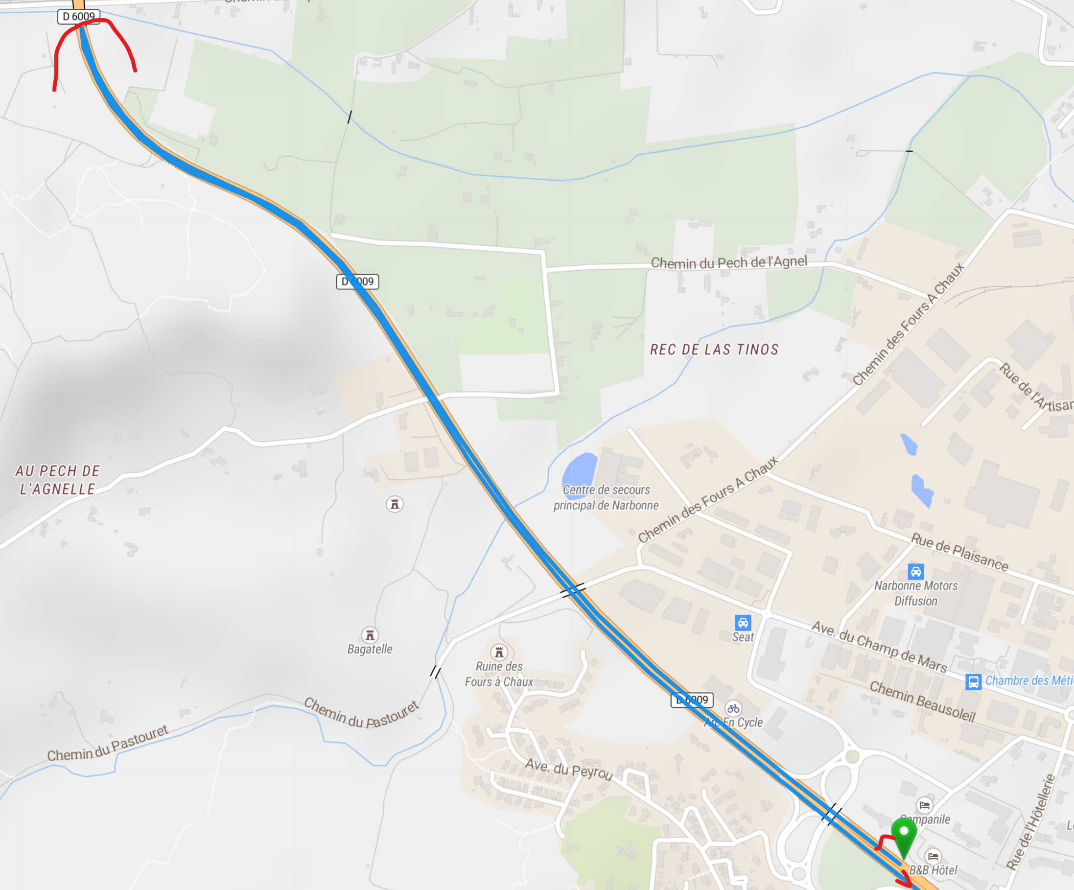
I added the route in France to excluide that there was a particular issue w/ the route in Spain. Your contribution suggests, that there is a peculiarity on the road in France. Hence I choose another road where the national road goes in parallel to a highway, and I end up with a similar problem.
Take a look at this route.
https://kurv.gr/icNCq
Over Highway is OK, when Highway is switched off, the routing takes you back! a few hundred meters and then asks for a U-turn.
Hi,
sorry I didn’t know this. I thought screen shots would be required. Screen shots show, what is on my screen, while I cannot control what shared links produce on other PCs.
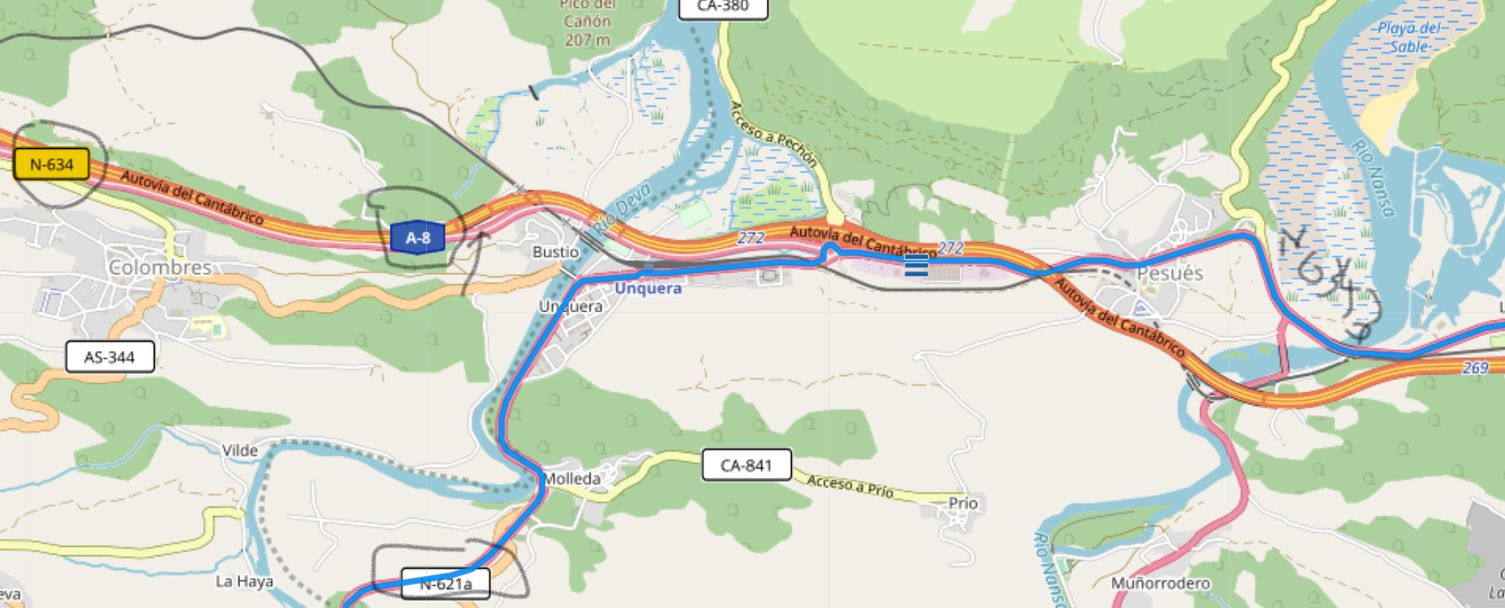
Here is now the link for the problem in Spain.
https://kurv.gr/Aq0G2
The problem is to use whatever configuration parameter, to convince Kurviger to route via the national road N632 and not over the Highway.
Rgds
hk
That’s the beauty of Kurviger links, they contain all the information needed to make a route with exactly the same parameters that you set. So we get by definition the same output as you from the algorithm. Links are really the easiest way for debugging. Screenshots on top are of course super nice and very helpful as well
Hi Ive, that’s not really correct. This entirely depends on the underlying map data, and in our case OSM treats most bigger highways as separate roads per direction. You can see this on the map itself most times as well, the “directional roads” are often separated by a few pixels. Thus we naviation users have to be a bit careful where we place our markers. To alleviate this, I would always recommend starting and ending somewhere else, on a smaller road
Do you have any other questions about this? In your last post it seems you’re good now, right? Don hesitate to ask again if anything’s unclear
Kurviger does not override things like that, it (again) follows the OSM data. If you find an error in the OSM data please don’t hesitate to correct it! ![]() (or ask in the forum and maybe somebody else has time to help out with the editing)
(or ask in the forum and maybe somebody else has time to help out with the editing)
Hi,
the general max speed parameter comes from OSM.
discussed here, but confusing
RGDS
hk
Yeah I know, I remembered that discussion, that’s what I meant to say, we can just listen to OSM, not more. If all roads in OSM have been correted -> nice. If not -> bad luck for us
The issue presented here is a data issue. Changing the max speed for France is definitely a challenge for OSM, if maxspeeds have been tagged that are now changed from 90 to 80, but not yet reflected in the data.
Every way in OSM has a direction. You can set many attributes in forward direction and in backward direction. For example with maxspeed it can happen that a road leading into town is already at 50km/h but the same road in other direction, leaving the town has a higher speed limit, like 80km/h. The forward and backward allows to set this. In your example, someone set the maxspeed to 1km/h. Therefore, Kurviger won’t use this road and take a detour.
What I wonder: Why did GraphHopper ignore the whole road (in both directions) when just one direction is set to 1 km/h?
Internally a really low speed is often seen as a road being inaccessible. That could be the reason.
Hi, All,
OK, I learnt a few things from this discussion:
Roads can be oneways or large streets with lanes and different directions.
When place waypoints on map, they use the closest road edge on routing.
Routing algorithms cannot guess how humans perceive the environment.
Need to define sufficiently the road side and where waypoints are placed.
And all others as well ![]() All waypoints are trying to put the route where the tip of the marker is. It’s just that only the most major of major roads even have separate lanes. So in absolutely most cases you’ll be fine with putting the marker roughly where you want to go
All waypoints are trying to put the route where the tip of the marker is. It’s just that only the most major of major roads even have separate lanes. So in absolutely most cases you’ll be fine with putting the marker roughly where you want to go
hm I guess maybe in this case it’s quite tricky to get Kurviger there because it thinks that the N632 is also a “bigger” road and not one to heavily prefer? I think setting the route profile to “curvy” helps already a little bit
Kurviger
But yeah, I mean it’s always true that… if you know best where to go, where the road is nicest, you’ll probably have to wrangle the computer a little bit to do what you want. I guess in this case you’ll need a couple waypoints to get this going
Hi Patrick,
so 'I dived into the guts of OSM and I found out that the A8 is tagged as Highway:Motorway and the N632 is tagged as Highway:Trunk. It was my initial guess, that both would be treated as Highways and therefore I choose the title of making the road types selectable as they are in OSM. I don’t know, how Grashopper selects the roads regarding only the first, or the complete tag. I would like to propose that the selectable road type “Schnellstraße” should be split into “Autobahn” and “Schnellstraße”. Many of us want to avoid real Highways, but eventually there are segments of a multi lane and crossing free major national roads (in Germany e.g. all single digit Bundesstraße (B3, B9 etc) which you can hardly avoid. Currently they are apparently all in the same category and if you switch “Schnellstraße” off, you end up on these very little roads.
RGDS
hk
Thanks for providing additional information regarding your issue. I can have a look if we can improve these cases when calculating a route.
I am happy to let you know that we improved our routing algorithm. The reported case from @lve0200 should work a lot better now. The “avoid motorway” option works correctly for this case now. Thanks for reporting this! Please let us know if you find anything worsened due to that change.
WOW!!, I am impressed!!
Yes, something is better now, but there are still issues.
Look at this now,
https://kurv.gr/jJWkf
Geht mir genauso. Man muss die Strecke die man fahren will, durch unendlich viele Punkte fixieren. Das ist sehr nervig. Hier muss etwas von Seiten ‘kurviger.de’ passieren. Unbedingt. Ansonsten bin ich mit der Software sehr zufrieden.
Hi Henry,
nachdem ich diesen Thread gestartet habe, möchte ich aber auch etwas zur Verteidigung der Entwickler sagen! Routing ist ein zickiges Biest und Nomen est Omen. Wenn schon im Namen “kurviger” steht, dann eben kurvig! Insofern ist den Entwicklern schon ein kleines Wunder gelungen, was bisher noch kein mir bekanntes Programm geschafft hat. Routing auf dem PC und auf dem Handy sind absolut identisch und die gefundenen Strecken sind im allg. für Motorradfahrer auch recht annehmbar. Der Rest ist der Versuch, die eierlegende Wollmilchsau zu erschaffen. Kein automatischer (KI) Algorithmus kann für jeden einzelnen DIE Route schaffen, die ER gerne hätte. Es ging mir in meinem Beitrag darum, zu erkennen, warum es manchmal krasse Ausreißer gibt. Ich denke, daß die letzte Änderung des Algo schon viel bringen wird, abgesehen von Datenfehler im OSM Material. Keine Software ist fehlerfrei und es gibt immer etwas zu verbessern. In diesem Sinne, “weiter so!”
But after I started this thread, I also want to say something in defense of the developers! Routing is a bitchy beast and nomen est omen. If the name is “curvy” , then just expect curvy! In this respect, the developers have already managed a small miracle, which has not yet managed any other program I know. Routing on the PC and on the phone are absolutely identical and the tracks found are generally quite acceptable for motorcyclists. The rest is an attempt to create the egg-laying Wollmilchsau. No automatic (AI) algorithm can accomplish the route that someone particular would like . In my post I wanted to know why there are sometimes some very strange outliers. I think that the last change of the Algo will bring a lot, apart from data errors in the OSM material. No software is error free and there is always something to improve. In this sense, “keep it up!”
Hans
Wenn Du eine so genaue Vorstellung von der Route hast, die Du fahren möchtest, ist Kurviger wohl nicht das richtige Produkt für Dich. Dann solltest Du eher auf herkömmliche Routingprogramme oder sowas wie Garmin Basecamp zurückgreifen, wo man die Route komplett mit der Hand malen kann/muss.