[EN] I think I have found an issue with the route calculated by Kurviger
[DE] Ich glaube ich habe einen Fehler bei der Routenberechnung von Kurviger gefunden
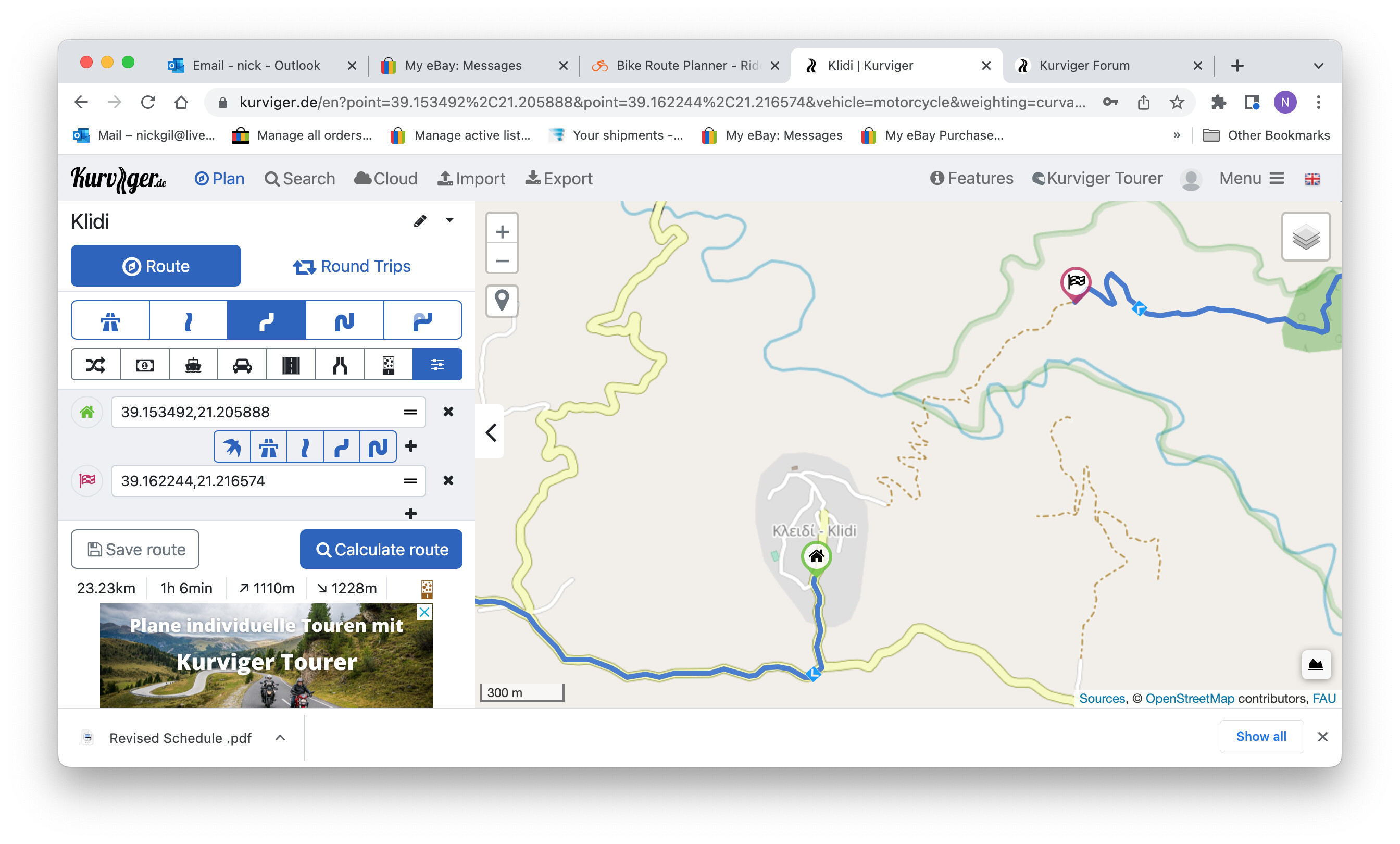
Hi i tried to make this route through the mountains.the route IS driveable and is also marked out on paper maps.The routing in the app wont connect the start/finish points using via points/it behaves as though this route is impassable.
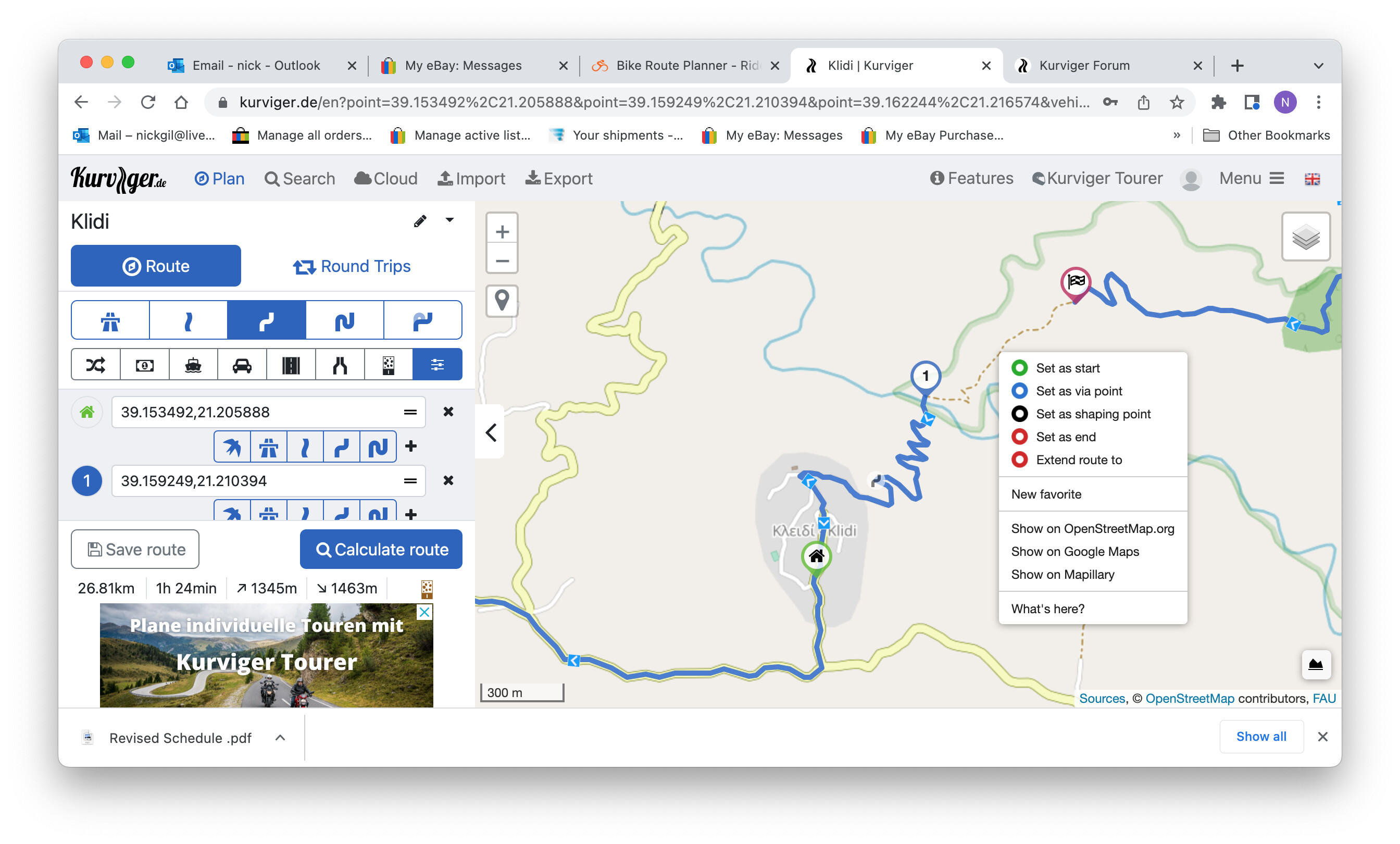
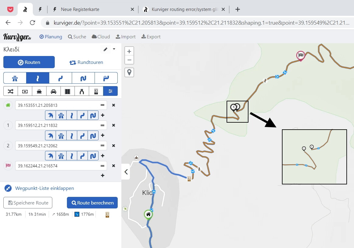
Usually if via points are added between the start and finish points the kurviger programme recognises my wish to make that route and joins the start/finish with the via points.This did not happen however hard i tried and the error only occurs(so far) on this route.the route is joined in the paper map,in the kurviger map and it exists in “real life” my opinion is that it is a mapping error.whats going on please
thanks Nick
First thanks to EVERYONE who assisted with this map detail problem. It seems there is a difference between the map used in my screenshots and the OS map. In the map I used there is a continuous dotted line between start and finish.To complicate matters slightly more the Greek map ( terrain editions) which is 5 years old at least clearly shows the ( dirt) road is joined .my opinion is this is a mapping error , usually any broken roads are repaired every year.
Best wishes to fellow bikers
Yes indeed you Connect it, but this is not the problem. The map doesn’t behave in the manner in which it should when planning routing. Do you have a response below shows why thanks for taking the time to respond