Yes, I know — and I wanted to say, that I like this feature. ![]()
2 Likes
In fact you’re absolutely right, of course. It wasn’t my intention to be too demanding ![]() .
.
I have to point out: looking at all the improvements and changes, Kurviger received over the last couple of month, it’s obvious what a great evolution both app and website made since started. And considering the fact that’s a two persons developer team those achievements are even more admirable! ![]()
IMHO it’s really a shame that other solutions seem to have much more customers (or at least more downloads in the Google store). Like calimoto for example, which has a much larger team, but is definitely inferior to Kurviger in many, many aspects.
Therefore I really use every opportunity to emphasize what a great product Kurviger is.
2 Likes
Yes, I do. Not if it’s a short detour, but quite often I prefer to choose an attractive (and sometimes therefore longer) way around obstacles. For this purpose I prefer a more zoomed out (2D) view. Nevertheless my original route temporarily isn’t visible in this view, so the indicator would be handy in this view too. But it’s not an essential issue of course.
Sounds good ![]() . Maybe I could also get rid of the large bubble showing my currently loaded offline maps every time I start the app. IMHO it’s a little bit annoying.
. Maybe I could also get rid of the large bubble showing my currently loaded offline maps every time I start the app. IMHO it’s a little bit annoying. ![]()
This was introduced because users complained about not remember what offline maps have opened.
Though we plan to offer a more detailed maps info feature in the future. ![]()
This week, I had a +200km ride with V1.7
“Automatic recalculation” was off, so I could see the behavior when you are off route.
-
arrow indicator is pointing towards next “yellow dot” not to the “blue line” as user might expect. This can lead to situations, where the “blue line” is 100m in front of you, but the arrow is pointing left.
I guess pointing towards “blue line” is not possible (performance). -
Often the “nearest yellow dot” is the one you have already passed, so the arrow indicator is guiding you backwards.
Would it be possible, to tune the algorithm so that routing points which are closer towards the end are preferred?
 Maybe by introducing a “virtual distance” from your current position to the next routing point.
VirtualDistance = RealDistance + Distance_of_RoutingPoint_to_EndPoint * Factor- RealDistance is the distance form your current position to the next routing point.
- Factor needs to be tuned carefully.
Factor = 0would be the current bahavior.
Nice detail, useful in combination with “auto hide screen buttons” ![]()
Touch map is meant literally. The screen buttons stay hidden, if the user is e.g. playing with the menu.
Is it possible, to let the screen buttons be visible, as log as there is any user interaction with the display?
Manfred
@linux-user thanks for the feedback!
We’re thinking to introduce more options in off route direction arrow, like next instruction, nearest point, next waypoint, destination.
Is it possible, to let the screen buttons be visible, as log as there is any user interaction with the display?
No, they work together and like zoom buttons, as long as there is interaction with the screen where they appear.
1 Like
Crosshair mode in Kurviger 1.7.1 works more friendly without the hint message. ![]()
1 Like
Hi. Thanks for the new version 1.7.1.
I think I have a problem with the new version on my Huawei Mate 10 pro (Android 9.0.0). I ask kurviger to navigate an imported kurviger route and once I click on the navigation buttom the app just crashes and disappears. Maybe it’s something about my hardware of software configuration but version 1.7 worked well.
I hope it is of any help.
Regards.
1 Like
Kurviger 1.7.1 was released with stability improvements and:
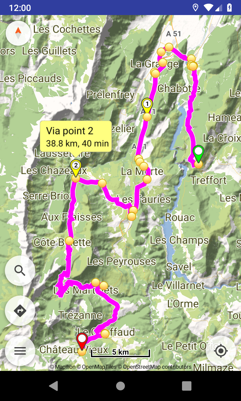
- Routing: show distance and time for waypoints
Waypoint info bubbles show also their distance and time (like in website).
3 Likes
@jcalonsol
Sorry for the inconvenience, please update to Kurviger 1.7.2 should solve that too. 
3 Likes
Thanks a lot. As soon as it is available in my google play, I will do it. It isn’t yet 
Thanks again. Regards.
![]()
![]()
![]()
1 Like
1.7.2 rolled out now by Play Store, have installed it this moment.
1 Like
Very nice feature ![]()
Thanks a lot!
1 Like
Hallo zusammen,
ich bin neu hier und finde die App wirklich schon sehr gut und bedanke mich für die Arbeit der Macher. Habe aber auch mal ein paar fragen.
Die Funktion mit der Distanz und Zeit zum nächsten Wegpunkten ist wirklich toll. Wäre es vielleicht möglich die tatsächliche Zeit auch einzublenden, wann ich den Wegpunkt erreiche ? So muss ich nicht so viel rechnen, wann ich zum Beispiel die Fähre am Wegpunkt 5 erreiche. Könnte man vielleicht auch eine Listenansicht darstellen, mit den gesamten Wegpunkten.
Kann man den Wegpunkten auch Namen geben, die dann angezeigt werden.
Wenn ich eine Route fahre und klicke unter Routing - Aktionen auf “Gesamte Route anzeigen”, dann wird mir die Route nur für einen Bruchteil einer Sekunde angezeigt, beim planen einer Route funktioniert es.
Gibt es für Autobahnen die Möglichkeit der Fahrspuranzeige oder in welche Richtung man sich halten muss.
Ich hoffe die Fragen wurden nicht schon öfter gestellt, sonst bitte ich das zu entschuldigen. Da ich nicht so gut englisch schreiben kann, versuche ich es auf Deutsch oder macht es mehr Sinn den Text übersetzen zu lassen.
Gruß Jürgen und Danke !!
1 Like
The actual time? That is already displayed at device task bar.
There is the relevant feature discussion here:
That’s expected behavior. While navigating any enabled options like follow location or auto zoom are working and adjusted continuously. Can disable them if need to plan whole route again.
Lanes indication is a feature we may consider for the future.
Thanks for the feedback!
Ich meinte, wenn ich auf einen Wegpunkt klicke und die gelbe Blase angezeigt wird. Dann erscheinen die Kilometer und die Zeit bis zum Wegpunkt, Hier wäre für mich die Uhrzeit interessant, wann ich den Wegpunkt erreiche. In der TaskBar wird ja immer der nächste Wegpunkt angezeigt.
Danke für den Hinweis, ich finde es während der Navigation schon einmal interessant die gesamte Route zu schauen, für den Überblick was die App so macht. Die Anzeige der gesamten Route bräuchte ja nur für eine gewisse Zeit angezeigt werden.
Danke für die schnelle Antwort,
Jürgen
Now I understand what you mean, we can think it, seems an interesting idea.
Currently can zoom out via one of the available gestures and auto zoom (if enabled) will work again in ~10".
We can see if integrating that functionality also to “Show whole route” action can improve navigation workflow.
1 Like