Hallo, wenn ich mir eine Route auf der “Kurviger-Homepage” zusammengestellt habe oder per gpx-Import geladen habe, möchte ich diese gerne für eine gute Übersicht der geplanten Tour ausdrucken können. Mit dem “Windows-Snipping-Tool” funktioniert dies auch ganz gut. Störend finde ich in diesem Fall die Darstellung der Wegpunkte.
Gibt es eine Möglichkeit die Wegpunkte für den Ausdruck auszublenden und nur die Karte und den Track darzustellen? Eine Druckfunktion innerhalb der Kurviger-Seite währe auch toll.
Jetzt in schlechtem Englisch
Now in bad english
Hi, I like to print a map off a planed or importet route. It works ok with the “Windows snipping tool” Is threre a possibillity too hide the waypoints for the printing and only show the map and the track? Also a function too make a print direktly from kurviger.de will be nice.
Okay - that was a misunderstanding … sorry for that!
For documentation purpose I export the kurviger-route as .gpx-File and then use several gpx tools to print it (e. g. RouteConverter, GPS Track Editor, …).
Remember that your browser (Firefox, Chrome…) has a print functionality implemented. Most times you can just press ctrl + p and the browser will show it.
You could for example export a GPX file and then import it in google my maps. There you can customize all the markers and colors and then just print from the browser
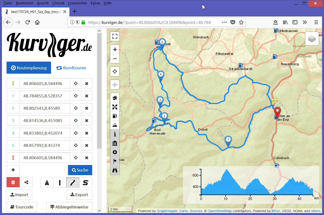
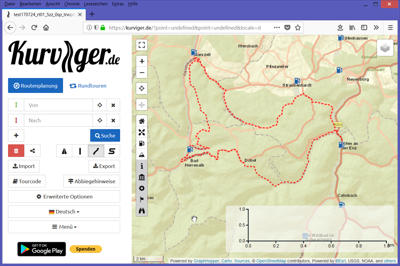
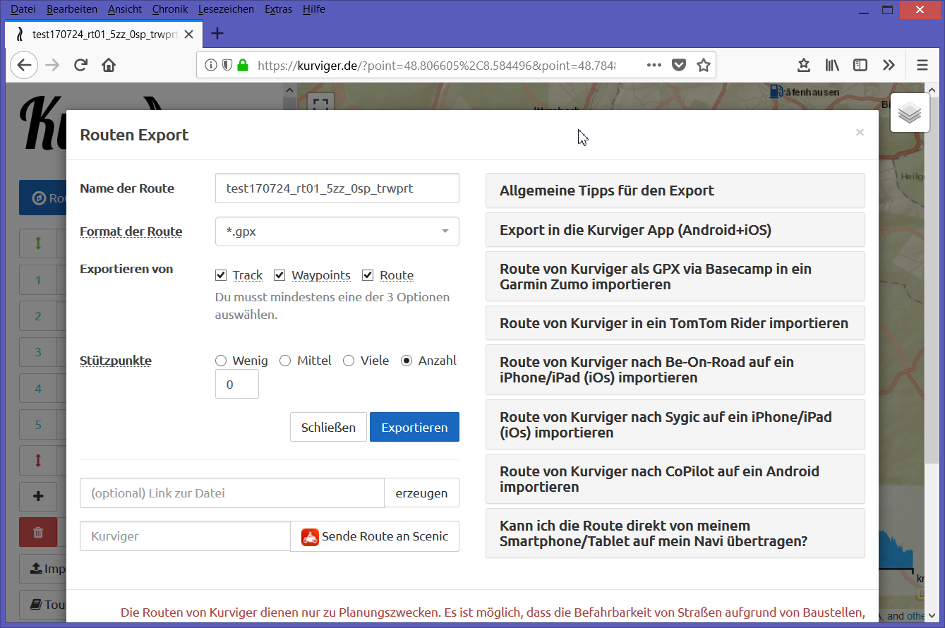
DE: Es gibt eine Möglichkeit, den Verlauf der Route ohne die Wegpunkt-Symbole anzuzeigen. Bitte eine Route erstellen. Diese als GPX-Datei exportieren. Dabei muss Track mit ausgewählt werden! Diese Datei dann als Overlay importieren. Dabei Track auswählen. Siehe Bilder unten.
EN: It’s possible to show the trace of the route without waypoint symbols. Please create a route. Export this route as gpx file. Track has to be selected! This file then import as overlay, track selected. See pictures below.
Bild / Picture 1:
Route mit Wegpunkten / Route with waypoints
Das Resultat des Imports entspricht Bild 2 / The result of this import you see in picture 2
DE: Von Track (siehe Bild 2) dann z.B. Screenshot erstellen und diesen drucken.
EN: From track (see picture 2) then e.g. take a screenshot and print this.
Danke für die Anfrage. Da müssten wir auf der Webseite eine Option anbieten die Wegpunkte auszublenden oder eventuell eine kleinere Version der Wegpunkte zu verwenden.
Hallo Zusammen,
vielen Dank für die vielen Tipps.
Einen Teil davon konnte ich gut gebrauchen um mir schöne Übersichtskarten von meinen geplanten Touren zu erstellen.
Die Lösung war letztendlich eine svg-Datei aus “Maperativ” zu exportieren und diese als Overlay auf eine schöne "Kurviger-Karte zu legen. Das brachte das beste Ergebnis.
Da es sich bei der svg-Datei um eine Vectorgrafik handelt, kann man die Linienstärke und Art, super an den benötigten Zoomfaktor der Karte anpassen.
Vielen Dank nochmal an alle !
LG Hoamgie
Das schaffe ich leider nicht ins englische zu übersetzen.
Hello, everyone,
many thanks for the many tips.
I could use some of them to create nice overview maps of my planned tours.
The solution was to export a svg file from “Maperativ” and put it as an overlay on a nice “Curviger” map. This brought the best result.
Since the svg file is a vector graphic, you can adjust the line thickness and type, super to the required zoom factor of the map.
Mittlerweile haben wir auf der Webseite einen Keyboard Shortcut um die Wegpunkte auszublenen, dazu einfach W halten. Ich hoffe das hilft dir bereits weiter .
just discovered the function to hide waypoints and shapepoints. How can I turn them on and off; e.g. for snipping a section of the route?
Thanks and greetings
Siegfried
I discovered the hotkeys W and S today randomly, it’s very usefull for printing.
And it would be perfect, if the symbols with the routing-type between the waypoints also would disappear when i hide the shapingpoints. ( this looks to be more a bug than a feature, with W it works correctly