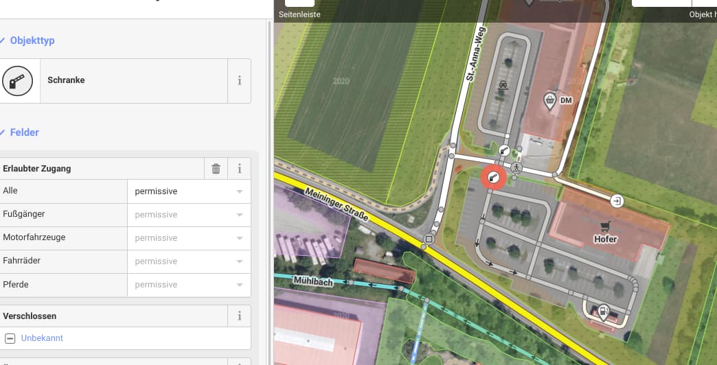
there are two gas stations as viapoints.
Both of them are shown as potentially blocked roads - perhaps because the ways are tagged with highway=service and service=driveway.
Tagging access=customers does not help.
From my point of view it is not useful to report that as potentially closed road - especially because viapoints are placed there.
You are right: At viapoint1 the barrier might be the reason (perhaps barrier should be tagged as access=customers) - but at viapoint2 I can not see any barrier.
Edit: I set access=customers for the lift gate @ viapoint1
This is somewhat expected behaviour. Routing over a parking_aisle, you never know if you can actually ride there. There might be gates or signs forbidding this, unless you are a customer, which means, it is potentially blocked.
Let’s focus on viapoint 2:
No barrier, only highway=service, service=driveway (the topic of this thread). I think for this point there should be no warning due to potentially closed road, especially if a viapoint is there.
Remark: From my point of view it is not useful to give too many cloased road warnings - if the user is used to get a lot of warnings, he will not care about them but just ignore tbem.
A driveway is a minor service road leading to a specific property. It typically branches from a bigger road and leads toward an entrance to a specific destination (building, etc.). It may end at or pass the entrance, but either way, it gets close to its destination. It is rare for a driveway to be the way to access another roadway (but see Pipestems below).
A pipestem or shared driveway leads away from a main road toward several houses, each with their own shorter driveways
So I think the display of potentially closed road is OK. If you use a driveway on your route, you might end up on private property or at least drive somewhere where it’s not really intended. I don’t know any driveways where I would like to ride and where this is not considered some secret shortcut or where I am at a destination and I am a customer.
Would it be possible not to warn if a waypoint is in that driveway section (as in my example)? But I guess that would be very complicated …
I put in the gas stations as viapoints so that I can see the distance to them while riding - unfortunately the POIs are not on the road before but directly at the gas station / on the driveway.
I have to read the documentation more in detail to fully understand the detailed differences between driveway, parking_aisle,
pipestem etc. - for me is not clear, if the tagging at the gas stations is correct or not, so - of course - I will not change it.
And I fully agree - of course - probably it is not useful, if Kurviger uses driveways for normal routing (e.g. shortcut via parking place ).
My proposal just would be not to warn, if a waypoint is located in a driveway sectiin.
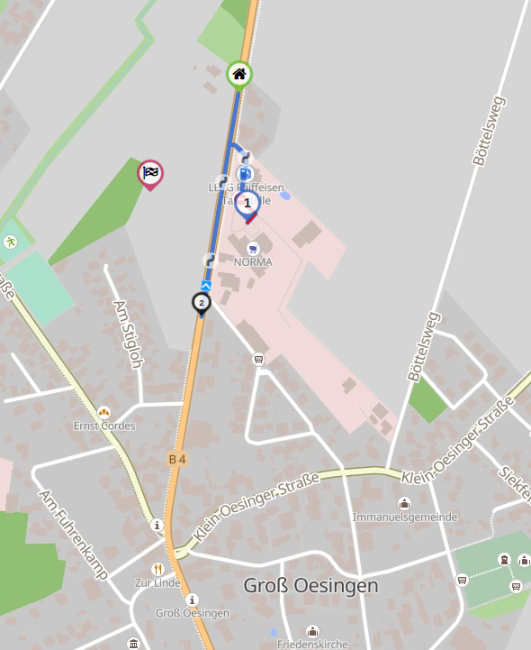
Hallo
Ich plane gerade eine Urlaubsroute,wie auf dem Screenshot zu sehen ist die Bezeichnung Einbahnstrasse falsch.Es ist eine Gewerbezufahrt,soweit ich es beurteilen kann ist dieses auf OSM
auch so eingetragen.Oder sehe ich das verkehrt?
Gruß manne
Dann verstehe ich aber nicht das diese Zufahrt zu einem Verbrauchermarkt potentiell gesperrt ist.
Meiner Meinung nach ist das im OSM auch nicht so eingetragen.Es ist jetzt nicht lebenswichtig,ich frage nur zu meinem eigenen Vesständnis.
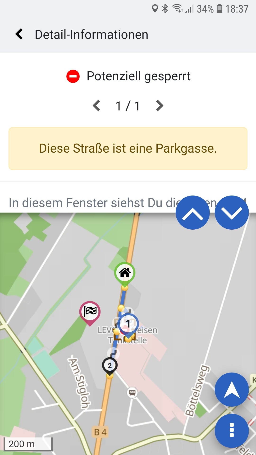
Tippe mal auf das rote “gesperrt Schild”!
Dann siehst Du dass das eine Parkgasse ist. Potenziell gesperrt, weil es soll nicht jeder über den Parkplatz fahren der dort nichts zu suchen hat.