Gravel roads

I recently was touring through Arkansas which has great roads, and services. I had spent a lot of time creating routes with K with a high avoidance of gravel. Unfortunately, we were routed on each segment through gravel, sometimes particularly painful gravel. I had the slider on K Pro set to highest gravel avoidance, but still routed.

This caused me to distrust K and move to another routing system. Is there a solution?

Could you please share with us an example of a bad road section so that we can look at the road problem on the maps?

Please copy and paste a link to this:

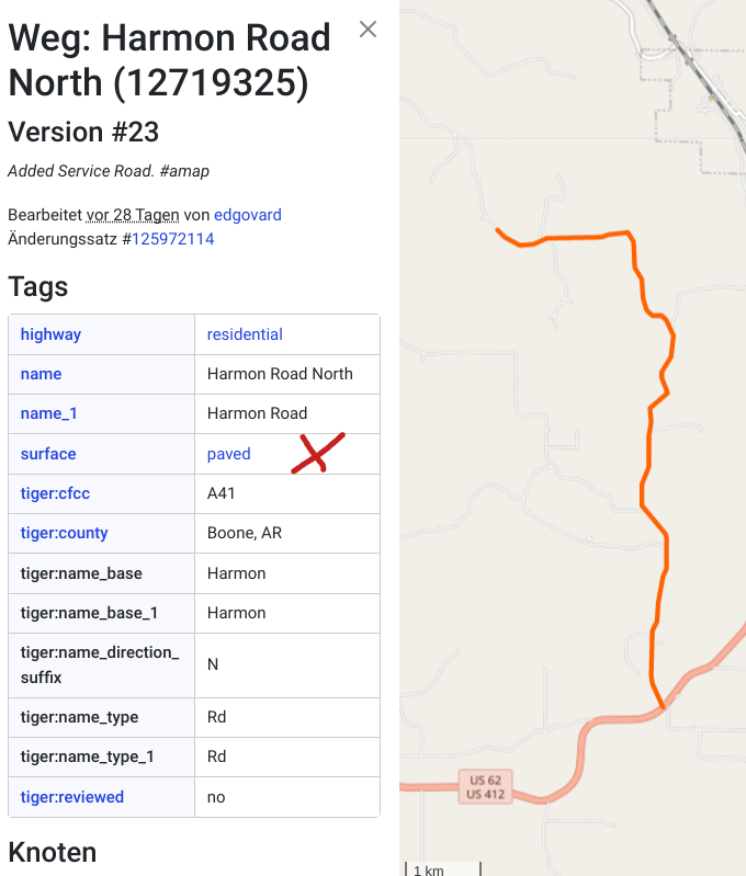
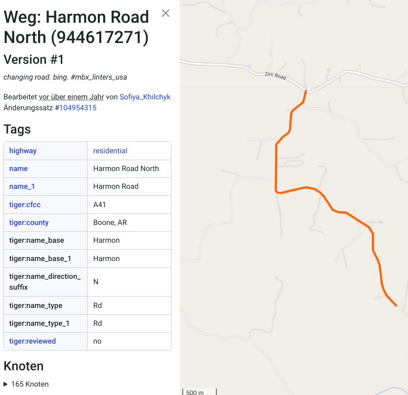
Kurviger uses the road data in OSM (Openstreetmap) and it could well be that the data is not cleanly maintained.

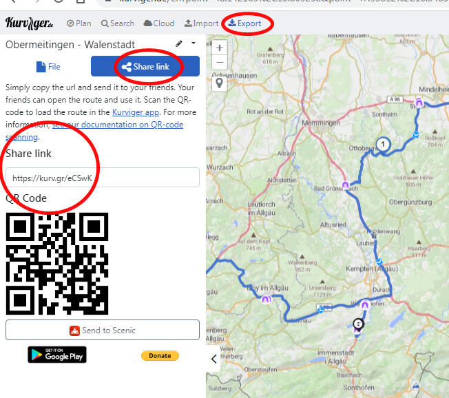
On the other hand, it could also be that various avoidances are set in kurviger when planning the route, so it is also very useful if you share a route with us. Please mark the road section that was bad.

1 Like

Viola, thanks for the quick reply. Here are two routes:

In this first one between waypoints 45-48 was very bad gravel

In this second one, the route was gravel and then impassable between 8 & 9.

Thanks for your support.

I have had a look at the first file. The following screenshots
show the details in the OSM. Kurviger uses this information for the navigation.

This picture shows the route before waypoint 45. Surface = paved.

No surface property is stored for the route after waypoint 45. I suspect that the Algorhythm of Kurviger therefore navigates through the road

You can also look at the data yourself in OSM. Place the cursor on the street, right click and then “Show on Openstreetmap”.

@boldtrn Do you have any further hints ? :wink:

1 Like

Thanks for the detailed analysis of the situation @Viola, I don’t have anything to add :slight_smile: