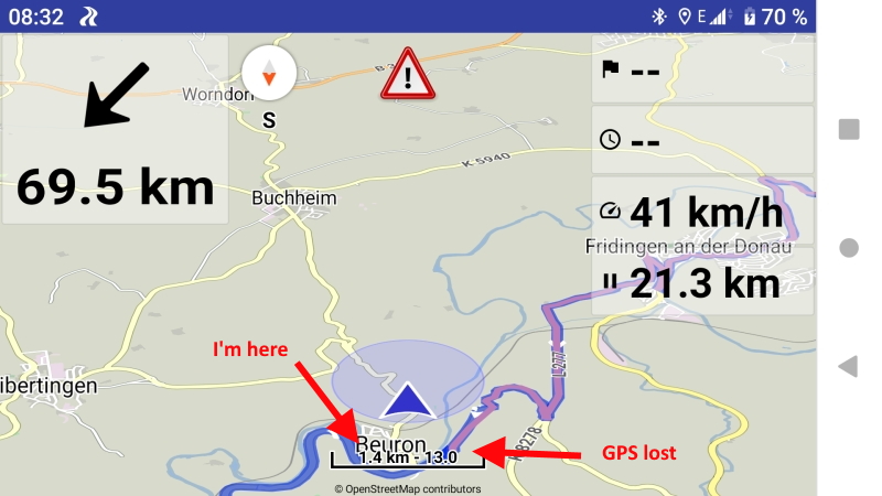
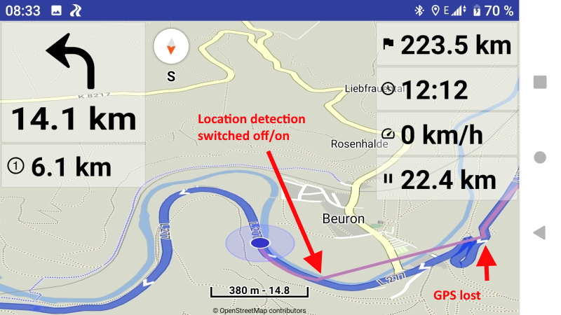
As already stated several times, KurvigerPRO loses the connection to the location detection every now and then (no, not being in a tunnel  ). It really happens very rarely. Two times on my tour on Friday (600km) and I was able to make screenshots.
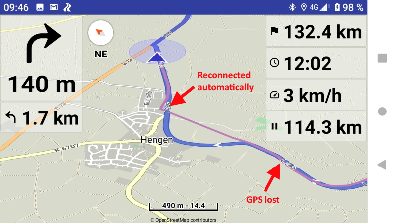
The indication is that KurvigerPRO reports “route lost” although I still follow the route. The position arrow is in nirvana (extrapolated with direction and speed I assume) and the GPS recording stops. If the location detection is switched off and on KurvigerPRO connects again. But there is also the situation where the reconnect happens automatically after a few seconds.
I suspect that my smartphone (Sony XZ1, Android 9) is causing the error, although the error only occurred in KurvigerPRO so far - but I don’t use any other navigation software.
Here are the screenshots:
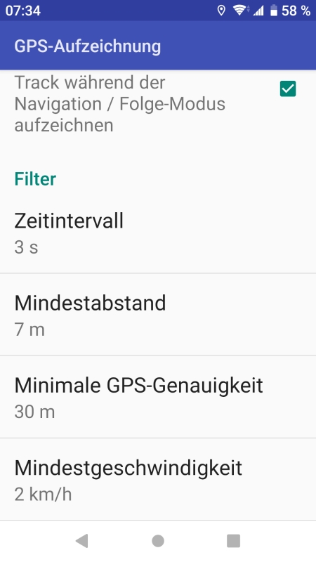
I’m using speed based zoom, my settings for GPS recording:
Is it possible to detect the lost connection in KurvigerPRO and try a reconnection?
Is there anything I can do to describe the problem in more detail?
Du könntest den Standortservice, Einstellungen > Standort > Standortservice > Google oder Android, mal wechseln; vielleicht bringt das was. Wobei mir bei meinem Android 9 ebenfalls aufgefallen ist das der Standort sehr ungenau ist, oft werde ich neben der Straße angezeigt. Allerdings passiert das auch bei Google Maps, sehr ungünstig bei Autobahnauffahrten oder ähnlichem.
You could change the location service, Settings > Location > Location Service > Google or Android, sometimes; maybe it’ll help. I also noticed on my Android 9 that the location is very imprecise, often I am shown next to the street. But this also happens with Google Maps, very unfavourable with motorway entrances or similar.
1 Like
Danke für den Tipp - momentan “fahre” ich ANDROID als Standortservice.
Ich werde mal auf GOOGLE wechseln und sehen was passiert …
Thanks for the tip - at the moment I “drive” ANDROID as a location service.
I will switch to GOOGLE and see what happens …
@devemux86 wäre es sinnvoll andere Satellitensysteme, wenn vorhanden zum Beispiel GLONASS, BeiDou, Galileo oder QZSS, zu nutzen?
@devemux86 would it make sense to use other satellite systems, for example GLONASS, BeiDou, Galileo or QZSS?
That is handled from the device based on its hardware,
each one supports different satellite positioning systems.
Ok, wie wird bei Geräten mit mehreren Systemen entschieden was genutzt wird?
Ok, how do you decide what to use for devices with multiple systems?
Can see here more details about how devices with multiple navigation satellite systems work
and how to test their performance:
1 Like