Hi, I know Kurviger is a route planner as well, but many people use Furkot to plan trips and a nav app to navigate the route. It is a service that has no nav app, so it can funnel many users into a phone nav app. Currently, Kurviger does not work with it. It has testing to determine if nav apps would be compatible. Here is what I sent them after testing Kurviger. I thought you might be interested. I think if you could work with it, showing their routes and your curvy routes, it would be the best of all worlds.
I am running the tests you recommend on help.furkot.com/api/test-gpx.html on Kurviger, an app specifically for motorcycle to help find motorcycle-friendly roads. In particular, it would be beneficial to motorcyclists and you for your service to work with this app.
-
All export options (tracks and routes) unchecked
Shows the two intermediate stops and connects the points by straight green lines. It calculates its own route as well, hitting the stops. -
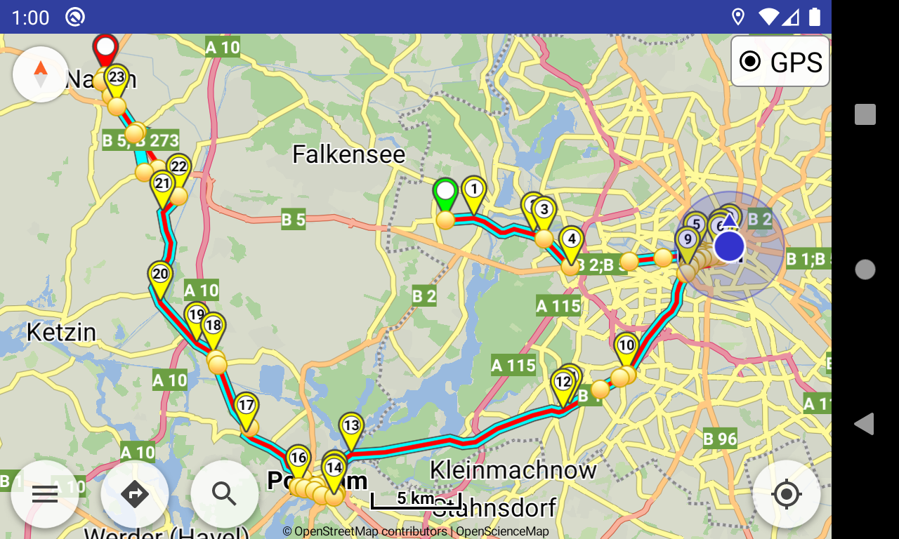
Only option tracks checked
The app shows the Furkot track in red but calculates and shows its own route in blue. It is red and blue where they overlap. I am told this is by design to navigate you along the Kurviger-generated route but allowing you to follow the original route also. The route goes to each stop. -
Only option routes checked (with 50 points per route)
The app shows the 50 waypoints, which is not enough to correspond exactly to roads, and connects them by straight green lines. It creates its own route in blue, which hits each waypoint and stop. -
All export options (tracks and routes) checked
Somewhat bizarre result. It shows all waypoints and the track in red and calculates its own route in blue, similar to 2 above. Most of the route follows the Furkot track and it hits all the waypoints. However, in certain places the blue route deviates from the Furkot track and in one instance does so in seemingly non-sensical fashion, making odd turns and backtracking on itself.