Smartphone is not the ideal solution for use as a motorcycle display. The following points are not “hard” points, more general “problems”:
it is not easily positionid in the field of view of the rider, so that does not have to move the head for seeing the display
display as used in smarpthone are not best in direct sunlight and sometimes hard to read
smartphone can get damn hot, which can affect the navigation and the smartphone itself
Solution
(As a mechanical engineer) I do like to tinker with arduino and all that stuff. So have I have some special display lying around and just thought to myself. What do I really need for navigation while riding.
A direction symbol (left, right, …)
a direction symbol (or the next action)
the distance when this will happen
So why not build a system (if interesting I will post my ideas) with excellent readable display (monochromatic) which are easy to position and the smarpthone communicates with them.
I would suggest that the smartphone sends special information to that unit like a “roadbook” of the navigation.
And with that information the navigation unit can maybe opperate “alone”.
I do have furhter technical details how to achieve this and I would like to build a prototype.
But only if this maybe “supported” within the kurviger app ( shouldn’t be tooooo much ^^ - as far as I understand it)
There are already some promising approaches existing (like Beeline).
But I prefer having a device (smartphone) capable to display a real map view. Only symbols won’t be enough to cover my personal needs (that’s also the reason why I never used only headphones for navigation).
Thanks for the question @Tim. I actually build something related with the Kurviger app for a uni project some time ago.
I think adding a way to send navigation instruction to a different screen could be interesting and I am happy to discuss potential options to do this (Cannot promise anything though ). Let us know a bit more about your idea and how you think this could/should work .
Maybe it would be possible to support Android Wear by displaying a small map view or only simple symbols and basic navigation instructions. This way there would be a lot of devices which can be used (some of them even relatively cheap, if you lower your sight concerning quality).
@diesel6876
Die angesprochenen Punkten sind natürlich nicht bei jedem zutreffend. Diversität
Kannnst du mal Beispiele für Befestigungsmöglichkeiten geben? Bin da immer auf der Suche nach besseren
@boldtrn
Thank you for the answer and I totally fine with no promise.
Tomorrow I’m going to the alps (with bike ^^) so I will get back to this topic in about 2-3 three weeks.
Looking forwad to it with more details
Wir haben sogar eine Doku dazu ;). Ich bin seit mehreren Jahren mit der Halterung von Interphone unterwegs. Ist Wasserdicht, Schützt vor Vibrationen, man kann laden und die Hülle halbwegs sicher halb geöffnet haben, sollte es mal zu heiß sein. Bisher ist die Hülle noch top in Schuss.
RAM Mount hat einen guten Ruf. HR Richter scheint mit der Platte kompatibel zu Interphone zu sein, hängen die irgendwie zusammen?
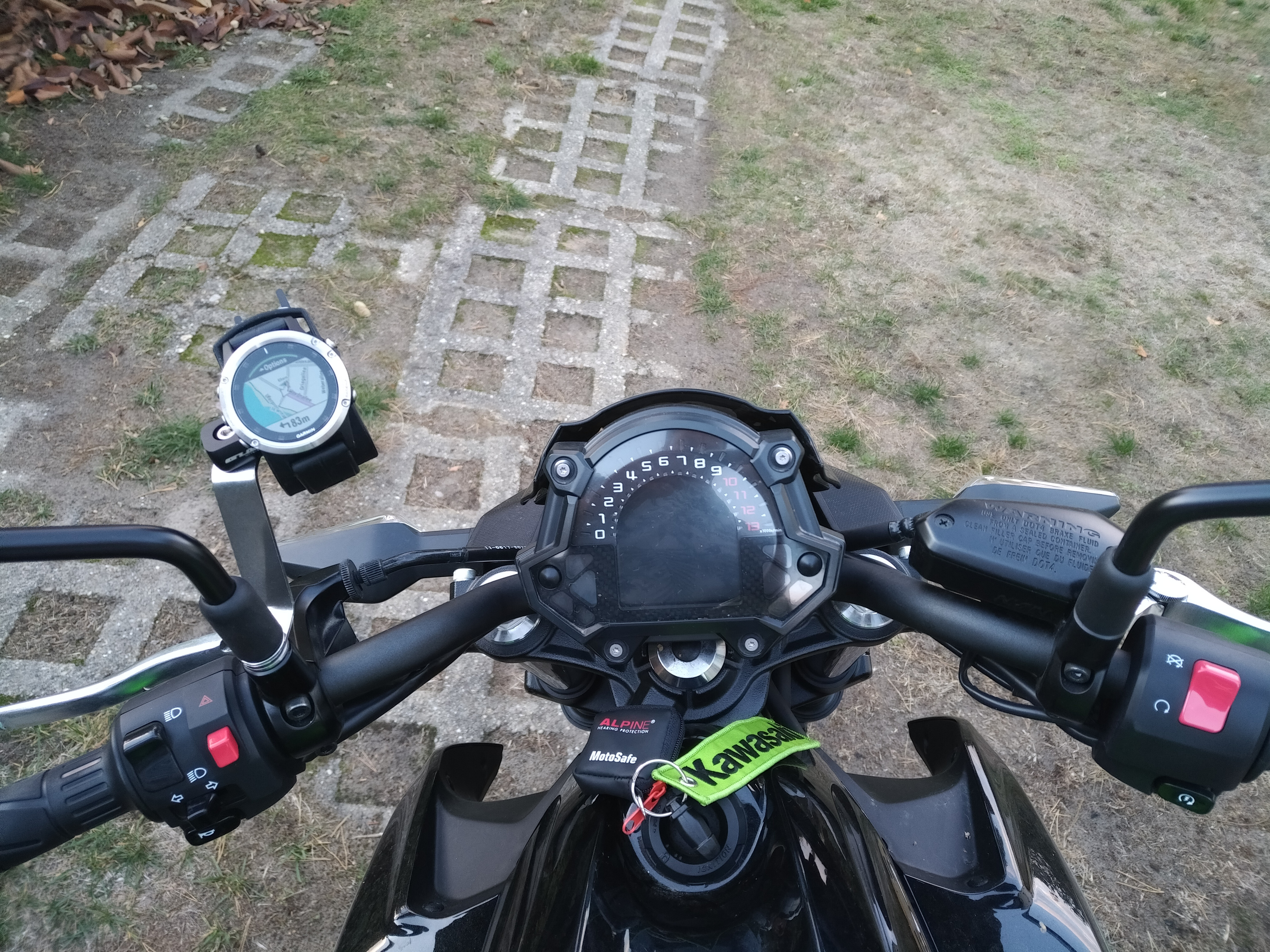
It’s the newer Fenix 5 Plus that comes with integrated routing (like the “old” 5X). So it can calculate a route to some place by itself. However, you can’t enter an address, just POIs like city centres, businesses, petrol stations, etc - or your own, or by marking a spot on the map. (But there’s an app to transfer a location from the phone to the watch.)
Navigation can be set to route for motorcycles (prefer curvy roads), cars (normal routing) and a few others. You can also set it to avoid toll roads, ferries, highways and/or unpaved roads. Although I don’t know if that works with any (OSM-)map or only with Garmin’s maps. (TopoActive Europe is included.)
Since it’s a Garmin device, you can, of course, also send a GPX to the watch and follow that. There’s even an “intelligent” following mode where it tries to route you back onto the track instead of just telling “you’re off track”.
And there’s an app to show navigation instructions from Google Maps (running on your phone) on the watch.
Hi there,
my name is Andi and I´m new here.
I´m also looking for solution to use a second display mounted on the handlebars. I found a pretty example: https://www.vaumax.com/eine-smartwatch-am-motorrad-als-navi/.
Perhaps it is possible to show route-informations produced with kurviger on a smartwatch like in the example using “ionwatch”? For me this figure is nearby perfect.
 ). Let us know a bit more about your idea and how you think this could/should work
  .
.