Compare Simple gpx and the Garmin gpx.
Non Garmin apps ignore extra by extensions.
In attached zip find “simple gpx and + extra = Garmin gpx”.
Compare gpx simple plus and Garmin extra.zip (2.3 KB)
Without timestamps nor elevation. (Optional)
View and compare by Notepad ++ (Plug in compare)
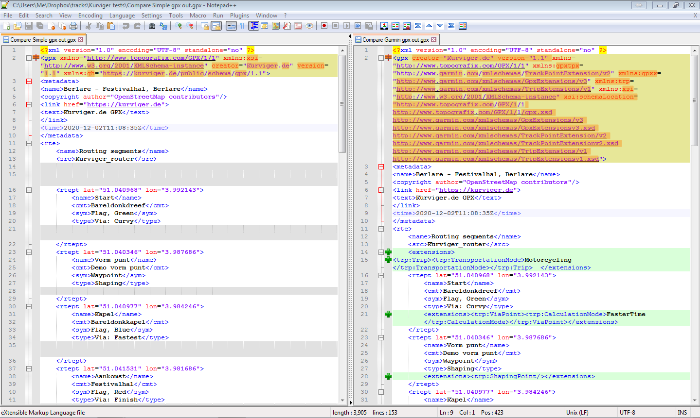
Find in the examples extra info in gpx point element cmt. As this is what the gpx standard says:
cmt = Comment (Optional)
Short point description to display on your GPS. Some receivers do not display comments.
Example: Shown In top panel @ navigate: “Bareldonkkapel”.
desc = Description (Optional)
Point description, information you can use to store notes about the location. Not to be displayed on your GPS.
Example: “De Bareldonkkapel, Donkkapel of Kapel van Onze-Lieve-Vrouw van Zeven Weeën is een kapel in het gehucht Donk in … etc”
Idea: Garmin specific gpx route Shaping/Via point export
Max 31 Via Points/route and max 50 Shaping Points/segment.
New: A nice to have TRACK distance tickmark indicator on/off tool.
Garmin gpx export. (wpt+rte+trk)
Ticker schedule points 2/50 (Shaping/Via)
- The Kurviger Custom Via Points are exported as gpx waypoints.
- The TRACK distance ticker points are exported as gpx route waypoints.
- The Kurviger track is exported as gpx track
Example file:
Motorbike_Kurviger_wpt_2km tickmark rte_trk.gpx (199.1 KB)
Mapsource route recalculation shows only few slight (expected) deviations from origin track.
By missing the hardware for a test. Someone ?