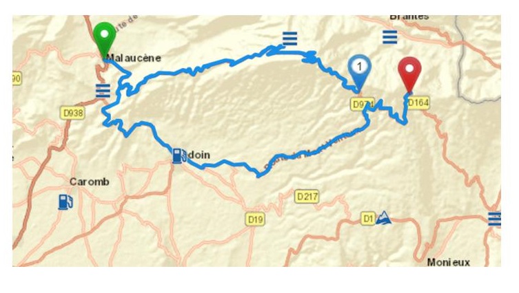
I try to plan a route from the village of Malaucène in France over the Mont Ventoux (D 974) to Sault. At on point close to 44.174177,5.129963 the program wants me to turn back and take the D19 south of the mountain, though this would be the longer way and would take more time anyway.
Hi Gunter,
would you mind to post the “kurviger”-link here.
It is difficult to reproduce your issue only with the image.
On the left side of the web site there is a share symbol.
Thank you linux-user for the hint. Life can be so easy if you know how to do.
Here is the link: Kurviger
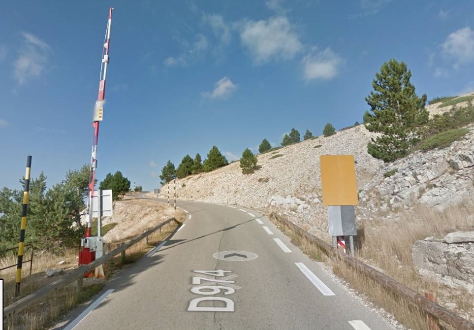
I checked the OSM data. At the mentioned point 44.174177,5.129963 is a barrier, a lift gate,
which is probably not closed in summer. Here it is:
Thanks for the report. Yes indeed the issue is this lift gate, it was just added 2 months ago and missed access rules. I checked on Mapillary and the gate seems to be accessible. (BTW: please note, we cannot use data from GMaps/Streetview)
I updated the lift gate, it should work as expected in about 10 days.
Some more information on the how we use OSM data can be found in our documentation.