We are about to launch a new feature to consider conditional restrictions. Working with conditional restrictions is extremely complicated. Therefore, we had to cut some corners to provide you with a way to consider conditional restrictions at all.
The current feature can be used like our avoidances, so you can enable/disable it. This still allows you to plan your summer rides during winter. You can enable to avoid seasonally closed roads. Kurviger will then avoid roads that are currently closed and might be closed over the next couple of days. This means if there is a weekend closure, it will be avoided during the week as well. There is no option to select a day or date. This is a technical limitation and cannot be easily changed. At some point we might be able to further improve this, but not in the near future.
Conditional restrictions in OSM are unfortunately a bit chaotic and not always entered. Kurviger should recognize most restrictions in OSM. If you find a case where you know the road should be currently closed, but Kurviger is not avoiding it properly, it might be that the conditional restriction is not tagged, please first check if it’s entered properly in OSM. You can have a look at the OSM Wiki on how to do that. Otherwise please let us know.
This feature is still in early BETA.
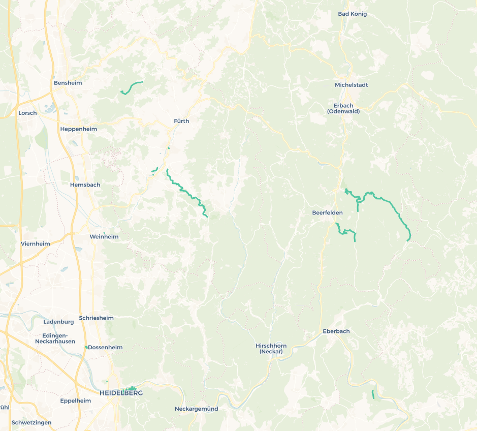
The feature is not yet visible, but you can use it with this link, showing you how the Kesselbergstraße is avoided. You can change the waypoints to check other roads in your area as well. We are planning to release this feature as experimental BETA feature over the next weeks.
There are two use cases where this feature will be especially helpful.
Avoid motorcycle restrictions on the weekend
Avoid road constructions (please note that these are often not tagged, so we will have to work together and tag them if we find them )
Please let us know what you think about this feature and how your first tests went.
Are motorcycle restrictions (as opposed to general retrictions) tagged/accepted better in OSM than motorcycle-specific tolls?
Are you planning to add a car/motorcycle switch like I suggested over in the other thread?
Also: Will you add a datepicker at some point so that we can plan a route for a specific date?
I’m think you are aware that the forward/backward namespace is not being considered (yet?), right?
Therefore the road is being avoided even though you were allowed to use it. For example, the Kesselbergstraße is only restricted uphill, from Kochelsee to Walchensee but not in the other direction.
Nevertheless:
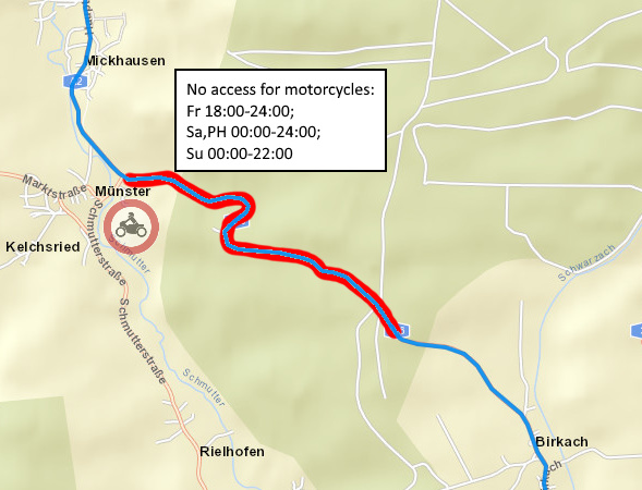
I have also tested the “Mickhauser Berg”
When I have tested it on Saturday, the restriction has worked. Today it doesn’t:
To be honest, I am not very happy about the current implementation. I don’t understand how the algorithm “might be closed over the next couple of days” works. (I am planning some of my trips not a couple of days before but during the winter.)
Maybe it is the reason why the Mickhauser Berg has been excluded from the route on Saturday but has been included today. It is not clear to me.
I have understood that route planning with a start date and time is too complicated.
So I try to find another solution: When the route includes a road which has conditional access restrictions then I need the information which part of the road it is and when the access is restricted. Then I can decide either to use the road (because I will use it outside of the forbidden time frame) or to manually change the route in order to avoid it.
Something like this would be fine for me:
(The white box is supposed to be a popup which is being shown after clicking on the “road sign”.)
Of course, the red marking should only be visible if the route direction is the same as the direction of the access restriction. (In this case the restriction is only valid for the direction from Münster to Birkach.)
This is only my opinion of course. What do you think about it?
Wenn ich das richtig verstehe sollte eine Routenplanung immer möglich sein, auch über zeitweise gesperrte Strecken.
Die gesperrten Strecken jedoch farblich markiert sein mit eineinem Infopopup.
Finde die Idee richtig gut.
Thanks for the input. You immediately found 2 of the things that don’t work . There are actually not that many that are not recognised ;).
Yes, the Kesselbergstraße is one of the very few roads that do have a oneway conditional restriction. We can either completely block it or not at all. So I decided it’s better to block it in both directions.
Are you sure that this worked on Saturday? This road uses a tagging scheme that is not yet supported. I doubt that this ever worked to be honest :).
The function is intended for trips that happen in the next week. So the intention was for navigation, not pre-planning of trips.
We are also thinking about different options, like overlays. Let’s see what actually can be done
Thanks for the hint. Unfortunately, we cannot use the opening_hours library. Internally it uses the YoHours library which is licensed under AGPL, that’s why the opening_hours library is licensed under AGPL as well. Basically, we cannot easily use code that’s under GPL or AGPL.
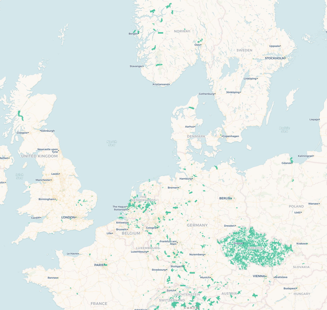
I did some research today in regards to the overlay. There are quite some issues with the overlay. There are a lot (I estimate this to be a 5 digit number; > 10.000 entries) of restrictions that are not valid anymore, especially in the Czech Republic (I really wonder why the Czech Republic is such a hotspot?). So we cannot simply show all conditional restrictions. I am not sure if outdated conditional access values should be deleted. I wouldn’t want to do this automatically and I am not sure if this would be the right approach - probably that’s something that has to be discussed in the OSM mailing list.
Therefore, we would still need to parse the restrictions. This also means that there is no straight forward solution available.
I’m not happy with this new feature, because we use Kesselberg downhill on weekend to go home. To block this road everytime would struggle a lot of trips of persons who don’t know the details.
I would prefer if Kurviger would always / all the time calculate the road without any blocks and would give a colour information to check this part of the street to decide if it is a oneway block, a saturday, sonday, weekend or whatever.
Thanks for the feedback Juschka. We will see how and if an overlay can be done. There are quite some tricky things to consider (see my post above). But we will certainly have a look whats possible.
Is maybe useful to skip the roads in germany that are forbidden for motards?
I’m going to the Eifel about 2 weekend and I found out that the routes I make are going over forbidden roads.
Hi, Kurviger is great application, only thing I miss is to avoid closed roads during navigating. There is free source for Czech republic, offered by National registry for traffic informations. Here is more info in ENglish http://registr.dopravniinfo.cz/en/sources/cz-ndic_d2-restrictions/
As there are many closed roads for construction works in whole country for some last years, I’d like Kurviger can use this informations for better planning.
 )
)