Clickable link in overlay waypoint description (GPX)

I am trying to create an GPX with waypoints (<wpt>) which I want to import in Kurviger as overlay.

I can show an URL via just putting it in the description:

GalamusDesc.gpx (1,4 KB)

But I would like to have a clickable link in the description in Kurviger, I tried several things:
GalamusDescLinkText.gpx (1,4 KB)
GalamusDescLink.gpx (1,4 KB)
GalamusDescA.gpx (1,4 KB)
GalamusLink.gpx (1,4 KB)

None of them works :frowning:

Is there anybody having an idea how to achieve a clickable link ?

In general, it should not be possible to import anything else than text. So adding HTML to GPX should not work.

For security reasons we do special handling on user imported files to make sure you can’t inject 3rd party code. See: Cross-site scripting - Wikipedia


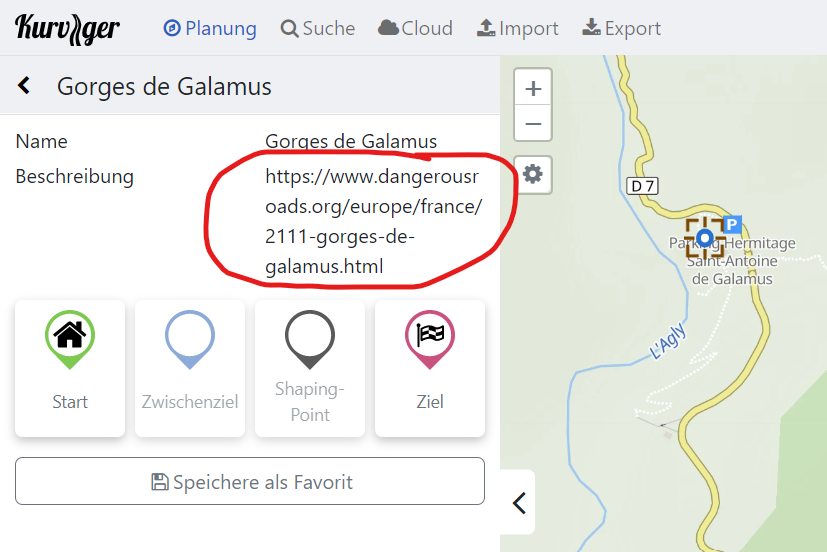
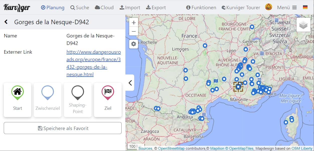
That said, the GPX schema defines a linkType that we could probably support (and that you already tried to use). I tested this locally and this works, I will need to do a few more checks to make sure we are actually not introducing a security issue.

1 Like

Thanks for the feedback!

I did not want to create additional effort, I think the prio is low (especially compared to the topics concerning the new app).

But I am not sure if I fully understand how to embed a link in GPX - I just entered a link in the waypoint edit mask in Mapsource (very old fashioned, I know :innocent:), exported the waypoint to GPX and tried to get it in Kurviger.

I think in general it is a good idea to avoid embedding HTML - I “crashed” the layout of an alpenrouten.de comment unintendedly by entering a Google Maps link in my comment :frowning_face:
Col de la Bigue - Alpen-Motorrad-Guide

1 Like

No worries :slight_smile: - I actually wanted to improve our cross site scripting protection, to catch a few other cases :slight_smile:.

Works with current website version :+1: and last Kurviger3 Beta App :+1:.

Works with following versions:
GalamusDescLinkText.gpx
GalamusDescLink.gpx
GalamusLink.gpx

To be compatible with
https://www.topografix.com/GPX/1/1/#type_wptType
I decided to use minimized link embedding ( <text> tag seems to be ignored by Kurviger )

  <wpt lat="42.83803" lon="2.48086">
    <name>Gorges de Galamus</name>
    <link href="http://www.dangerousroads.org/europe/france/2111-gorges-de-galamus.html"/>
  </wpt>

So if I export the KMZ from the Google Maps map in

and convert it to GPX for Kurviger, I get

French balcony roads V0.gpx (14,3 KB)

Edit2: Upload file again due to permission from dangerousroads.org

Importing that GPX as overlay, you can use it for planning Kurviger routes and get more information by clicking on links:

@moderators : I put copyright remarks and links to dangerousroads.org in the GPX - if you think that nevertheless it is not allowed to provide that GPX here, please give feedback or remove it immediately.
In that case I can think about providing a converter - then everyone has to extrakt the KMZ from dangerousroads.org himself and put it in the converter.
Perhaps I should provide that GPX in an an other thread (in “Nice routes - reports and recommendations”) - if yes, please give feedback, then I will create it.

Perhaps in the future it might be a benefit for Kurviger to embed points from dangerousroads.org as Kurviger POIs … there are also a lot of interesting POIs wordwide, I put them all in one GPX (more than 7000 POIs), but that breaks down performance of Kurviger in browser, I am thinking about breaking that down into regions …

2 Likes

Good question, it is somewhat borderline I guess, especially, without the consent from dangerousroads.org

We can remove it or maybe you could check with the website if you are allowed to post this file?

Sure that would definitely be interesting and something we can discuss :slight_smile:

I removed the uploaded file and ask dangerousroads.org in a mail for permission.

Edit: Meanwhile I got the permission from dangerousroads.org to post that GPX here, so I uploaded it again in the post above

2 Likes

I downloaded the world wide KML file from

and converted it into separate GPX for each country.
Each continent is located in a separate folder:

dangerousroads.org.zip (322,3 KB)

But - of course - there is a certain overlap with Kurviger POI database and other (mountain pass) databases.

Have fun during route planning and surfing!

6 Likes

@rumbrummer
Ich finde diese Datei super. Mittlerweile sind das auf der Webseite wohl schon ca. 13.000 POI’s.
Hast Du das ev. nochmal mit den aktuellen dangerousroads POI’s gemacht, bzw. kannst Du das (mich interessiert Eropa) nochmal aktuell machen und hier verlinken?
Ich habe leider keine Ahnung wie man solche Daten von der Webseite extrahiert.

Interessant, ich schaue es mir noch mal an, kann aber ein paar Tage dauern, bis ich dazu komme.

1 Like

:+1: das wäre toll. Bin gerade dabei meine Touren für 2024 fertig zu planen.