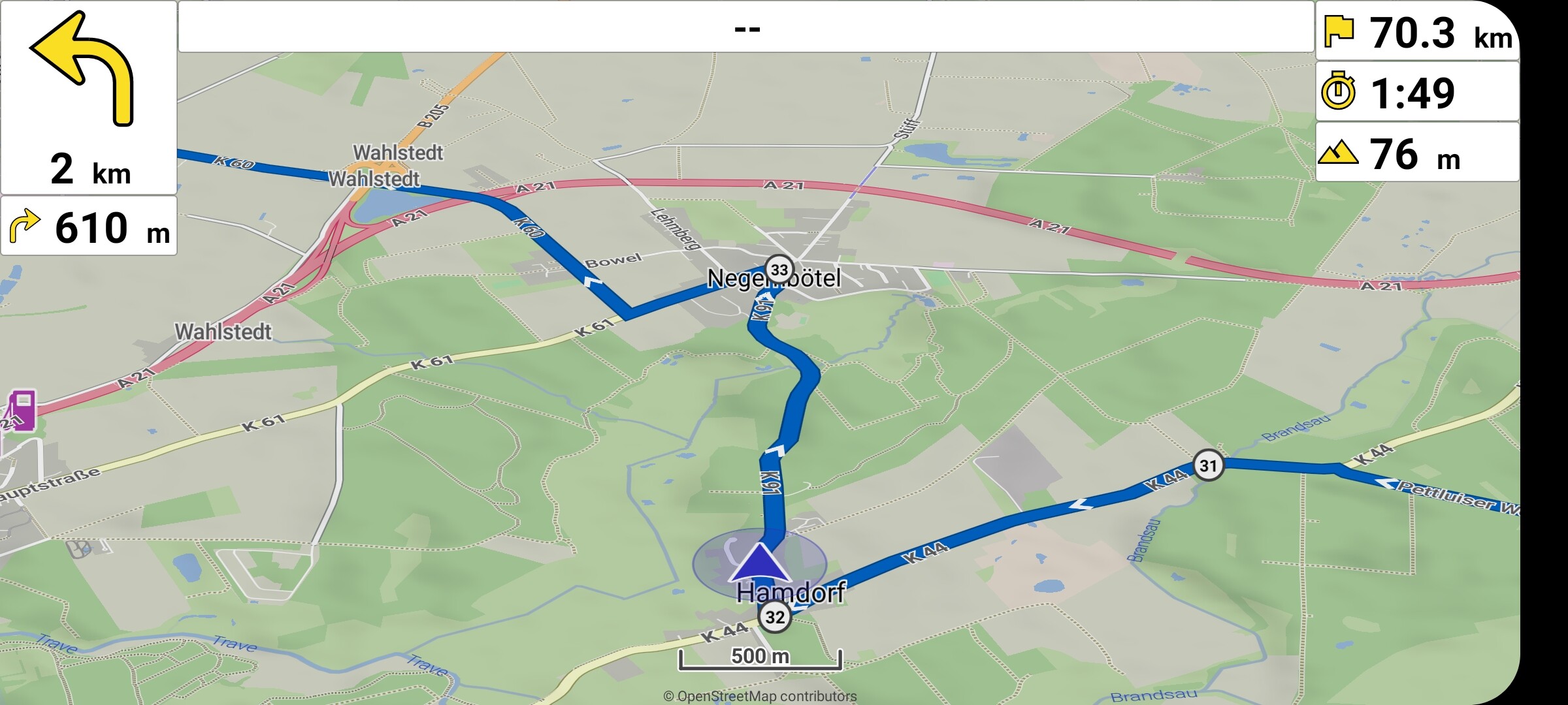
mit ist aufgefallen, dass die obere mittlere Zeile (Anzeige Straßenname) beim Abfahren von .kurviger Routen immer leer ist aber dennoch angezeigt wird.
Kann man das nicht ausblenden wenn ohne Inhalt, denn dann hat man mehr Karte und weniger feste Element, die sich ins OLED Display einbrennen können?
Warum würde das im Querformat springen? Die anderen Felder können an ihrer Postion bleiben. Ich finde es nur nicht besonders praktisch, das relativ kleine Display nicht voll zu Nutzen und ein leeres Feld dafür anzuzeigen anstatt mehr Karte.
Wenn ich “Zeige Straßennamen” ausschalte ist das Feld weg aber das möchte ich eigentlich nicht. Warum wird bei einer .kurviger Route kein Straßenname angezeigt und das Feld ist leer?
Die Abbiegeanweisung funktioniert perfekt; weshalb der aktuelle Straßenname nicht angezeigt wird, erschließt sich mir nicht. M. E. ist er im .kurviger-File Hamdorf - Wahlstedt.kurviger (1.6 KB) vorhanden.
The display of the street name (and also the turn instruction) I do not use. Therefore I wanted to try it out.
The turn-by-turn instruction works perfectly; why the current street name is not displayed is beyond me. For my opinion it’s available in the .kurviger file Hamdorf - Wahlstedt.kurviger (1.6 KB).
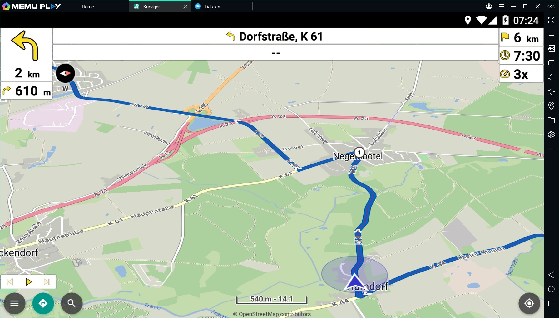
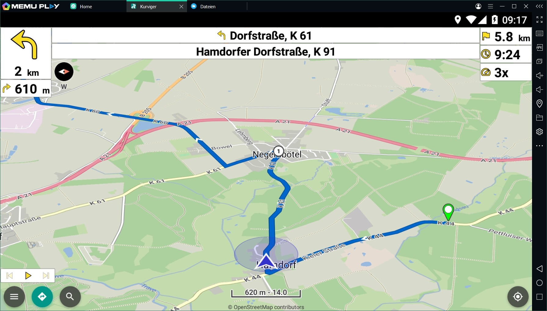
Import this file into the app
Result: no street names are displayed
now transfer the same route via QR-code (i.e. Route is calculated by the app)
Result street names are displayed.
Seems like the .kurviger files exported by the website behave different than those created by the app RouteApp.kurviger (2.0 KB) RouteWebsite.kurviger (2.0 KB)
Okay - that’s probably the explanation!
That there are differences in the “layout” of the .kurviger file between WEB and APP, I have already noticed. That also the content differs is new to me.
Wenn bekannt ist das Straßennamen in einer .kurviger Datei nicht unterstützt werden, könnte man doch dieses Feld automatisch bei .kurviger Datei ausblenden. Kann man das eventuell so realisieren?
Ich dache die Straßennamen werden basierend vom aktuellen Standort angezeigt, aus den OSM Kartendaten.
Well.
It seems (by text viewer) that the kurviger file produced by the website does contain the streetnames.
But…the .kurviger files exported by the website behave different than those created by the app indeed.
@devemux86
Sorry guy, but I don’t understand anything.
Please be aware that not all persons here are 1) IT-guys with special knowledge and 2) are perfect in writing and understanding english expressions.
I still don’t understand what do do or how to solve this interesting topic.
For me it’s the question if finally - after your discussion with the other experts - we “normal” persons get a translation and instruction what to do?