For reference see:
So this thread is basically the app-side implementation for that feature? Voted! ![]() let’s go!
let’s go!
“Straight line” profile can be implemented after and as part of “multiple profiles” feature:
But app not only has route planning like Motoplaner but also navigation.
Straight lines in navigation? I have to think carefully if that is possible…
1 Like
Are there options when planning parts of the route where there is no road in the map
is to be bridged?
Do you mean this feature?
That needs first this feature:
And then we have to think about what navigation can do on straight lines…
What about just to say: “route missed” and give the whole navigation into the responsibility of the driver till to the next “normal” waypoint?
According to the motto: trust me - I know what I’m doing!
1 Like
If you want to drive off road network with straight lines,
the simplest solution would be to disable the rerouting.
(use the manual rerouting)
Then navigation will use the beeline off route indicator.
That is probably the best solution.
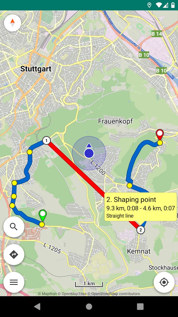
For example, I have a track from the internet.
There is a small part of the path that was driven, but this path does not exist on the map. If I now want to form a route from this track, he makes a huge detour on this path because according to the map this path does not exist. And now I want to “bridge” this short stretch with a straight line
“Straight line” routing is less necessary for navigation, much more useful for planning!
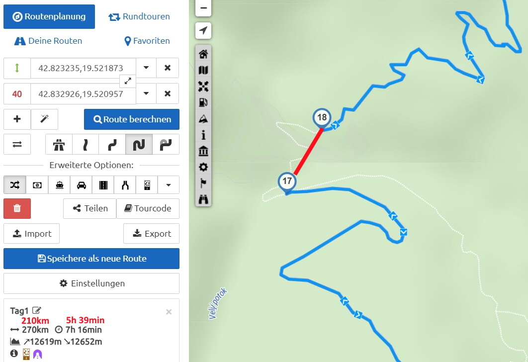
In this example (from another thread) Kurviger the “detour” is about 60 km because the connection between (17) and (18) can not be driven legally. It would be useful to be able to draw a line between (17) and (18) on one’s own responsibility:
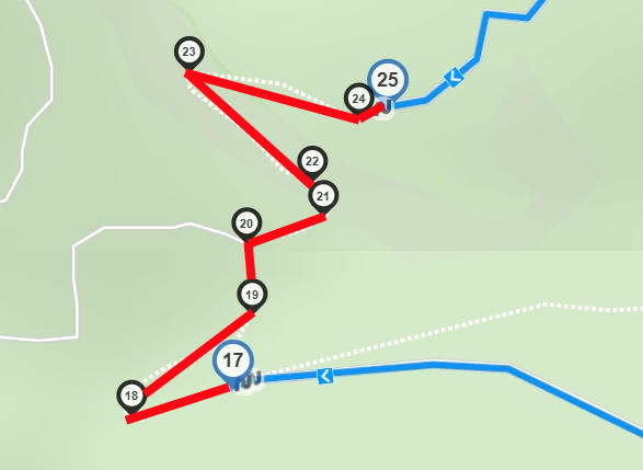
Then the plan matches the vision. Whether this also corresponds to reality will be shown when driving the route. The fact that routing instructions could be issued now and then when crossing the “straigth line” is not disturbing in my opinion. On the contrary: with a little effort, the “straight line” can even be drawn in detail:
Assuming that the “shortcut” does not work in the end (e.g. missing bridge), the detour can still be taken with “avoid roadblock” and the associated recalculation.
1 Like
We must first wait for the website to support this route profile in routing API.
Then I will see how it can be implemented in the application and navigation.
2 Likes
Hallo, kann man den Website-Entwickler fragen bis wann man mit diesem Routenprofil rechnen kann.
Das ist eines der nächsten größeren Funktionen die umgesetzt werden.
3 Likes
The hype is real my friend, the hype is real

1 Like
I can not give any constructive feedback besides: Works fine! 
I did not use it for offroad riding, but during my vacation it was very useful as immediate workaround for skipping several bugs in OSM data (I will fix that bugs as soon as I have stable / fast WiFi connection!).
So my conclusion: A precious feature!
Of course this also concerns the according website feature - but my main use case during vacation is the app for planning.
4 Likes