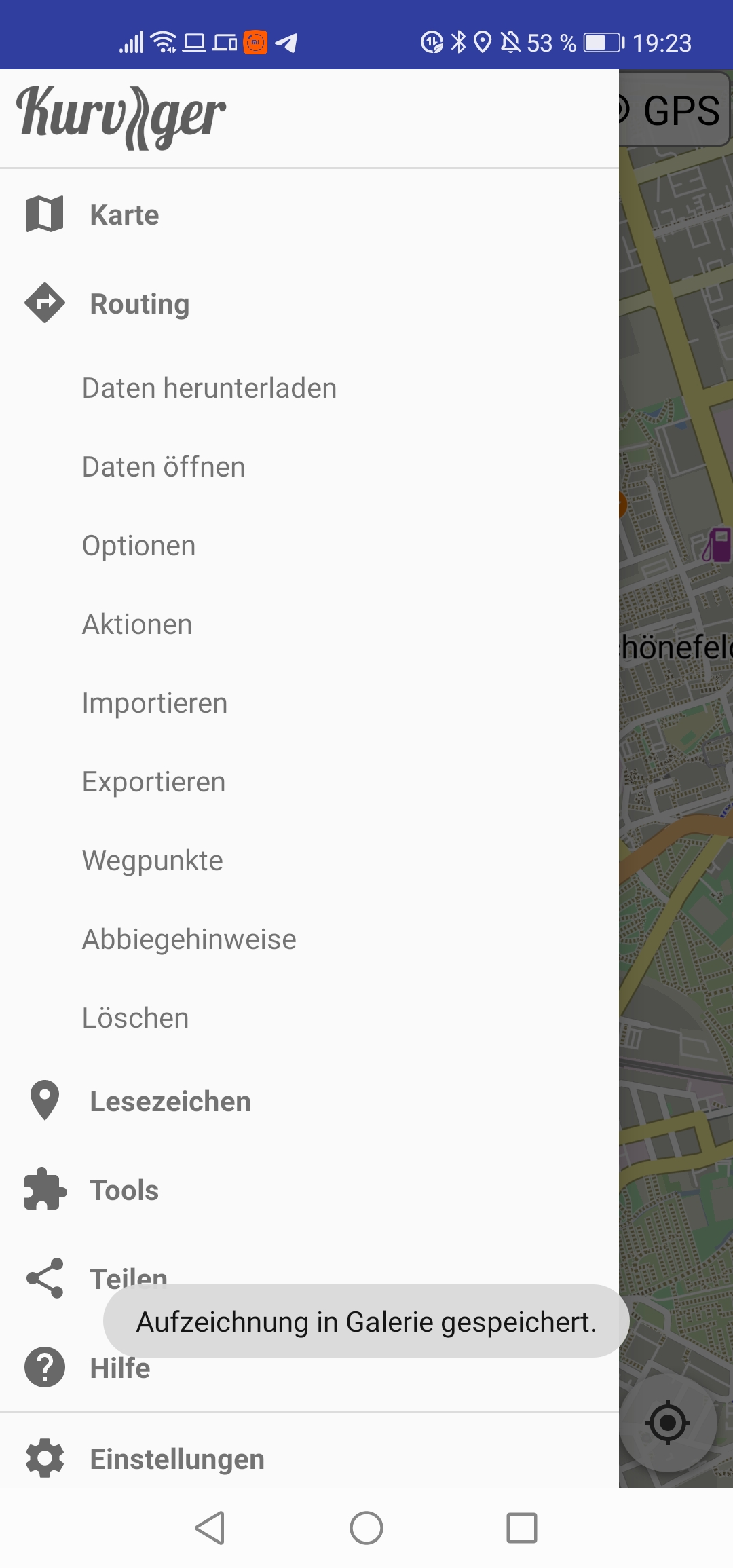
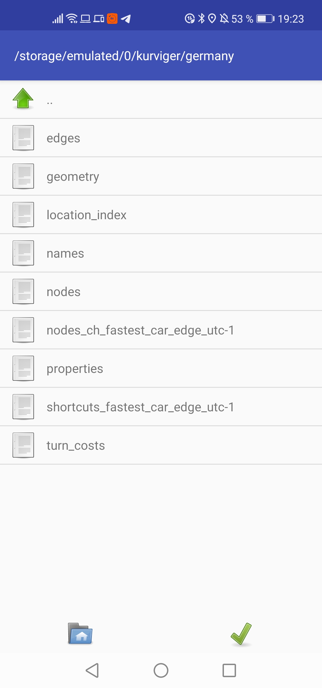
Kurviger starten > auf die 3 Striche klicken > Routing anklicken > Daten öffnen anklicken > dann den entpackten Ordner raussuchen und das grüne Häkchen anklicken
Start curvy > click on the 3 lines > click on Routing > click on Open Data > then select the unzipped folder and click on the green check mark.
bis “Routing” anklicken alles gefunden, aber “Daten öffnen” habe ich nicht.
Ich kann “Optionen”, “Aktionen”, “Importieren”, “Exportieren”, “Wegpunkte”, “Abbiegehinweise” und “Löschen” anbieten.
Und nun???
I installed the US-South graph and it enabled Kurviger to calculate a GPX route file starting from my home state, North Carolina, across the border into Tennessee. Thanks!
New Version is not yet available, but I’ve played around with flightmode and online mode, because of the question what is calculated new in the fallback mode, the complete route or only the route from the actual position to the next unvisited waypoint (depending of this setting). It would be good if only the route to the next waypoint would be recalculated and not the complete route, because this changes a lot. The fallback scenario should be in my point of view just a way to get a drivable route to the next wp, but actually the complete route is recalculated and this makes the planned curvy road looking a bit weird, also with the effect of turning instructions.
When I just switch between flight and online mode, the route isn’t changed. This means in order to get a new calculation I have to skip a waypoint, then I have again the curvy road.
Did I explain it well? What I want to say is, in case someone really wants to have the complete route recalculated, there should be another option for this
o complete route
o waypoint only
What is your opinion? In any case I would prefert option 2 as default.
Ok sorry for the confusion. Sometimes not too easy to explain in non native language.
And it was only a simulation in previous version, no reality. I will test the 1.12.1 in practice on the bike as soon as the weather conditions are allowing it. Already starting in rain is not fun. In any case having the option is a big benefit.
When you are testing offline routing, you must distinguish between the different situations.
In case of a rerouting while navigating I would expect a route change only up to the next WP; rest of the route should be unchanged.
If you change the route e.g. by inserting a new WP I would expect a complete new route.
Different scenarios:
While riding (navigation is running) you deviate from the original route, and a rerouting is triggered.
You trigger a rerouting by hitting the “skip next WP button”
You trigger a rerouting by hitting “avoid roadblock”
You are away from the route, and start navigation.
All this is difficult or impossible to test, while you are at home.
All these already work, I copy here the relevant section from offline routing announcement:
(seen above and in Beta topic)
Route planning: all routing calculations fallback to offline routing profile when there is no online connection.
Navigation: offline partial rerouting is calculated from user’s location to the route (based on rerouting mode).
Offline reroute section joins the rest of the existing curvy route and navigation continues on the merged route.
Every other “rerouting” nav activity should work similarly offline, like avoid road block or skip next waypoint.
Hallo @linux-user und @devemux86,
so habe ich das auch gemeint. Danke Manfred für die klarere Ausdruckweise
Die Datensätze funktionieren jetzt. Entweder habe ich etwas falsch verstanden oder die falschen Einstellungen. Wenn ich eine importierte Route und diese offline ändere, verläuft danach meine ganze Route anders. Die Einstellung: bis zum nächsten Wegpunkt habe ich noch nicht gefunden.
Was mir dabei aber lobend aufgefallen ist, das jetzt auch die Kurviger-Dateien unterscheiden zwischen Overlay und Routenberechnung. Da ich am liebsten diesen Dateityp verwende ist es für mich eine große Hilfe.