when I’m visiting foreign areas, I’m always looking for biker meeting places in that area.
Unfortunately this very special type of POI is only available on the website. However,
being on the road, using the website on my smart phone instead of the app is rather
awkward.
Is it asked too much to add the Biker Meeting Places POI to the App as well?
From older posts in this forum I took it that the Biker Cafe / Meeting Place
POIs are hand crafted for the Kurviger website. If these are publically
available, I don’t know where. OSM data doesn’t contain this info afaics.
Great, but what does that mean? If it’s all open information, the information
how the biker cafe POIs are generated, should be publically available, isn’t it?
How is it possible to replicate this info in the App?
I’m NOT asking for specific places in the area I’m living in. I’m interested in such places
in foreign areas while I’m on vacation, for instance. In theory I can look them up on the
Kurviger website, but the website is awkward to use with a smart phone. It’s designed
for PCs with big screens.
What I’d like to do when I’m not at home is to plan a route with the Kurviger App and
if there are Meeting Places in the vicinity, I’d like to visit them.
So, how do I get the coordinates of the biker meeting places from the Kurviger website?
What are the OSM rules constituting a Biker Cafe / Meeting Place? I can import them,
but without knowing how to create this list of places, I’m lost.
No, please don’t remove the Kurviger offline maps!
I tried Mapsforge maps and they are at least missing the most important map level: gas stations.
I just installed the Mapsforge map for germany again, just to be sure. The Kurviger offline map
shows gas stations prominently, the Mapsforge map doesn’t.
I’m getting confused now. What POI are you talking about, biker cafes or gas stations?
If it’s Biker Cafes, I can see one example at a lot of zoom levels on OSM, but it’s
not clear what data point or points constitute the biker cafe:
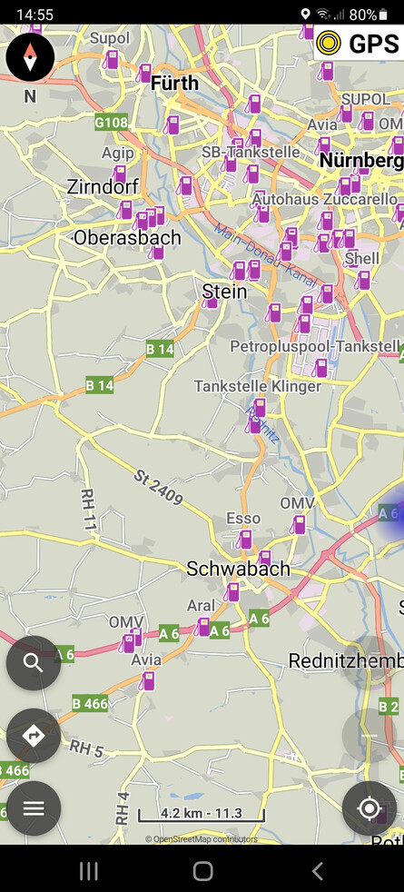
If it’s gas stations, the big advantage of Kurviger offline maps vs. Mapsforge maps
is how the gas stations are visible in low zoom levels, so it’s easy to chose where
to drive to for gas when in an unknown area.
Yes some POI categories like, Biker Cafes / Meeting Places and “Passes Editorial” are researched and maintained separately, that way we can show addiitonal information like images which would not be possible through OSM.